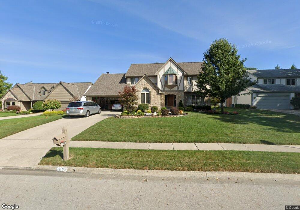
1030 Denman Ct Westerville, OH 43081
Estimated Value: $556,086 - $593,000
4
Beds
3
Baths
3,016
Sq Ft
$190/Sq Ft
Est. Value
About This Home
This home is located at 1030 Denman Ct, Westerville, OH 43081 and is currently estimated at $573,022, approximately $189 per square foot. 1030 Denman Ct is a home located in Franklin County with nearby schools including Mcvay Elementary School, Walnut Springs Middle School, and Westerville-North High School.
Ownership History
Date
Name
Owned For
Owner Type
Purchase Details
Closed on
Jul 17, 2020
Sold by
Heberling B Todd
Bought by
Cruz Edward S Dela and Cruz Connie N
Current Estimated Value
Home Financials for this Owner
Home Financials are based on the most recent Mortgage that was taken out on this home.
Original Mortgage
$361,000
Outstanding Balance
$319,511
Interest Rate
3%
Mortgage Type
New Conventional
Estimated Equity
$253,511
Purchase Details
Closed on
Oct 31, 1986
Bought by
Heberling Heberling B and Heberling Jean E
Create a Home Valuation Report for This Property
The Home Valuation Report is an in-depth analysis detailing your home's value as well as a comparison with similar homes in the area
Home Values in the Area
Average Home Value in this Area
Purchase History
| Date | Buyer | Sale Price | Title Company |
|---|---|---|---|
| Cruz Edward S Dela | $380,100 | First Ohio Title Insurance | |
| Heberling Heberling B | $36,000 | -- |
Source: Public Records
Mortgage History
| Date | Status | Borrower | Loan Amount |
|---|---|---|---|
| Open | Cruz Edward S Dela | $361,000 |
Source: Public Records
Tax History Compared to Growth
Tax History
| Year | Tax Paid | Tax Assessment Tax Assessment Total Assessment is a certain percentage of the fair market value that is determined by local assessors to be the total taxable value of land and additions on the property. | Land | Improvement |
|---|---|---|---|---|
| 2024 | $9,102 | $160,160 | $43,750 | $116,410 |
| 2023 | $8,909 | $160,160 | $43,750 | $116,410 |
| 2022 | $10,004 | $137,310 | $21,000 | $116,310 |
| 2021 | $10,088 | $137,310 | $21,000 | $116,310 |
| 2020 | $9,418 | $137,310 | $21,000 | $116,310 |
| 2019 | $8,037 | $112,320 | $17,500 | $94,820 |
| 2018 | $7,419 | $112,320 | $17,500 | $94,820 |
| 2017 | $7,544 | $112,320 | $17,500 | $94,820 |
| 2016 | $7,184 | $94,440 | $22,230 | $72,210 |
| 2015 | $6,958 | $94,440 | $22,230 | $72,210 |
| 2014 | $6,963 | $94,440 | $22,230 | $72,210 |
| 2013 | $3,295 | $89,950 | $21,175 | $68,775 |
Source: Public Records
Map
Nearby Homes
- 969 Farrington Dr
- 613 Valley Wood Ct
- 1368 Nutmeg Ct
- 858 Knebworth Ct
- 1003 Autumn Meadows Dr
- 857 E Walnut St
- 1015 Autumn Woods Dr
- 994 Autumn Lake Ct
- 1203 Autumn Creek Cir
- 539 Cherrington Rd
- 283 Apache Cir
- 192 Buckeye Ct
- 187 Bernadine Ct
- 615 Vancouver Dr
- 768 Collingwood Dr
- 430 Electric Ave
- 437 Potawatomi Dr
- 393 Sentry Ln
- 974 Timberbank Dr
- 203 Fairdale Ave
- 1038 Denman Ct
- 1022 Denman Ct
- 1051 Farrington Dr
- 1046 Denman Ct
- 1043 Farrington Dr
- 1059 Farrington Dr
- 1018 Denman Ct
- 1067 Farrington Dr
- 1035 Denman Ct
- 1029 Denman Ct
- 1035 Farrington Dr
- 1054 Denman Ct
- 1043 Denman Ct
- 1025 Denman Ct
- 1021 Denman Ct
- 1075 Farrington Dr
- 1051 Denman Ct
- 1079 Denman Ct
- 1054 Farrington Dr
- 1046 Farrington Dr