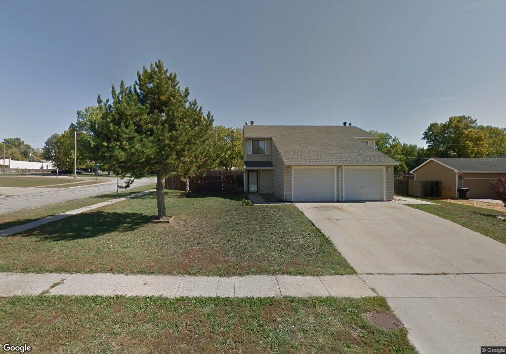
1030 SW Amhurst Ct Topeka, KS 66604
West Topeka NeighborhoodEstimated Value: $121,000 - $192,000
2
Beds
2
Baths
1,128
Sq Ft
$131/Sq Ft
Est. Value
About This Home
This home is located at 1030 SW Amhurst Ct, Topeka, KS 66604 and is currently estimated at $148,261, approximately $131 per square foot. 1030 SW Amhurst Ct is a home located in Shawnee County with nearby schools including McCarter Elementary School, Landon Middle School, and Topeka West High School.
Ownership History
Date
Name
Owned For
Owner Type
Purchase Details
Closed on
Sep 19, 2011
Sold by
Secretary Of Housing & Urban Development
Bought by
Madison Marsha J and J Warren Hildreth Sr Revocable
Current Estimated Value
Purchase Details
Closed on
Feb 15, 2011
Sold by
Us Bank Na
Bought by
Secretary Of Housing & Urban Development
Purchase Details
Closed on
Jan 17, 2005
Sold by
Vance Amy
Bought by
Durguti Kayce and Durguti Elhan
Home Financials for this Owner
Home Financials are based on the most recent Mortgage that was taken out on this home.
Original Mortgage
$73,841
Interest Rate
6.25%
Mortgage Type
FHA
Create a Home Valuation Report for This Property
The Home Valuation Report is an in-depth analysis detailing your home's value as well as a comparison with similar homes in the area
Home Values in the Area
Average Home Value in this Area
Purchase History
| Date | Buyer | Sale Price | Title Company |
|---|---|---|---|
| Madison Marsha J | -- | First American Title | |
| Secretary Of Housing & Urban Development | -- | None Available | |
| Durguti Kayce | -- | None Available |
Source: Public Records
Mortgage History
| Date | Status | Borrower | Loan Amount |
|---|---|---|---|
| Previous Owner | Durguti Kayce | $73,841 |
Source: Public Records
Tax History Compared to Growth
Tax History
| Year | Tax Paid | Tax Assessment Tax Assessment Total Assessment is a certain percentage of the fair market value that is determined by local assessors to be the total taxable value of land and additions on the property. | Land | Improvement |
|---|---|---|---|---|
| 2025 | $1,650 | $12,481 | -- | -- |
| 2023 | $1,650 | $11,996 | $0 | $0 |
| 2022 | $1,550 | $10,616 | $0 | $0 |
| 2021 | $1,432 | $9,231 | $0 | $0 |
| 2020 | $1,346 | $8,792 | $0 | $0 |
| 2019 | $1,300 | $8,454 | $0 | $0 |
| 2018 | $1,263 | $8,208 | $0 | $0 |
| 2017 | $1,240 | $8,047 | $0 | $0 |
| 2014 | $1,227 | $7,889 | $0 | $0 |
Source: Public Records
Map
Nearby Homes
- 1042 SW Amhurst Ct
- 1100 SW Amhurst Ct
- 5452 SW 12th Terrace Unit 3
- Lot 4 & .5 of 3 SW Balmoral Ln
- Lot 2 SW Balmoral Ln Unit and east 1/2 of Lot
- Lot 17 SW Balmoral Ln
- 741 SW Mifflin Rd
- 613 SW Grand Ct
- 5639 SW West Dr
- 5618 SW 14th St
- 5518 SW Avalon Ln
- 1019 SW Exmoor Ln Unit Tract 17
- 1023 SW Exmoor Ln Unit Tract 16
- 1306 SW Glendale Dr
- 1212 SW New Forest Dr
- 1053 SW Harvey St
- 1274 SW Indian Trail Ct
- 5802 SW Sterling Ln
- 1421 SW Mcalister Ave
- 1609 SW Burnett Rd
- 1032 SW Amhurst Ct
- 1036 SW Amhurst Ct
- 5202 SW 10th Terrace
- 5210 SW 10th Terrace
- 5212 SW 10th Terrace
- 1031 SW Amhurst Ct
- 5218 SW 10th Terrace
- 1037 SW Amhurst Ct
- 5220 SW 10th Terrace
- 5226 SW 10th Terrace
- 1060 SW Fairlawn Rd
- 1048 SW Amhurst Ct
- 1043 SW Amhurst Ct
- 5228 SW 10th Terrace
- 1080 SW Fairlawn Rd
- 1020 SW Fairlawn Rd
- 1036 SW Belle Ave
- 1038 SW Belle Ave
- 1049 SW Amhurst Ct
- 1042 SW Belle Ave