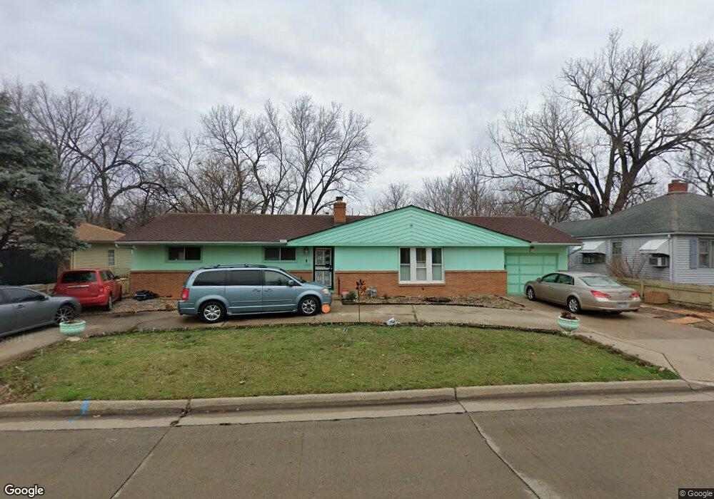
1030 Washington Blvd Kansas City, KS 66102
Northeast Kansas City NeighborhoodEstimated Value: $183,000 - $237,000
3
Beds
3
Baths
1,396
Sq Ft
$146/Sq Ft
Est. Value
About This Home
This home is located at 1030 Washington Blvd, Kansas City, KS 66102 and is currently estimated at $203,719, approximately $145 per square foot. 1030 Washington Blvd is a home located in Wyandotte County with nearby schools including Douglass Elementary School, Carl B. Bruce Middle School, and Wyandotte High School.
Ownership History
Date
Name
Owned For
Owner Type
Purchase Details
Closed on
Apr 21, 2014
Sold by
Wyatt Willie Earl and Wyatt Rahsaan
Bought by
Grajeda Luis Raul Rodriquez
Current Estimated Value
Home Financials for this Owner
Home Financials are based on the most recent Mortgage that was taken out on this home.
Original Mortgage
$90,550
Outstanding Balance
$68,686
Interest Rate
4.36%
Mortgage Type
New Conventional
Estimated Equity
$135,033
Purchase Details
Closed on
Oct 15, 2013
Sold by
Wyatt Moses and Wyatt Joyce M
Bought by
Wyatt Rashaan and Wyatt Sonya
Create a Home Valuation Report for This Property
The Home Valuation Report is an in-depth analysis detailing your home's value as well as a comparison with similar homes in the area
Home Values in the Area
Average Home Value in this Area
Purchase History
| Date | Buyer | Sale Price | Title Company |
|---|---|---|---|
| Grajeda Luis Raul Rodriquez | $97,000 | Chicago Title | |
| Wyatt Rashaan | -- | None Available |
Source: Public Records
Mortgage History
| Date | Status | Borrower | Loan Amount |
|---|---|---|---|
| Open | Grajeda Luis Raul Rodriquez | $90,550 |
Source: Public Records
Tax History Compared to Growth
Tax History
| Year | Tax Paid | Tax Assessment Tax Assessment Total Assessment is a certain percentage of the fair market value that is determined by local assessors to be the total taxable value of land and additions on the property. | Land | Improvement |
|---|---|---|---|---|
| 2024 | $2,737 | $18,734 | $2,458 | $16,276 |
| 2023 | $2,099 | $13,352 | $1,929 | $11,423 |
| 2022 | $1,423 | $9,154 | $1,380 | $7,774 |
| 2021 | $1,258 | $7,786 | $436 | $7,350 |
| 2020 | $1,145 | $7,107 | $365 | $6,742 |
| 2019 | $1,144 | $7,107 | $365 | $6,742 |
| 2018 | $1,190 | $7,417 | $339 | $7,078 |
| 2017 | $971 | $6,049 | $339 | $5,710 |
| 2016 | $832 | $5,171 | $339 | $4,832 |
| 2015 | $842 | $5,171 | $339 | $4,832 |
Source: Public Records
Map
Nearby Homes
- 1214 Nebraska Ave
- 1126 Armstrong Ave
- 1007 Armstrong Ave
- 1013 Armstrong Ave
- 810 N 10th St
- 1027 Barnett Ave
- 729 Oakland Ave
- 1244 Ann Ave
- 723 N 9th St
- 1228 Richmond Ave
- 1831 N 14th St
- 1137 Grandview Blvd
- 1329 Ann Ave
- 1502 Wood Ave
- 1712 Washington Ave
- 831 Tauromee Ave
- 948 Orville Ave
- 1215 N 18th St
- 1800 Oakland Ave
- 815 Troup Ave
- 1034 Washington Blvd
- 1028 Washington Blvd
- 1027 Everett Ave
- 1040 Washington Blvd
- 1025 Everett Ave
- 1029 Everett Ave
- 1023 Everett Ave
- 1037 Everett Ave
- 1017 Everett Ave
- 1041 Everett Ave
- 1044 Washington Blvd
- 1043 Everett Ave
- 1013 Everett Ave
- 1048 Washington Blvd
- 1011 Everett Ave
- 1052 Washington Blvd
- 1008 Washington Blvd
- 1047 Everett Ave
- 1009 Everett Ave
- 1050 Washington Blvd