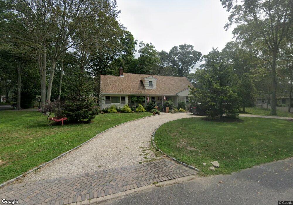
1030 Westview Dr Mattituck, NY 11952
Estimated Value: $912,000 - $1,067,000
5
Beds
2
Baths
2,164
Sq Ft
$453/Sq Ft
Est. Value
About This Home
This home is located at 1030 Westview Dr, Mattituck, NY 11952 and is currently estimated at $979,597, approximately $452 per square foot. 1030 Westview Dr is a home located in Suffolk County with nearby schools including Mattituck-Cutchogue Elementary School, Mattituck Junior/Senior High School, and Peconic Community School.
Ownership History
Date
Name
Owned For
Owner Type
Purchase Details
Closed on
Dec 5, 2025
Sold by
Paul Smith and Paul Anthea Carr
Bought by
Anthea Carr
Current Estimated Value
Purchase Details
Closed on
Apr 10, 2019
Sold by
Murphy James
Bought by
Smith Paul and Carr Anthea
Home Financials for this Owner
Home Financials are based on the most recent Mortgage that was taken out on this home.
Original Mortgage
$522,000
Interest Rate
4.3%
Mortgage Type
New Conventional
Purchase Details
Closed on
Nov 26, 2017
Sold by
Murphy James and Murphy Paul
Bought by
Murphy James
Purchase Details
Closed on
Aug 19, 2005
Sold by
Murphy Paul
Bought by
Murphy Paul
Create a Home Valuation Report for This Property
The Home Valuation Report is an in-depth analysis detailing your home's value as well as a comparison with similar homes in the area
Home Values in the Area
Average Home Value in this Area
Purchase History
| Date | Buyer | Sale Price | Title Company |
|---|---|---|---|
| Anthea Carr | -- | -- | |
| Smith Paul | -- | -- | |
| Murphy James | $493,500 | -- | |
| Murphy Paul | -- | -- |
Source: Public Records
Mortgage History
| Date | Status | Borrower | Loan Amount |
|---|---|---|---|
| Previous Owner | Smith Paul | $522,000 |
Source: Public Records
Tax History
| Year | Tax Paid | Tax Assessment Tax Assessment Total Assessment is a certain percentage of the fair market value that is determined by local assessors to be the total taxable value of land and additions on the property. | Land | Improvement |
|---|---|---|---|---|
| 2024 | $8,919 | $5,700 | $1,300 | $4,400 |
| 2023 | $8,919 | $5,700 | $1,300 | $4,400 |
| 2022 | $7,901 | $5,700 | $1,300 | $4,400 |
| 2021 | $7,685 | $5,300 | $1,300 | $4,000 |
| 2020 | $7,585 | $5,300 | $1,300 | $4,000 |
| 2019 | $7,585 | $0 | $0 | $0 |
| 2018 | $5,102 | $5,300 | $1,300 | $4,000 |
| 2017 | $11,196 | $5,300 | $1,300 | $4,000 |
| 2016 | $3,149 | $5,900 | $1,300 | $4,600 |
| 2015 | -- | $5,900 | $1,300 | $4,600 |
| 2014 | -- | $5,900 | $1,300 | $4,600 |
Source: Public Records
Map
Nearby Homes
- 780 Westview Dr
- 2005 Westview Dr
- 725 Youngs Ave
- 540 Conklin Rd
- 3000 Grand Ave
- 870 Horton Ave
- 15 Youngs Ave
- 1050 Greton Ct
- 13100 Main Rd
- 385 New Suffolk Ave
- 5697 Westphalia Rd
- 2590 Cox Neck Rd
- 9450 Old Sound Ave
- 375 Factory Ave
- 1775 Naugles Dr
- 1150 Ruth Rd
- 1645 Ruth Rd
- 1750 Laurel Lake Dr
- 1995 Ruth Rd
- 5660 Sound Ave
- 825 Brower Rd
- 680 Westview Dr
- 1180 Westview Dr
- 675 Brower Rd
- 1155 Westview Dr
- 580 Westview Dr
- 1085 Westview Dr
- 1260 Westview Dr
- 1025 Westview Dr
- 75 Woodcliff Dr
- 975 Westview Dr
- 1225 Westview Dr
- 460 Westview Dr
- 595 Brower Rd
- 1330 Westview Dr
- 855 Westview Dr
- 155 Woodcliff Dr
- 765 Westview Dr
- 675 Westview Dr
Your Personal Tour Guide
Ask me questions while you tour the home.