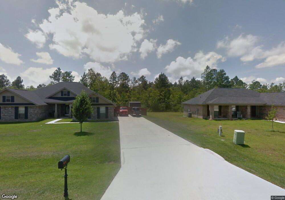
10300 Mayhaw Cove Vancleave, MS 39565
Estimated Value: $318,090 - $395,000
--
Bed
2
Baths
2,722
Sq Ft
$130/Sq Ft
Est. Value
About This Home
This home is located at 10300 Mayhaw Cove, Vancleave, MS 39565 and is currently estimated at $354,273, approximately $130 per square foot. 10300 Mayhaw Cove is a home located in Jackson County with nearby schools including St Martin East Elementary School, St Martin North Elementary School, and St Martin Upper Elementary School.
Ownership History
Date
Name
Owned For
Owner Type
Purchase Details
Closed on
Aug 31, 2009
Sold by
Adams Homes Llc
Bought by
Hughes Gloria A
Current Estimated Value
Home Financials for this Owner
Home Financials are based on the most recent Mortgage that was taken out on this home.
Original Mortgage
$250,381
Outstanding Balance
$163,748
Interest Rate
5.19%
Mortgage Type
Purchase Money Mortgage
Estimated Equity
$190,525
Create a Home Valuation Report for This Property
The Home Valuation Report is an in-depth analysis detailing your home's value as well as a comparison with similar homes in the area
Home Values in the Area
Average Home Value in this Area
Purchase History
| Date | Buyer | Sale Price | Title Company |
|---|---|---|---|
| Hughes Gloria A | -- | -- |
Source: Public Records
Mortgage History
| Date | Status | Borrower | Loan Amount |
|---|---|---|---|
| Open | Hughes Gloria A | $250,381 |
Source: Public Records
Tax History Compared to Growth
Tax History
| Year | Tax Paid | Tax Assessment Tax Assessment Total Assessment is a certain percentage of the fair market value that is determined by local assessors to be the total taxable value of land and additions on the property. | Land | Improvement |
|---|---|---|---|---|
| 2024 | $1,504 | $20,350 | $2,665 | $17,685 |
| 2023 | $1,504 | $20,350 | $2,665 | $17,685 |
| 2022 | $1,462 | $20,030 | $0 | $0 |
| 2021 | $1,461 | $20,030 | $20,030 | $0 |
| 2020 | $1,514 | $20,030 | $2,747 | $17,283 |
| 2019 | $1,497 | $20,030 | $2,747 | $17,283 |
| 2018 | $2,140 | $20,030 | $2,747 | $17,283 |
| 2017 | $2,181 | $20,030 | $2,747 | $17,283 |
| 2016 | $2,083 | $20,030 | $2,747 | $17,283 |
| 2015 | $1,929 | $186,370 | $27,470 | $158,900 |
| 2014 | $1,950 | $19,152 | $2,747 | $16,405 |
| 2013 | $1,875 | $19,152 | $2,747 | $16,405 |
Source: Public Records
Map
Nearby Homes
- 0 Maple Cove
- 0 Muszar Ln
- 13601 Virginia St
- 13809 Briarwood Dr
- 13505 Sarus Dr
- The Camden Plan at Crane Landing
- The Jasmine Plan at Crane Landing
- The Destin Plan at Crane Landing
- The Hawthorne Plan at Crane Landing
- The Holly Plan at Crane Landing
- 13509 Sarus Dr
- 13517 Sarus Dr
- 13461 Crane Dr
- 13465 Crane Dr
- 13412 Crane Dr
- 13457 Crane Dr
- 13445 Crane Dr
- 13409 Crane Dr
- 13441 Crane Dr
- 13529 Sarus Dr
- 10307 Black Gum Dr
- 10305 Mayhaw Cove
- 10304 Black Gum Dr
- 10308 Black Gum Dr
- 10310 Mayhaw Cove
- 10301 Mayhaw Cove
- 10311 Black Gum Dr
- 10309 Mayhaw Cove
- 10313 Mayhaw Cove
- 10314 Black Gum Dr
- 10300 Black Gum Dr
- 10315 Black Gum Dr
- 0 Black Gum Dr
- 10330 Black Gum Dr
- 10319 Black Gum Dr
- 10335 Black Gum Dr
- 0 Black Gum Ln Unit 4024116
- 10327 Black Gum Dr
- 10323 Black Gum Dr
- 10331 Black Gum Dr