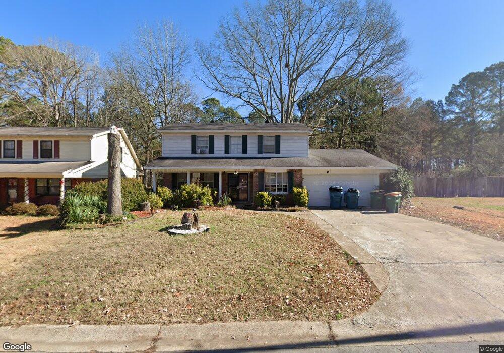
10301 Independence Ln Little Rock, AR 72209
Upper Baseline NeighborhoodEstimated Value: $130,698 - $165,000
--
Bed
2
Baths
1,809
Sq Ft
$85/Sq Ft
Est. Value
About This Home
This home is located at 10301 Independence Ln, Little Rock, AR 72209 and is currently estimated at $153,675, approximately $84 per square foot. 10301 Independence Ln is a home located in Pulaski County with nearby schools including Watson Elementary School, Cloverdale Middle School, and Little Rock Southwest High School.
Ownership History
Date
Name
Owned For
Owner Type
Purchase Details
Closed on
Jun 11, 2012
Sold by
Marbley Freddie and Marbley Latanya
Bought by
Marbley Freddie and Marbley Latanya
Current Estimated Value
Home Financials for this Owner
Home Financials are based on the most recent Mortgage that was taken out on this home.
Original Mortgage
$93,862
Outstanding Balance
$64,958
Interest Rate
3.8%
Mortgage Type
VA
Estimated Equity
$88,717
Purchase Details
Closed on
Dec 10, 2001
Sold by
Zinamon Bert R and Zinamon Alephina D
Bought by
Marbley Freddie and Summerville Latanya
Home Financials for this Owner
Home Financials are based on the most recent Mortgage that was taken out on this home.
Original Mortgage
$77,343
Interest Rate
6.52%
Mortgage Type
FHA
Create a Home Valuation Report for This Property
The Home Valuation Report is an in-depth analysis detailing your home's value as well as a comparison with similar homes in the area
Home Values in the Area
Average Home Value in this Area
Purchase History
| Date | Buyer | Sale Price | Title Company |
|---|---|---|---|
| Marbley Freddie | -- | Lsi | |
| Marbley Freddie | $80,000 | Stewart Title |
Source: Public Records
Mortgage History
| Date | Status | Borrower | Loan Amount |
|---|---|---|---|
| Open | Marbley Freddie | $93,862 | |
| Closed | Marbley Freddie | $77,343 |
Source: Public Records
Tax History Compared to Growth
Tax History
| Year | Tax Paid | Tax Assessment Tax Assessment Total Assessment is a certain percentage of the fair market value that is determined by local assessors to be the total taxable value of land and additions on the property. | Land | Improvement |
|---|---|---|---|---|
| 2025 | $1,350 | $23,407 | $3,000 | $20,407 |
| 2024 | $1,238 | $23,407 | $3,000 | $20,407 |
| 2023 | $1,238 | $23,407 | $3,000 | $20,407 |
| 2022 | $1,182 | $23,407 | $3,000 | $20,407 |
| 2021 | $1,134 | $16,080 | $4,300 | $11,780 |
| 2020 | $751 | $16,080 | $4,300 | $11,780 |
| 2019 | $751 | $16,080 | $4,300 | $11,780 |
| 2018 | $776 | $16,080 | $4,300 | $11,780 |
| 2017 | $776 | $16,080 | $4,300 | $11,780 |
| 2016 | $810 | $16,570 | $3,000 | $13,570 |
| 2015 | $1,162 | $16,570 | $3,000 | $13,570 |
| 2014 | $1,162 | $16,570 | $3,000 | $13,570 |
Source: Public Records
Map
Nearby Homes
- 10407 Republic Ln
- 5817 Drexel Ave
- 5823 Liberty Cove
- 00 Lovett Dr
- 22 Old Glory Ct
- 5300 Southboro Ct
- 000 Geyer Springs Rd
- 6711 Woodfield Rd
- 10001 Warren Dr
- 6313 Senate Dr
- 9220 Reck Rd
- 6611 Fairfield Dr
- 3938 Wooddale Dr
- 8616 Dreher Ln
- 8600 Dreher Ln
- 11902 Chariot Dr
- 8511 Dreher Ln
- 9901 Eva Ln
- 0000 Eva Ln
- 7009 Guinevere Dr
- 10223 Independence Ln
- 10307 Independence Ln
- 10215 Independence Ln
- 10311 Independence Ln
- 10300 Independence Ln
- 10209 Independence Ln
- 10222 Independence Ln
- 10306 Independence Ln
- 10317 Independence Ln
- 10216 Independence Ln
- 10312 Independence Ln
- 10205 Independence Ln
- 10323 Independence Ln
- 0 Independence Ln
- 10210 Independence Ln
- 10318 Independence Ln
- 10301 Republic Ln
- 10223 Republic Ln
- 10204 Independence Ln
- 10123 Independence Ln