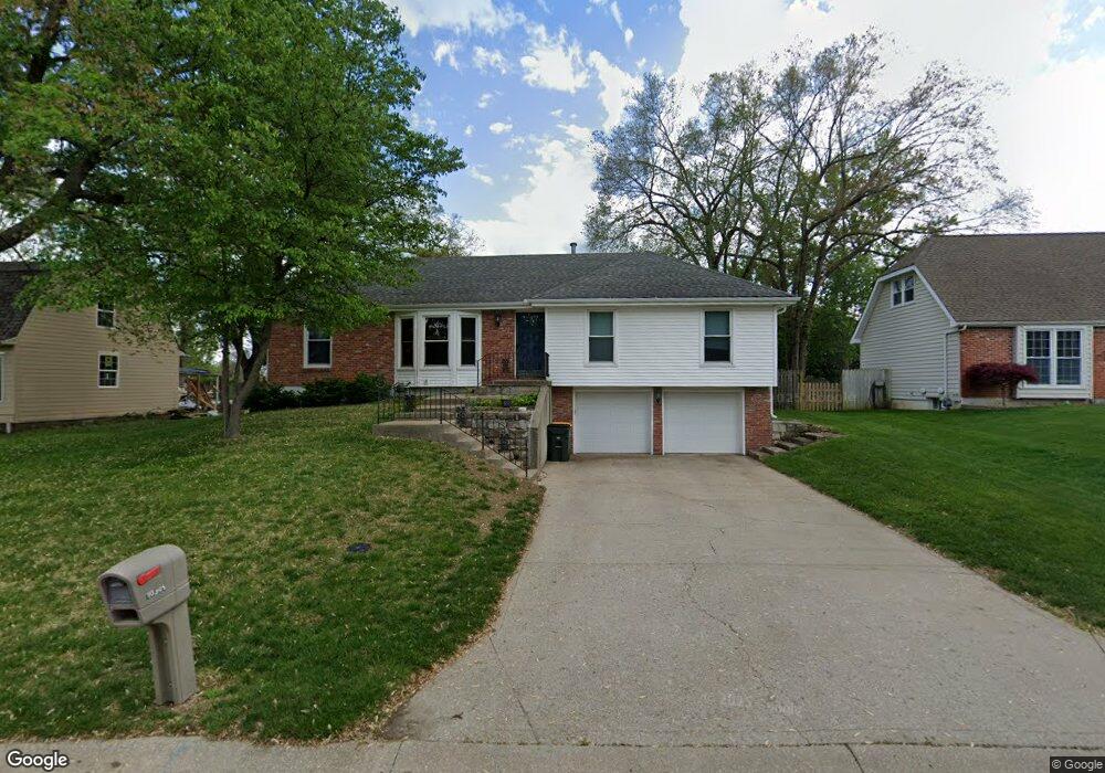
10305 W 49th Place Shawnee, KS 66203
Estimated Value: $348,000 - $358,000
3
Beds
3
Baths
1,406
Sq Ft
$250/Sq Ft
Est. Value
About This Home
This home is located at 10305 W 49th Place, Shawnee, KS 66203 and is currently estimated at $351,811, approximately $250 per square foot. 10305 W 49th Place is a home located in Johnson County with nearby schools including Bluejacket / Flint Elementary, Hocker Grove Middle School, and Shawnee Mission North High School.
Ownership History
Date
Name
Owned For
Owner Type
Purchase Details
Closed on
Jun 24, 2002
Sold by
Holmes Sonny and Holmes Arlene
Bought by
Woodruff Matthew B and Woodruff Amanda M
Current Estimated Value
Home Financials for this Owner
Home Financials are based on the most recent Mortgage that was taken out on this home.
Original Mortgage
$139,680
Outstanding Balance
$59,394
Interest Rate
6.89%
Estimated Equity
$292,417
Create a Home Valuation Report for This Property
The Home Valuation Report is an in-depth analysis detailing your home's value as well as a comparison with similar homes in the area
Home Values in the Area
Average Home Value in this Area
Purchase History
| Date | Buyer | Sale Price | Title Company |
|---|---|---|---|
| Woodruff Matthew B | -- | Security Land Title Company |
Source: Public Records
Mortgage History
| Date | Status | Borrower | Loan Amount |
|---|---|---|---|
| Open | Woodruff Matthew B | $139,680 |
Source: Public Records
Tax History Compared to Growth
Tax History
| Year | Tax Paid | Tax Assessment Tax Assessment Total Assessment is a certain percentage of the fair market value that is determined by local assessors to be the total taxable value of land and additions on the property. | Land | Improvement |
|---|---|---|---|---|
| 2024 | $3,836 | $36,340 | $7,324 | $29,016 |
| 2023 | $3,781 | $35,282 | $6,657 | $28,625 |
| 2022 | $3,372 | $31,360 | $6,052 | $25,308 |
| 2021 | $3,190 | $27,795 | $5,261 | $22,534 |
| 2020 | $3,010 | $25,875 | $4,781 | $21,094 |
| 2019 | $2,890 | $24,817 | $4,557 | $20,260 |
| 2018 | $2,681 | $22,919 | $4,557 | $18,362 |
| 2017 | $2,630 | $22,138 | $4,138 | $18,000 |
| 2016 | $2,474 | $20,551 | $4,138 | $16,413 |
| 2015 | $2,290 | $19,803 | $4,138 | $15,665 |
| 2013 | -- | $18,688 | $4,138 | $14,550 |
Source: Public Records
Map
Nearby Homes
- 10511 W 49th Place
- 0 W 49th St
- 10116 W 52nd Terrace
- 9929 W 52nd St
- 5003 Knox Ave
- 5405 Oliver St
- 9719 W 53rd St
- 3017 S 56th St
- 9328 W 51st St
- 5607 Crest Dr
- 5603 Crest Dr
- 11403 W 51st Terrace
- 5220 Hayes St
- 5308 Mcanany Dr
- Ashwood Plan at Bristol Highlands - North
- The Fleetwood Plan at Bristol Highlands - The Villas
- Cypress II Plan at Bristol Highlands - North
- The Fleetwood Plan at Bristol Highlands - The Manors
- The Brentwood Plan at Bristol Highlands - The Villas
- Yorkshire V Plan at Bristol Highlands - North
- 10309 W 49th Place
- 4940 Switzer St
- 4940 Switzer Rd
- 5010 Stearns St
- 10313 W 49th Place
- 5009 Stearns St
- 5014 Stearns St
- 10304 W 49th Place
- 10308 W 49th Place
- 10300 W 49th Place
- 10312 W 49th Place
- 10249 W 49th Place
- 5017 Stearns St
- 5018 Stearns St
- 10406 W 49th Place
- 10412 W 50th Terrace
- 10411 W 49th Place
- 10411 W 50th Terrace
- 10237 W 49th Place
- 10248 W 49th Place