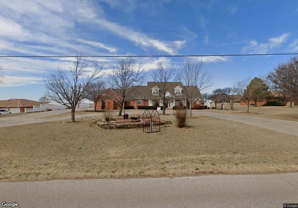
10307 Airport Rd Clinton, OK 73601
Estimated Value: $287,000 - $572,000
4
Beds
4
Baths
3,987
Sq Ft
$114/Sq Ft
Est. Value
About This Home
This home is located at 10307 Airport Rd, Clinton, OK 73601 and is currently estimated at $454,087, approximately $113 per square foot. 10307 Airport Rd is a home located in Custer County with nearby schools including Nance Elementary School, Southwest Elementary School, and Clinton Middle School.
Ownership History
Date
Name
Owned For
Owner Type
Purchase Details
Closed on
Apr 7, 2021
Sold by
Zerby and Sandra
Bought by
Dudgeon Donald J
Current Estimated Value
Home Financials for this Owner
Home Financials are based on the most recent Mortgage that was taken out on this home.
Original Mortgage
$375,200
Outstanding Balance
$337,469
Interest Rate
2.9%
Mortgage Type
Construction
Estimated Equity
$116,618
Purchase Details
Closed on
Mar 25, 2014
Sold by
Ollenburger Gary Leroy
Bought by
Zerby Joe
Purchase Details
Closed on
Oct 1, 2010
Sold by
Lee Troy E
Bought by
Ollenburger Gary Leroy
Purchase Details
Closed on
Jun 9, 1998
Sold by
Lloyd R Ernst
Bought by
Troy E Lee
Create a Home Valuation Report for This Property
The Home Valuation Report is an in-depth analysis detailing your home's value as well as a comparison with similar homes in the area
Home Values in the Area
Average Home Value in this Area
Purchase History
| Date | Buyer | Sale Price | Title Company |
|---|---|---|---|
| Dudgeon Donald J | $469,000 | County Abstract Co | |
| Zerby Joe | $390,000 | -- | |
| Ollenburger Gary Leroy | $400,000 | -- | |
| Troy E Lee | $5,000 | -- |
Source: Public Records
Mortgage History
| Date | Status | Borrower | Loan Amount |
|---|---|---|---|
| Open | Dudgeon Donald J | $375,200 |
Source: Public Records
Tax History Compared to Growth
Tax History
| Year | Tax Paid | Tax Assessment Tax Assessment Total Assessment is a certain percentage of the fair market value that is determined by local assessors to be the total taxable value of land and additions on the property. | Land | Improvement |
|---|---|---|---|---|
| 2025 | $4,989 | $47,657 | $1,313 | $46,344 |
| 2024 | $5,430 | $50,600 | $1,313 | $49,287 |
| 2023 | $5,430 | $50,600 | $1,313 | $49,287 |
| 2022 | $4,763 | $50,600 | $1,313 | $49,287 |
| 2021 | $4,201 | $44,545 | $1,313 | $43,232 |
| 2020 | $4,014 | $42,708 | $1,678 | $41,030 |
| 2019 | $4,023 | $42,972 | $1,678 | $41,294 |
| 2018 | $4,078 | $43,899 | $1,678 | $42,221 |
| 2017 | $3,958 | $43,081 | $1,678 | $41,403 |
| 2016 | $3,918 | $42,900 | $1,312 | $41,588 |
| 2015 | $3,887 | $42,900 | $1,312 | $41,588 |
| 2014 | $3,398 | $38,605 | $876 | $37,729 |
Source: Public Records
Map
Nearby Homes
- 0 Turtle Creek
- 604 N 3rd St
- 323 N 8th St
- 605 S 5th St
- 921 Dunn Ave
- 614 S 6th St
- 1125 Blackstone Ave
- 404 S 9th St
- 511 S 9th St
- 600 Opal Ave Unit LOT
- 1201 Blackstone Ave
- 412 S 11th St
- 527 S 11th St
- 616 S 11th St
- 22676 Route 66 N
- 1509 Orient Ave
- 409 S 15th St
- 1709 Nowahy Ave
- 1030 Circle Dr
- 1419 Pine Ave
- 10311 N Airport Rd
- 10311 N 2270 Rd
- 10303 N Airport Rd
- 10313 N Airport Rd
- 22690 E 1030 Rd
- 22697 E 1030 Rd
- 10317 N Airport Rd
- 10317 N Airport Rd
- 22680 E 1030 Rd
- 10291 N Airport Rd
- 22691 E 1030 Rd
- 10287 N Airport Rd
- 22681 E 1030 Rd
- 10333 N Airport Rd
- 22685 E 1030 Rd
- 22674 E 1030 Rd
- 10339 N Airport Rd
- 10279 N Airport Rd
- 23003 E 1030 Rd
- 22288 E 1070 Rd