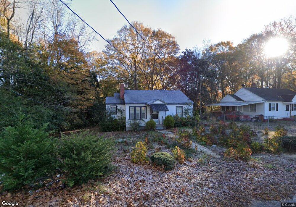
1031 Mullis Cir Lancaster, SC 29720
Estimated Value: $175,000 - $210,262
--
Bed
--
Bath
856
Sq Ft
$225/Sq Ft
Est. Value
About This Home
This home is located at 1031 Mullis Cir, Lancaster, SC 29720 and is currently estimated at $192,816, approximately $225 per square foot. 1031 Mullis Cir is a home with nearby schools including Erwin Elementary School, South Middle School, and Lancaster High School.
Ownership History
Date
Name
Owned For
Owner Type
Purchase Details
Closed on
Sep 28, 2023
Sold by
Red Rose Property Resolutions Llc
Bought by
Privette Andrew Dalton and Murphy Allison Breanna
Current Estimated Value
Home Financials for this Owner
Home Financials are based on the most recent Mortgage that was taken out on this home.
Original Mortgage
$190,606
Outstanding Balance
$186,837
Interest Rate
7.09%
Mortgage Type
New Conventional
Estimated Equity
$5,979
Purchase Details
Closed on
Dec 17, 2021
Sold by
Smith Mary Bailey
Bought by
Red Rose Property Resolutions Llc
Create a Home Valuation Report for This Property
The Home Valuation Report is an in-depth analysis detailing your home's value as well as a comparison with similar homes in the area
Home Values in the Area
Average Home Value in this Area
Purchase History
| Date | Buyer | Sale Price | Title Company |
|---|---|---|---|
| Privette Andrew Dalton | $188,700 | None Listed On Document | |
| Red Rose Property Resolutions Llc | -- | None Available | |
| Red Rose Property Resolutions Llc | $2,500 | None Available |
Source: Public Records
Mortgage History
| Date | Status | Borrower | Loan Amount |
|---|---|---|---|
| Open | Privette Andrew Dalton | $190,606 |
Source: Public Records
Tax History Compared to Growth
Tax History
| Year | Tax Paid | Tax Assessment Tax Assessment Total Assessment is a certain percentage of the fair market value that is determined by local assessors to be the total taxable value of land and additions on the property. | Land | Improvement |
|---|---|---|---|---|
| 2024 | $1,142 | $7,436 | $1,200 | $6,236 |
| 2023 | $609 | $1,228 | $156 | $1,072 |
| 2022 | $607 | $1,842 | $234 | $1,608 |
| 2021 | $536 | $1,651 | $210 | $1,441 |
| 2020 | $519 | $1,596 | $234 | $1,362 |
| 2019 | $487 | $1,435 | $210 | $1,225 |
| 2018 | $469 | $1,435 | $210 | $1,225 |
| 2017 | $440 | $0 | $0 | $0 |
| 2016 | $434 | $0 | $0 | $0 |
| 2015 | $338 | $0 | $0 | $0 |
| 2014 | $338 | $0 | $0 | $0 |
| 2013 | $338 | $0 | $0 | $0 |
Source: Public Records
Map
Nearby Homes
- 1324 Jefferson St
- 1499 Old Landsford Rd
- TBD Old Landsford Rd
- 1453 Old Landsford Rd
- 1121 W Edgemont Dr
- 422 Plantation Rd
- 1109 W Edgemont Dr
- 1110 W Edgemont Dr
- 5.45 acres Memorial Park Rd
- 3.04 acres Memorial Park Rd
- 1334 Williams Estate Dr
- 1676 Partridge Cir
- 526 Rock Springs Rd
- 530 Oxford Place
- 1447 Carmel Rd
- 1429 Williams Estate Dr
- 1257 Springdale Rd
- 1530 Danlee Dr
- 406 N Pine St
- 704 Marion Sims Dr
- 1037 Mullis Cir
- 1031 State Road S-29-424
- 1032 Mullis Cir
- 1036 Mullis Cir
- 1042 Mullis Cir
- 1046 Mullis Cir
- 1057 Palidin Rd
- 1348 Westwood Rd
- 1355 Westwood Rd
- 1052 Mullis Cir
- 1050 Mullis Cir
- 105 State Road S-29-424
- 1338 Westwood Rd
- 1338 Westwood Rd Unit 15
- 1341 Westwood Rd
- 1433 W Meeting St
- 1332 Westwood Rd
- 1352 Wade St
- 1335 Westwood Rd
- 1392 Wade St