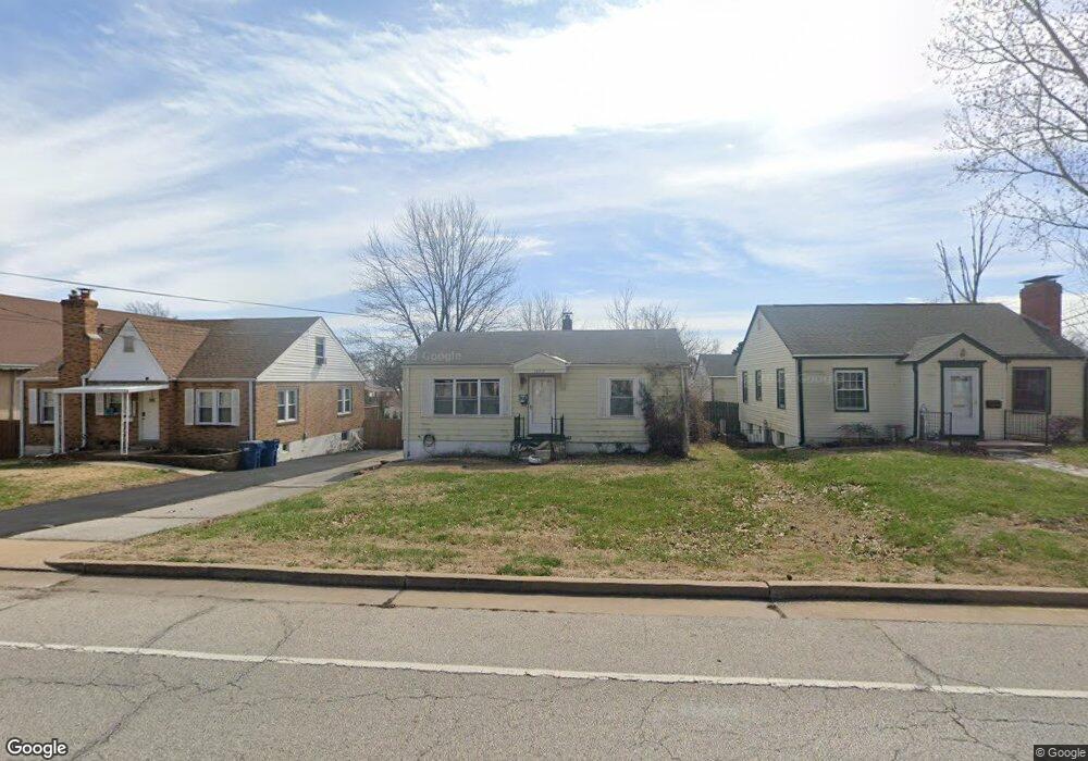
10312 Lackland Rd Saint Louis, MO 63114
Estimated Value: $162,000 - $171,000
3
Beds
3
Baths
1,033
Sq Ft
$160/Sq Ft
Est. Value
About This Home
This home is located at 10312 Lackland Rd, Saint Louis, MO 63114 and is currently estimated at $165,604, approximately $160 per square foot. 10312 Lackland Rd is a home located in St. Louis County with nearby schools including Iveland Elementary School, Hoech Middle School, and Ritenour Senior High School.
Ownership History
Date
Name
Owned For
Owner Type
Purchase Details
Closed on
May 28, 1998
Sold by
Tullock Nora M and Tullock John F
Bought by
Jackson Suzanne D
Current Estimated Value
Home Financials for this Owner
Home Financials are based on the most recent Mortgage that was taken out on this home.
Original Mortgage
$63,446
Outstanding Balance
$12,505
Interest Rate
7.2%
Mortgage Type
FHA
Estimated Equity
$153,099
Create a Home Valuation Report for This Property
The Home Valuation Report is an in-depth analysis detailing your home's value as well as a comparison with similar homes in the area
Home Values in the Area
Average Home Value in this Area
Purchase History
| Date | Buyer | Sale Price | Title Company |
|---|---|---|---|
| Jackson Suzanne D | -- | -- |
Source: Public Records
Mortgage History
| Date | Status | Borrower | Loan Amount |
|---|---|---|---|
| Open | Jackson Suzanne D | $63,446 |
Source: Public Records
Tax History Compared to Growth
Tax History
| Year | Tax Paid | Tax Assessment Tax Assessment Total Assessment is a certain percentage of the fair market value that is determined by local assessors to be the total taxable value of land and additions on the property. | Land | Improvement |
|---|---|---|---|---|
| 2025 | $2,126 | $28,680 | $5,400 | $23,280 |
| 2024 | $2,126 | $24,830 | $3,230 | $21,600 |
| 2023 | $2,080 | $24,830 | $3,230 | $21,600 |
| 2022 | $2,003 | $20,980 | $2,510 | $18,470 |
| 2021 | $2,003 | $20,980 | $2,510 | $18,470 |
| 2020 | $1,736 | $16,740 | $3,550 | $13,190 |
| 2019 | $1,719 | $16,740 | $3,550 | $13,190 |
| 2018 | $1,601 | $14,020 | $2,790 | $11,230 |
| 2017 | $1,527 | $14,020 | $2,790 | $11,230 |
| 2016 | $1,405 | $13,130 | $2,870 | $10,260 |
| 2015 | $1,436 | $13,130 | $2,870 | $10,260 |
| 2014 | $1,243 | $11,520 | $1,730 | $9,790 |
Source: Public Records
Map
Nearby Homes
- 10310 Lackland Rd
- 10301 Niblic Dr
- 1735 O Connell Ave
- 10222 Driver Ave
- 10110 Lackland Rd
- 10111 Niblic Dr
- 10107 Niblic Dr
- 10490 Canter Way
- 2106 Lackland Rd
- 9913 Zykan Ct
- 9833 Eastbrook Dr
- 9906 Zykan Ct
- 2412 Silkwood Dr
- 2450 Fowler Ave
- 10627 Canter Way
- 9833 Zykan Dr
- 1841 N Warson Rd
- 2430 Prouhet Ave
- 10726 Niblic Dr
- 2454 Prouhet Ave
- 10314 Lackland Rd
- 10308 Lackland Rd
- 1966 Korando Ave
- 10306 Lackland Rd
- 1964 Korando Ave
- 10330 Lackland Rd
- 1969 Uceyle Ave
- 1963 Uceyle Ave
- 10329 Lackland Rd
- 10327 Lackland Rd
- 1952 Korando Ave
- 10331 Lackland Rd
- 10336 Lackland Rd
- 10307 Lackland Rd
- 1965 Korando Ave
- 10333 Lackland Rd
- 1961 Uceyle Ave
- 10305 Lackland Rd
- 1957 Korando Ave
- 10256 Lackland Rd