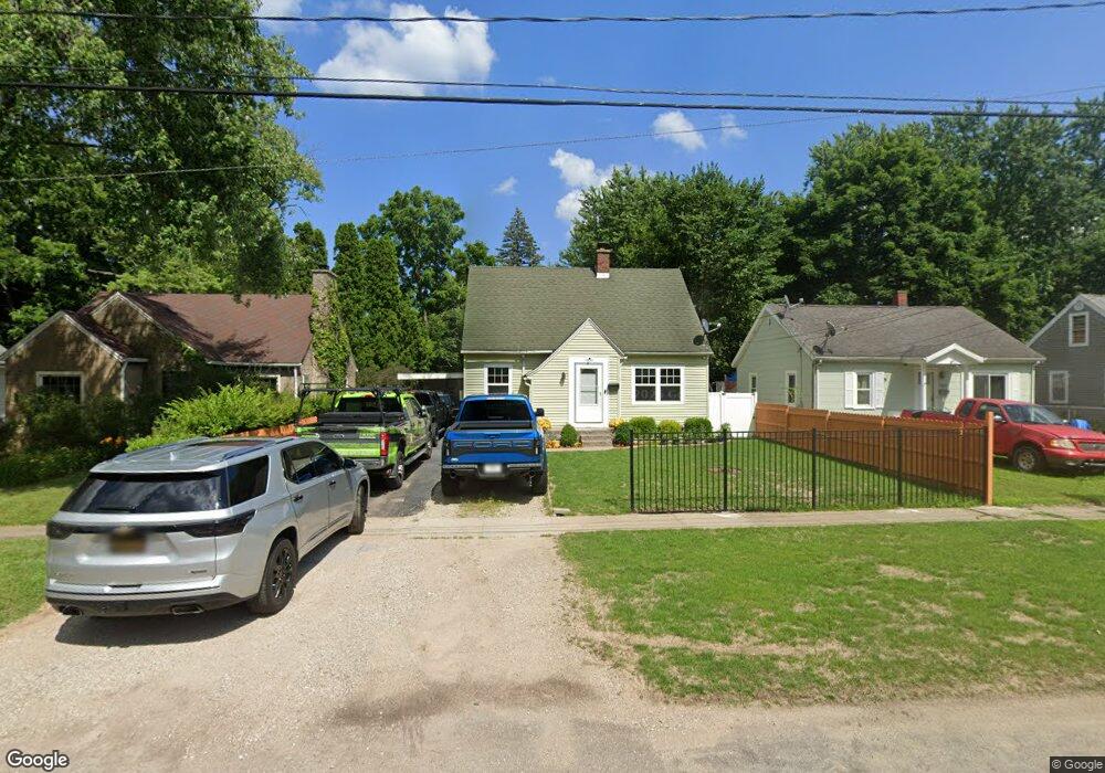
1032 Arthur Ave Kalamazoo, MI 49048
Estimated Value: $170,000 - $176,850
3
Beds
1
Bath
1,380
Sq Ft
$126/Sq Ft
Est. Value
About This Home
This home is located at 1032 Arthur Ave, Kalamazoo, MI 49048 and is currently estimated at $173,713, approximately $125 per square foot. 1032 Arthur Ave is a home located in Kalamazoo County with nearby schools including Northeastern Elementary School, Linden Grove Middle School, and Kalamazoo Central High School.
Ownership History
Date
Name
Owned For
Owner Type
Purchase Details
Closed on
Jun 5, 2009
Sold by
Devereaux James R
Bought by
Vargas Francisco
Current Estimated Value
Purchase Details
Closed on
Apr 5, 2007
Sold by
Doerschler Matthew James and Ridings Sara Lynn
Bought by
Deutsche Bank National Trust Co and Ameriquest Mortgage Securities Inc Asset
Purchase Details
Closed on
Jul 29, 2004
Sold by
Doerschler Matthew J and Doerschler Sara Lynn
Bought by
Doerschler Matthew J and Doerschler Sara Lynn
Home Financials for this Owner
Home Financials are based on the most recent Mortgage that was taken out on this home.
Original Mortgage
$86,400
Interest Rate
6.35%
Mortgage Type
Stand Alone Refi Refinance Of Original Loan
Create a Home Valuation Report for This Property
The Home Valuation Report is an in-depth analysis detailing your home's value as well as a comparison with similar homes in the area
Home Values in the Area
Average Home Value in this Area
Purchase History
| Date | Buyer | Sale Price | Title Company |
|---|---|---|---|
| Vargas Francisco | $59,900 | Devon Title | |
| Deutsche Bank National Trust Co | $89,368 | None Available | |
| Doerschler Matthew J | -- | Devon Title |
Source: Public Records
Mortgage History
| Date | Status | Borrower | Loan Amount |
|---|---|---|---|
| Previous Owner | Doerschler Matthew J | $86,400 |
Source: Public Records
Tax History Compared to Growth
Tax History
| Year | Tax Paid | Tax Assessment Tax Assessment Total Assessment is a certain percentage of the fair market value that is determined by local assessors to be the total taxable value of land and additions on the property. | Land | Improvement |
|---|---|---|---|---|
| 2025 | $1,935 | $76,200 | $0 | $0 |
| 2024 | $369 | $61,100 | $0 | $0 |
| 2023 | $351 | $49,600 | $0 | $0 |
| 2022 | $1,760 | $48,900 | $0 | $0 |
| 2021 | $1,653 | $43,800 | $0 | $0 |
| 2020 | $1,626 | $37,900 | $0 | $0 |
| 2019 | $1,553 | $33,200 | $0 | $0 |
| 2018 | $1,514 | $28,800 | $0 | $0 |
| 2017 | $0 | $28,800 | $0 | $0 |
| 2016 | -- | $27,700 | $0 | $0 |
| 2015 | -- | $27,600 | $0 | $0 |
| 2014 | -- | $28,100 | $0 | $0 |
Source: Public Records
Map
Nearby Homes
- 1030 Dwillard Dr
- 925 Dayton Ave
- 1312 Sunnyside Dr
- 1013 Chrysler St
- 1242 Nassau St
- 1415 Upland Dr
- 1512 Upland Dr
- 3305 Kenilworth Ave
- 1008 Cooper Ave
- 518 Dayton Ave
- 1727 Sunnyside Dr
- 905 Cooper Ave
- 1320 Nazareth Rd
- 811 Cooper Ave
- 3221 Miami Ave
- 535 Washburn Ave
- 2820 Asbury Ave
- 713 Chicago Ave
- 707 Fenimore Ave
- 705 Fenimore Ave
- 1024 Arthur Ave
- 1106 Arthur Ave
- 1022 Arthur Ave
- 1110 Arthur Ave
- 1105 Dwillard Dr
- 1025 Dwillard Dr
- 1016 Arthur Ave
- 1114 Arthur Ave
- 1120 Arthur Ave
- 1017 Dwillard Dr
- 1031 Arthur Ave
- 1012 Arthur Ave
- 1025 Arthur Ave
- 1103 Arthur Ave
- 1107 Arthur Ave
- 1021 Arthur Ave
- 1113 Arthur Ave
- 1008 Arthur Ave
- 2918 E Main St
- 1007 Dwillard Dr