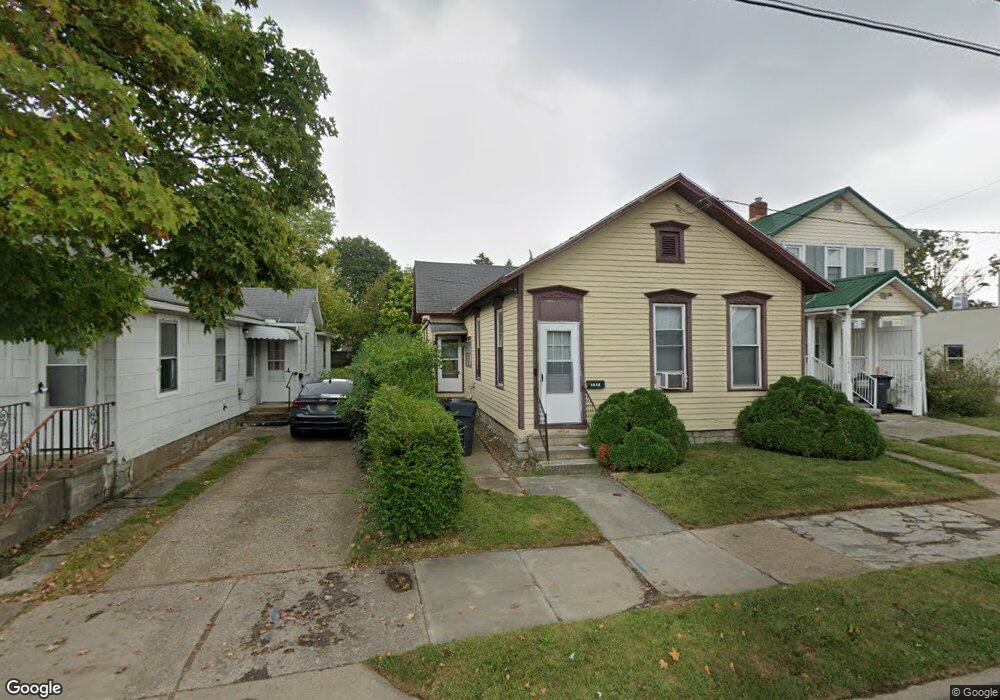
1032 Camp St Sandusky, OH 44870
Estimated Value: $58,000 - $106,000
4
Beds
2
Baths
1,032
Sq Ft
$84/Sq Ft
Est. Value
About This Home
This home is located at 1032 Camp St, Sandusky, OH 44870 and is currently estimated at $87,000, approximately $84 per square foot. 1032 Camp St is a home located in Erie County with nearby schools including Sandusky High School, Monroe Preparatory Academy, and Sandusky Central Catholic School.
Ownership History
Date
Name
Owned For
Owner Type
Purchase Details
Closed on
Aug 30, 2016
Sold by
S & J Property Management Llc
Bought by
C R S Investment Properties Llc
Current Estimated Value
Purchase Details
Closed on
Mar 24, 2014
Sold by
Haider Junaid
Bought by
S & J Property Management Llc
Purchase Details
Closed on
Aug 21, 2008
Sold by
J P Morgan Chase Bank
Bought by
Haider Junaid
Purchase Details
Closed on
Nov 28, 2007
Sold by
Ramsey Bertha L
Bought by
Jpmorgan Chase Bank
Create a Home Valuation Report for This Property
The Home Valuation Report is an in-depth analysis detailing your home's value as well as a comparison with similar homes in the area
Home Values in the Area
Average Home Value in this Area
Purchase History
| Date | Buyer | Sale Price | Title Company |
|---|---|---|---|
| C R S Investment Properties Llc | $8,000 | None Available | |
| S & J Property Management Llc | -- | First American Title Ins Co | |
| Haider Junaid | $13,000 | Accutitle Agency Inc | |
| Jpmorgan Chase Bank | $31,000 | None Available |
Source: Public Records
Tax History Compared to Growth
Tax History
| Year | Tax Paid | Tax Assessment Tax Assessment Total Assessment is a certain percentage of the fair market value that is determined by local assessors to be the total taxable value of land and additions on the property. | Land | Improvement |
|---|---|---|---|---|
| 2024 | $809 | $20,548 | $3,031 | $17,517 |
| 2023 | $809 | $14,906 | $2,425 | $12,481 |
| 2022 | $756 | $14,906 | $2,425 | $12,481 |
| 2021 | $763 | $14,910 | $2,430 | $12,480 |
| 2020 | $793 | $14,250 | $2,430 | $11,820 |
| 2019 | $815 | $14,250 | $2,430 | $11,820 |
| 2018 | $816 | $14,250 | $2,430 | $11,820 |
| 2017 | $887 | $15,430 | $2,610 | $12,820 |
| 2016 | $886 | $15,430 | $2,610 | $12,820 |
| 2015 | $803 | $15,430 | $2,610 | $12,820 |
| 2014 | $872 | $16,860 | $2,610 | $14,250 |
| 2013 | $863 | $16,860 | $2,610 | $14,250 |
Source: Public Records
Map
Nearby Homes
- 1329 Carr St
- 1225 Polk St
- 1204 W Monroe St
- 1413 Seneca St
- 1317 Stone St
- 621 Mcdonough St
- 1813 Sandusky St
- 912 Central Ave
- 1017 Putnam St
- 1318 Mills St
- 1618 Mcdonough St
- 1311 Filmore St
- 1014 Jay St
- 717 W Osborne St
- 934 W Washington St Unit 2B
- 934 W Washington St Unit 1A
- 823 Decatur St
- 831 Decatur St
- 1514 Prospect St
- 1319 Tiffin Ave