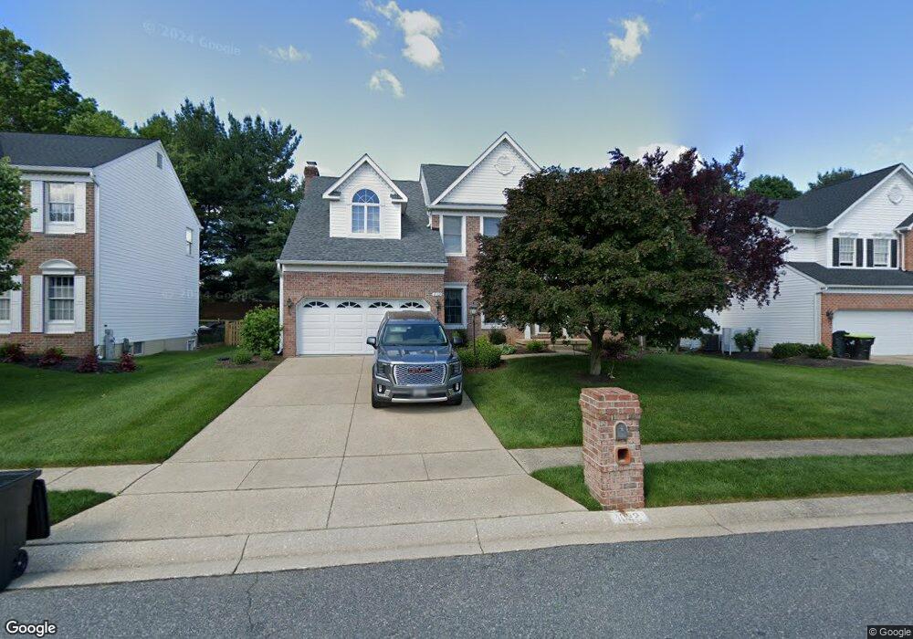
1032 Hazel Ln Bel Air, MD 21014
Estimated Value: $588,227 - $670,000
--
Bed
3
Baths
2,587
Sq Ft
$247/Sq Ft
Est. Value
About This Home
This home is located at 1032 Hazel Ln, Bel Air, MD 21014 and is currently estimated at $640,057, approximately $247 per square foot. 1032 Hazel Ln is a home located in Harford County with nearby schools including Homestead-Wakefield Elementary School, Bel Air Middle School, and Bel Air High School.
Ownership History
Date
Name
Owned For
Owner Type
Purchase Details
Closed on
Jul 16, 2024
Sold by
Mcdonough Kevin and Mcdonough Susan
Bought by
Mcdonough Family Trust and Mcdonough
Current Estimated Value
Purchase Details
Closed on
Sep 9, 1997
Sold by
Stapf Contractors Llc
Bought by
Mcdonough Kevin and Mc Donough Susan
Purchase Details
Closed on
Jun 18, 1997
Sold by
Westleigh Llc
Bought by
Stapf Contractors Llc
Create a Home Valuation Report for This Property
The Home Valuation Report is an in-depth analysis detailing your home's value as well as a comparison with similar homes in the area
Home Values in the Area
Average Home Value in this Area
Purchase History
| Date | Buyer | Sale Price | Title Company |
|---|---|---|---|
| Mcdonough Family Trust | -- | None Listed On Document | |
| Mcdonough Family Trust | -- | None Listed On Document | |
| Mcdonough Kevin | $250,273 | -- | |
| Stapf Contractors Llc | $62,500 | -- |
Source: Public Records
Mortgage History
| Date | Status | Borrower | Loan Amount |
|---|---|---|---|
| Closed | Mcdonough Kevin | -- |
Source: Public Records
Tax History Compared to Growth
Tax History
| Year | Tax Paid | Tax Assessment Tax Assessment Total Assessment is a certain percentage of the fair market value that is determined by local assessors to be the total taxable value of land and additions on the property. | Land | Improvement |
|---|---|---|---|---|
| 2025 | $4,766 | $460,800 | $133,500 | $327,300 |
| 2024 | $4,509 | $437,267 | $0 | $0 |
| 2023 | $4,509 | $413,733 | $0 | $0 |
| 2022 | $4,253 | $390,200 | $133,500 | $256,700 |
| 2021 | $4,414 | $386,333 | $0 | $0 |
| 2020 | $4,414 | $382,467 | $0 | $0 |
| 2019 | $4,369 | $378,600 | $123,700 | $254,900 |
| 2018 | $4,325 | $378,200 | $0 | $0 |
| 2017 | $4,320 | $378,600 | $0 | $0 |
| 2016 | $140 | $377,400 | $0 | $0 |
| 2015 | $4,450 | $377,233 | $0 | $0 |
| 2014 | $4,450 | $377,067 | $0 | $0 |
Source: Public Records
Map
Nearby Homes
- 1055 Sansa Ct
- 416 Salvia Ct
- 600 Harvest Ct
- 412 Viola Ct N
- 726 Iron Gate Rd
- 515 W Ring Factory Rd
- 110 W Ring Factory Rd
- 1504 Houndslow Ct
- 3 Forest Dr
- 804 Grady Ct
- 231 E Belcrest Rd
- 4 Colonial Rd
- 2 Colonial Ct
- 2 Colonial Rd
- 632 Camelot Dr
- 17 Bonnie Ave
- 68 Crystal Ct
- 1505 Westminster Ct
- 12 Lexington Rd
- 123 Wakely Terrace