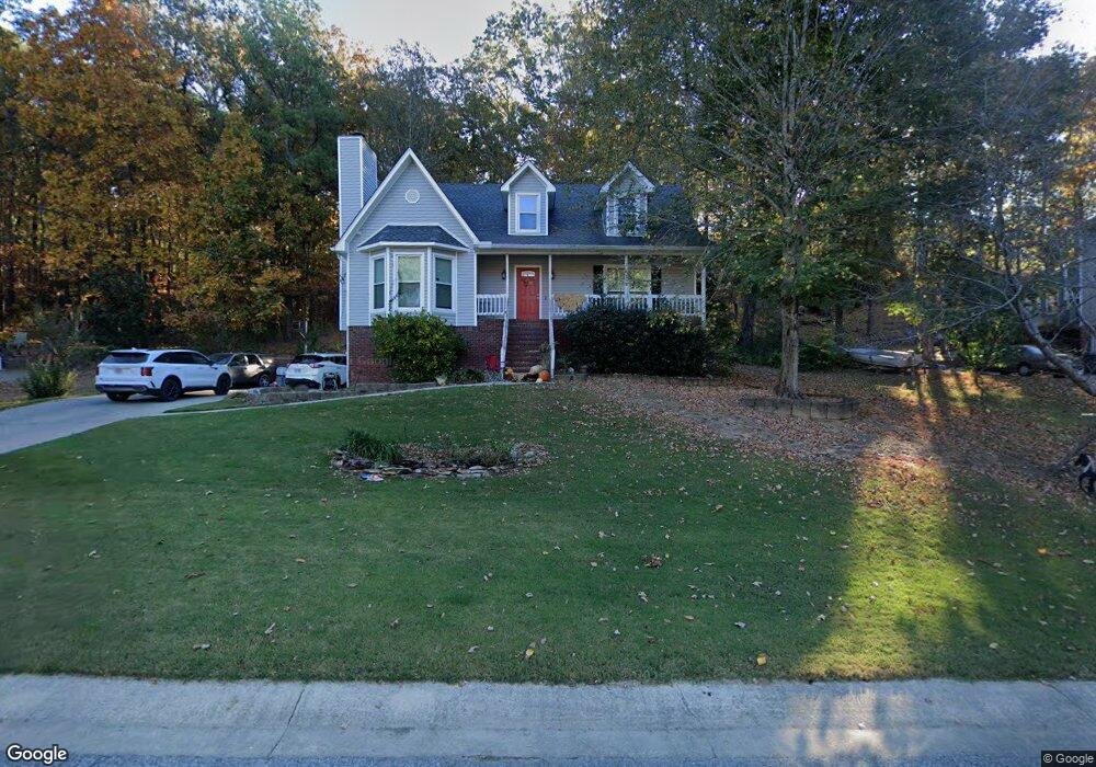
1032 Independence Ct Alabaster, AL 35007
Estimated Value: $283,000 - $311,000
Studio
2
Baths
1,806
Sq Ft
$164/Sq Ft
Est. Value
About This Home
This home is located at 1032 Independence Ct, Alabaster, AL 35007 and is currently estimated at $296,109, approximately $163 per square foot. 1032 Independence Ct is a home located in Shelby County with nearby schools including Thompson Intermediate School, Thompson Middle School, and Thompson High School.
Ownership History
Date
Name
Owned For
Owner Type
Purchase Details
Closed on
Oct 18, 2000
Sold by
Jenkins Landry Becky Lee and Jenkins Philip A
Bought by
Underhill George T and Underhill Susan Byars
Current Estimated Value
Home Financials for this Owner
Home Financials are based on the most recent Mortgage that was taken out on this home.
Original Mortgage
$129,200
Outstanding Balance
$47,084
Interest Rate
7.91%
Estimated Equity
$249,025
Create a Home Valuation Report for This Property
The Home Valuation Report is an in-depth analysis detailing your home's value as well as a comparison with similar homes in the area
Home Values in the Area
Average Home Value in this Area
Purchase History
| Date | Buyer | Sale Price | Title Company |
|---|---|---|---|
| Underhill George T | $136,000 | -- |
Source: Public Records
Mortgage History
| Date | Status | Borrower | Loan Amount |
|---|---|---|---|
| Open | Underhill George T | $129,200 |
Source: Public Records
Tax History
| Year | Tax Paid | Tax Assessment Tax Assessment Total Assessment is a certain percentage of the fair market value that is determined by local assessors to be the total taxable value of land and additions on the property. | Land | Improvement |
|---|---|---|---|---|
| 2024 | $1,399 | $25,900 | $0 | $0 |
| 2023 | $1,241 | $23,740 | $0 | $0 |
| 2022 | $1,190 | $22,800 | $0 | $0 |
| 2021 | $1,043 | $20,080 | $0 | $0 |
| 2020 | $975 | $18,820 | $0 | $0 |
| 2019 | $901 | $17,440 | $0 | $0 |
| 2017 | $791 | $15,400 | $0 | $0 |
| 2015 | $755 | $14,740 | $0 | $0 |
| 2014 | $737 | $14,400 | $0 | $0 |
Source: Public Records
Map
Nearby Homes
- 1125 Independence Dr
- 2026 Amberley Woods Trail
- 1509 Sequoia Trail
- 1349 Old Boston Rd
- 1317 W Navajo Dr
- 1317 Old Boston Rd
- 109 Longfeather Cir
- 110 Frances Ln
- 152 Roy Ct
- 112 Portsouth Ln
- 1222 Falling Star Ln
- 834 Burning Tree Trail
- 122 Roy Ct
- 2916 Dublin Dr N
- 000 9th St NW
- 0001 9th St NW
- 1208 Siskin Dr
- 204 Portsouth Ln
- 542 Navajo Trail
- 301 Tradewinds Cir
- 1034 Independence Ct
- 1030 Independence Ct
- 1105 Independence Dr
- 1103 Independence Dr
- 1036 Independence Ct
- 1033 Independence Ct
- 1028 Independence Ct
- 1035 Independence Ct
- 1107 Independence Dr
- 1031 Independence Ct
- 1101 Independence Dr
- 1037 Independence Ct
- 1029 Independence Ct
- 1109 Independence Dr
- 1024 Independence Ct
- 1038 Independence Ct
- 1039 Independence Ct
- 1025 Independence Dr
- 1111 Independence Dr
- 1025 Independence Ct
Your Personal Tour Guide
Ask me questions while you tour the home.