Estimated Value: $200,031 - $242,000
3
Beds
1
Bath
1,008
Sq Ft
$224/Sq Ft
Est. Value
About This Home
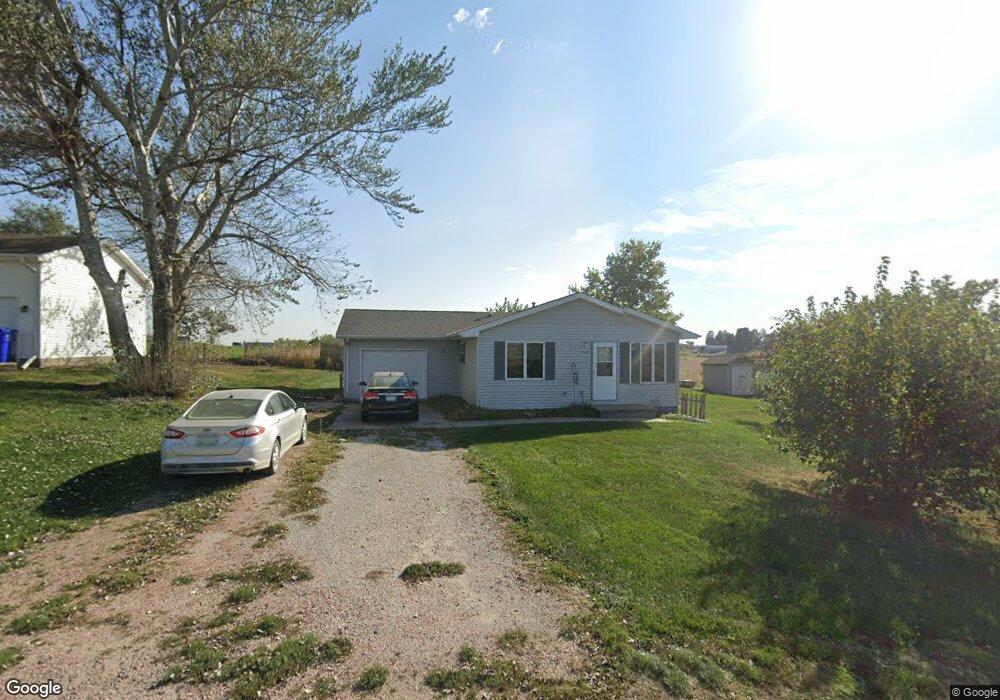
This home is located at 1032 Kerry Ln, Logan, IA 51546 and is currently estimated at $225,758, approximately $223 per square foot. 1032 Kerry Ln is a home located in Harrison County with nearby schools including Logan-Magnolia Elementary School and Logan-Magnolia Junior/Senior High School.
Create a Home Valuation Report for This Property
The Home Valuation Report is an in-depth analysis detailing your home's value as well as a comparison with similar homes in the area
Home Values in the Area
Average Home Value in this Area
Tax History Compared to Growth
Tax History
| Year | Tax Paid | Tax Assessment Tax Assessment Total Assessment is a certain percentage of the fair market value that is determined by local assessors to be the total taxable value of land and additions on the property. | Land | Improvement |
|---|---|---|---|---|
| 2025 | $2,690 | $179,330 | $19,800 | $159,530 |
| 2024 | $2,690 | $163,340 | $19,800 | $143,540 |
| 2023 | $2,592 | $163,340 | $19,800 | $143,540 |
| 2022 | $2,222 | $122,899 | $19,800 | $103,099 |
| 2021 | $2,222 | $122,899 | $19,800 | $103,099 |
| 2020 | $2,028 | $115,890 | $19,800 | $96,090 |
| 2019 | $1,784 | $115,890 | $19,800 | $96,090 |
| 2018 | $1,744 | $97,609 | $0 | $0 |
| 2017 | $1,744 | $97,609 | $0 | $0 |
| 2016 | $1,828 | $97,609 | $0 | $0 |
| 2015 | $1,828 | $87,936 | $0 | $0 |
| 2014 | $1,576 | $87,936 | $0 | $0 |
Source: Public Records
Map
Nearby Homes
- 1010 Skyline Dr
- 124 Glen Ave
- 721 Glen Rd
- 415 Wessar Dr
- 114 E 10th St
- Lot 18 Mulligan Trail
- 2607 220th St
- 2144 Norton Ave
- LOT 27 Mulligan Trail
- 2484 280th St
- LOT 26 Lmvcc Estates
- 2464 Mulligan Trail
- LOT 20 Lmvcc Estates
- LOT 17 Lmvcc Estates
- Lot 17 Lmvcc Estates Trail
- LOT 15 Mulligan Trail
- 2853 Preston Place
- LOT D Fieldcrest Dr
- LOT E & K Fieldcrest Dr
- LOT C Fieldcrest Dr
- 6 LOTS Kerry Ln
- 0000 Kerry Ln
- LOT 5 Kerry Ln
- LOT 11 Kerry Ln
- LOT 10 Kerry Ln
- LOT 16 Kerry Ln
- 1042 Kerry Ln
- 1011 Kerry Ln
- 812 Kole Dr
- 932 Kerry Ln
- 1111 Kerry Ln
- 925 Kerry Ln
- 1121 Kerry Ln
- 2467 Norton Ave
- 2467 Norton Ave
- 2630 242nd Trail
- 1300 Kerry Ln
- 2636 242nd Trail
- 2623 242nd Trail
- 2639 242nd Trail