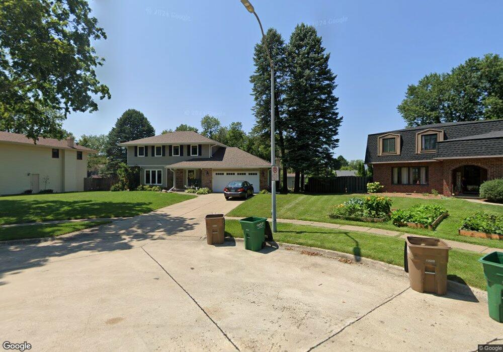
1032 Maplenol Cir West Des Moines, IA 50266
Estimated Value: $323,000 - $352,000
4
Beds
3
Baths
1,876
Sq Ft
$181/Sq Ft
Est. Value
About This Home
This home is located at 1032 Maplenol Cir, West Des Moines, IA 50266 and is currently estimated at $339,199, approximately $180 per square foot. 1032 Maplenol Cir is a home located in Polk County with nearby schools including Crossroads Park Elementary School, Indian Hills Junior High School, and Valley Southwoods Freshman High School.
Ownership History
Date
Name
Owned For
Owner Type
Purchase Details
Closed on
May 23, 2024
Sold by
Smeins Chad R and Smeins Angela
Bought by
Chad Il Smeins Revocable Trust and Angela Smeins Revocable Trust
Current Estimated Value
Purchase Details
Closed on
Jul 8, 1997
Sold by
Wright Dianne L
Bought by
Smeins Chad and Smeins Angela
Home Financials for this Owner
Home Financials are based on the most recent Mortgage that was taken out on this home.
Original Mortgage
$103,500
Interest Rate
8%
Create a Home Valuation Report for This Property
The Home Valuation Report is an in-depth analysis detailing your home's value as well as a comparison with similar homes in the area
Home Values in the Area
Average Home Value in this Area
Purchase History
| Date | Buyer | Sale Price | Title Company |
|---|---|---|---|
| Chad Il Smeins Revocable Trust | -- | None Listed On Document | |
| Smeins Chad | $129,000 | -- |
Source: Public Records
Mortgage History
| Date | Status | Borrower | Loan Amount |
|---|---|---|---|
| Previous Owner | Smeins Chad | $103,500 |
Source: Public Records
Tax History Compared to Growth
Tax History
| Year | Tax Paid | Tax Assessment Tax Assessment Total Assessment is a certain percentage of the fair market value that is determined by local assessors to be the total taxable value of land and additions on the property. | Land | Improvement |
|---|---|---|---|---|
| 2025 | $4,550 | $332,200 | $66,200 | $266,000 |
| 2024 | $4,550 | $297,500 | $58,500 | $239,000 |
| 2023 | $4,474 | $297,500 | $58,500 | $239,000 |
| 2022 | $4,420 | $240,600 | $49,000 | $191,600 |
| 2021 | $4,256 | $240,600 | $49,000 | $191,600 |
| 2020 | $4,188 | $220,800 | $44,800 | $176,000 |
| 2019 | $3,980 | $220,800 | $44,800 | $176,000 |
| 2018 | $3,986 | $202,800 | $39,900 | $162,900 |
| 2017 | $3,732 | $202,800 | $39,900 | $162,900 |
| 2016 | $3,648 | $185,100 | $35,900 | $149,200 |
| 2015 | $3,648 | $185,100 | $35,900 | $149,200 |
| 2014 | $3,380 | $170,300 | $32,800 | $137,500 |
Source: Public Records
Map
Nearby Homes
- 1035 Belle Mar Dr
- 1007 Marcourt Ln
- 1100 42nd St
- 3931 Ashworth Rd
- 3905 Francrest Dr
- 942 42nd St
- 909 39th St
- 4533 Woodland Ave Unit 2
- 4549 Woodland Ave Unit 4
- 4609 Woodland Ave Unit 5
- 4830 Cedar Dr Unit 86
- 4300 Pommel Place
- 3701 Aspen Dr
- 4765 Woodland Ave Unit 4
- 4781 Woodland Ave Unit 2
- 1112 49th St Unit 2
- 4849 Woodland Ave Unit 3
- 4865 Woodland Ave Unit 1
- 1168 49th St Unit 1
- 4801 Westbrooke Place
- 1028 Maplenol Dr
- 1038 Maplenol Cir
- 1041 Belle Mar Dr
- 1044 Maplenol Cir
- 1007 Belle Mar Dr
- 1013 Belle Mar Dr
- 1025 Maplenol Dr
- 1059 Belle Mar Dr
- 1053 Belle Mar Dr
- 1065 Belle Mar Dr
- 1050 Maplenol Dr
- 1019 Maplenol Dr
- 1029 Belle Mar Dr
- 1071 Belle Mar Dr
- 1031 Maplenol Dr
- 1014 Marcourt Ln
- 1056 Maplenol Dr
- 1049 Maplenol Dr
- 1048 Belle Mar Dr