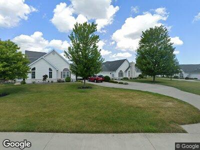
1032 Mohawk Way Wauseon, OH 43567
Wauseon NeighborhoodEstimated Value: $165,408 - $228,000
2
Beds
2
Baths
1,298
Sq Ft
$154/Sq Ft
Est. Value
About This Home
This home is located at 1032 Mohawk Way, Wauseon, OH 43567 and is currently estimated at $199,352, approximately $153 per square foot. 1032 Mohawk Way is a home located in Fulton County with nearby schools including Wauseon Primary School, Wauseon Elementary School, and Wauseon Middle School.
Ownership History
Date
Name
Owned For
Owner Type
Purchase Details
Closed on
Jun 9, 2017
Sold by
Laidlaw Joan M
Bought by
Laidlaw Robert and Laidlaw Andrew
Current Estimated Value
Create a Home Valuation Report for This Property
The Home Valuation Report is an in-depth analysis detailing your home's value as well as a comparison with similar homes in the area
Home Values in the Area
Average Home Value in this Area
Purchase History
| Date | Buyer | Sale Price | Title Company |
|---|---|---|---|
| Laidlaw Robert | -- | Attorney |
Source: Public Records
Mortgage History
| Date | Status | Borrower | Loan Amount |
|---|---|---|---|
| Closed | Miller Ronald F | $88,000 |
Source: Public Records
Tax History Compared to Growth
Tax History
| Year | Tax Paid | Tax Assessment Tax Assessment Total Assessment is a certain percentage of the fair market value that is determined by local assessors to be the total taxable value of land and additions on the property. | Land | Improvement |
|---|---|---|---|---|
| 2024 | $2,464 | $48,370 | $420 | $47,950 |
| 2023 | $2,464 | $48,370 | $420 | $47,950 |
| 2022 | $2,654 | $43,930 | $350 | $43,580 |
| 2021 | $2,811 | $43,930 | $350 | $43,580 |
| 2020 | $2,581 | $43,930 | $350 | $43,580 |
| 2019 | $2,290 | $38,290 | $350 | $37,940 |
| 2018 | $1,889 | $38,290 | $350 | $37,940 |
| 2017 | $1,598 | $38,290 | $350 | $37,940 |
| 2016 | $1,671 | $38,290 | $350 | $37,940 |
| 2015 | $1,570 | $38,290 | $350 | $37,940 |
| 2014 | $1,490 | $38,290 | $350 | $37,940 |
| 2013 | $1,736 | $40,570 | $1,020 | $39,550 |
Source: Public Records
Map
Nearby Homes
- 928 Black Hawk Dr
- 1285 N Shoop Ave
- 13354 U S 20a
- 0 Neva Dr Unit 6105767
- 00 Glenwood
- 0 Glenwood Unit 6124946
- 755 N Harvest Ln
- 745 N Harvest Ln
- 460 Airport Hwy
- 634 Cherry St
- 210 E Elm St
- 243 Maple St
- 240 W Oak St
- 1270 S Park Ln
- 119 Cherry St
- 310 W Oak St
- 588 Douglas Dr
- 749 Parkside Dr
- 14900 County Road H Unit 84
- 14900 County Road H Unit 85
- 1032 Mohawk Way
- 934 Arrowhead Trail
- 930 Arrowhead Trail
- 1034 Mohawk Way
- 0 Mohawk Way Unit 2 4505601
- 0 Mohawk Way Unit 2 4522649
- 0 Mohawk Way Unit 3 4649078
- 4 Mohawk Way Unit 3
- 1 Mohawk Way
- 2 Mohawk Way
- 1028 Mohawk Way Unit 1028
- 1022 Mohawk Way Unit 1022
- 1024 Mohawk Way Unit 1024
- 1026 Mohawk Way Unit 1026
- 1033 Mohawk Way
- 927 Arrowhead Trail
- 925 Arrowhead Trail
- 935 & 937 Arrowhead Trail
- 1037 Mohawk Way Unit 1037M
- 1035 Mohawk Way