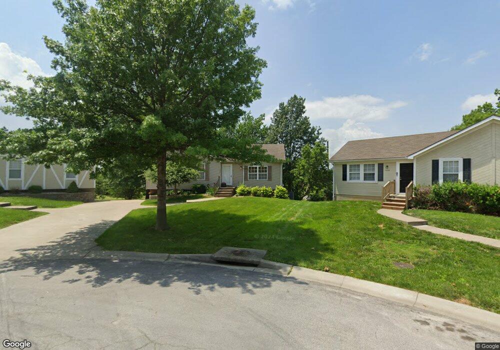
1032 NE Queens Ct Lees Summit, MO 64064
Estimated Value: $291,205 - $382,000
3
Beds
2
Baths
1,080
Sq Ft
$304/Sq Ft
Est. Value
About This Home
This home is located at 1032 NE Queens Ct, Lees Summit, MO 64064 and is currently estimated at $328,301, approximately $303 per square foot. 1032 NE Queens Ct is a home located in Jackson County with nearby schools including Voy Spears Jr. Elementary School, Delta Woods Middle School, and Blue Springs South High School.
Ownership History
Date
Name
Owned For
Owner Type
Purchase Details
Closed on
Aug 15, 1996
Sold by
Newsom Farris Foundations Inc
Bought by
Buller Elizabeth A and Buller Beth A
Current Estimated Value
Home Financials for this Owner
Home Financials are based on the most recent Mortgage that was taken out on this home.
Original Mortgage
$60,000
Outstanding Balance
$4,718
Interest Rate
8.15%
Mortgage Type
Purchase Money Mortgage
Estimated Equity
$323,583
Create a Home Valuation Report for This Property
The Home Valuation Report is an in-depth analysis detailing your home's value as well as a comparison with similar homes in the area
Home Values in the Area
Average Home Value in this Area
Purchase History
| Date | Buyer | Sale Price | Title Company |
|---|---|---|---|
| Buller Elizabeth A | -- | Chicago Title Insurance Co |
Source: Public Records
Mortgage History
| Date | Status | Borrower | Loan Amount |
|---|---|---|---|
| Open | Buller Elizabeth A | $60,000 |
Source: Public Records
Tax History Compared to Growth
Tax History
| Year | Tax Paid | Tax Assessment Tax Assessment Total Assessment is a certain percentage of the fair market value that is determined by local assessors to be the total taxable value of land and additions on the property. | Land | Improvement |
|---|---|---|---|---|
| 2025 | $3,390 | $40,455 | $7,475 | $32,980 |
| 2024 | $3,329 | $44,270 | $1,837 | $42,433 |
| 2023 | $3,329 | $44,271 | $5,349 | $38,922 |
| 2022 | $2,598 | $30,590 | $2,803 | $27,787 |
| 2021 | $2,595 | $30,590 | $2,803 | $27,787 |
| 2020 | $2,495 | $29,088 | $2,803 | $26,285 |
| 2019 | $2,419 | $29,088 | $2,803 | $26,285 |
| 2018 | $2,412 | $28,143 | $4,650 | $23,493 |
| 2017 | $2,412 | $28,143 | $4,650 | $23,493 |
| 2016 | $2,091 | $24,472 | $4,731 | $19,741 |
| 2014 | $1,874 | $21,795 | $4,854 | $16,941 |
Source: Public Records
Map
Nearby Homes
- 4517 NE Fairway Homes Dr
- 917 NE Kenwood Dr
- 4524 NE Kingston Dr
- 708 NE Lake Pointe Dr
- 4600 NE Kingston Dr
- 4605 NE Kingston Dr
- 637 NE Shoreline Dr
- 1108 NE Goshen Ct
- 4557 NE Webster Dr
- 1225 NE Kenwood Dr
- 4405 NE Blue Jay Dr
- 4412 NE Gateway Dr
- 712 NE Ashmont Place
- 1317 NE Kenwood Dr
- 1305 NE Goshen Dr
- 824 NE Algonquin St Unit A
- 4213 NE Kennesaw Ridge
- 4015 NE Sagamore Dr
- 793 NE Algonquin St Unit A
- 801 NE Fairway Homes Ct
- 1028 NE Queens Ct
- 1036 NE Queens Ct
- 1024 NE Queens Ct
- 1044 NE Queens Ct
- 1020 NE Queens Ct
- 1048 NE Queens Ct
- 1056 NE Queens Ct
- 1052 NE Queens Ct
- 1016 NE Queens Ct
- 1012 NE Queens Ct
- 1008 NE Queens Ct
- 1053 NE Queens Cir
- 1049 NE Queens Cir
- 1004 NE Queens Ct
- 1000 NE Queens Ct
- 1057 NE Queens Cir
- 1045 NE Queens Cir
- 1041 NE Queens Cir
- 1001 NE Queens Cir
- 1037 NE Queens Cir