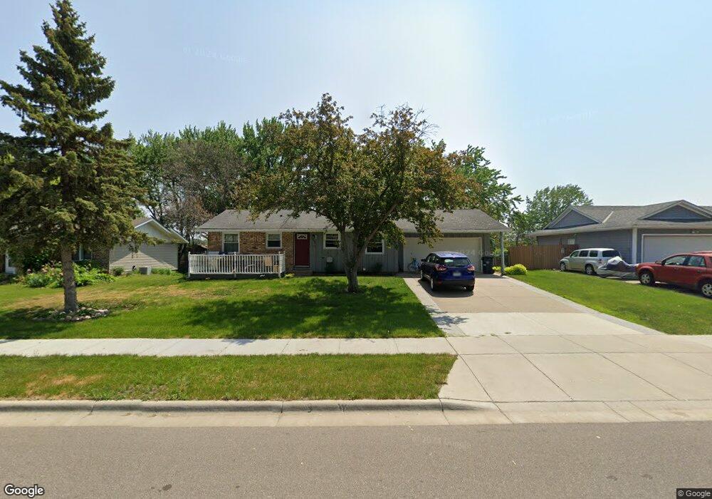
1032 Ramsdell Dr Saint Paul, MN 55124
Old Town NeighborhoodEstimated Value: $362,000 - $375,000
4
Beds
2
Baths
1,005
Sq Ft
$365/Sq Ft
Est. Value
About This Home
This home is located at 1032 Ramsdell Dr, Saint Paul, MN 55124 and is currently estimated at $366,796, approximately $364 per square foot. 1032 Ramsdell Dr is a home located in Dakota County with nearby schools including Southview Elementary School, Valley Middle School, and Apple Valley Senior High School.
Ownership History
Date
Name
Owned For
Owner Type
Purchase Details
Closed on
Sep 27, 2018
Sold by
Schneider Rental Properties Llc
Bought by
Voge Alexa Rae and Voge Adam W Rae
Current Estimated Value
Home Financials for this Owner
Home Financials are based on the most recent Mortgage that was taken out on this home.
Original Mortgage
$241,300
Outstanding Balance
$88,416
Interest Rate
4.5%
Mortgage Type
Stand Alone Second
Estimated Equity
$278,380
Purchase Details
Closed on
Oct 10, 2016
Sold by
Schneider Joshua and Plas Catherine Vanden
Bought by
Schneider Rental Properties Llc
Purchase Details
Closed on
Jan 29, 2009
Sold by
Schneider Eileen C
Bought by
Schneider Joshua
Create a Home Valuation Report for This Property
The Home Valuation Report is an in-depth analysis detailing your home's value as well as a comparison with similar homes in the area
Home Values in the Area
Average Home Value in this Area
Purchase History
| Date | Buyer | Sale Price | Title Company |
|---|---|---|---|
| Voge Alexa Rae | $254,000 | Titlesmart Inc | |
| Schneider Rental Properties Llc | -- | None Available | |
| Schneider Joshua | $205,000 | -- |
Source: Public Records
Mortgage History
| Date | Status | Borrower | Loan Amount |
|---|---|---|---|
| Open | Voge Alexa Rae | $241,300 | |
| Closed | Voge Alexa Rae | $241,300 |
Source: Public Records
Tax History
| Year | Tax Paid | Tax Assessment Tax Assessment Total Assessment is a certain percentage of the fair market value that is determined by local assessors to be the total taxable value of land and additions on the property. | Land | Improvement |
|---|---|---|---|---|
| 2024 | $3,752 | $342,700 | $83,000 | $259,700 |
| 2023 | $3,752 | $336,400 | $83,100 | $253,300 |
| 2022 | $3,270 | $338,000 | $82,900 | $255,100 |
| 2021 | $3,034 | $289,700 | $72,100 | $217,600 |
| 2020 | $3,044 | $265,100 | $68,600 | $196,500 |
| 2019 | $2,608 | $258,600 | $65,400 | $193,200 |
| 2018 | $2,754 | $234,600 | $62,200 | $172,400 |
| 2017 | $2,752 | $224,300 | $59,300 | $165,000 |
| 2016 | $2,481 | $212,300 | $56,500 | $155,800 |
| 2015 | $2,365 | $184,902 | $50,263 | $134,639 |
| 2014 | -- | $177,381 | $48,016 | $129,365 |
| 2013 | -- | $161,794 | $43,683 | $118,111 |
Source: Public Records
Map
Nearby Homes
- 946 Redwood Dr
- 120 Oakwood Rd
- 15621 Highview Dr
- 1801 Keller Lake Dr
- 1704 Sunrise Ct
- 14709 White Oak Dr
- 14704 White Oak Dr
- 15765 Hayes Trail
- 858 Haralson Dr
- 1309 Keller Lake Rd
- 8681 144th Street Ct
- 1416 Forest Park Ln
- 15740 Harmony Way
- 15958 Harwell Ave
- 8560 Holland Ave
- 15809 Harmony Way Ct
- 15635 Hallmark Path
- 8427 143rd St W
- 14207 Hibiscus Ct
- 15125 Southwind Dr
- 1028 Ramsdell Dr
- 1036 Ramsdell Dr
- 1033 Baldwin Dr
- 1040 Ramsdell Dr
- 1024 Ramsdell Dr
- 1037 Baldwin Dr
- 1029 Baldwin Dr
- 1031 Ramsdell Dr
- 1027 Ramsdell Dr
- 1035 Ramsdell Dr
- 1041 Baldwin Dr
- 1025 Baldwin Dr
- 1044 Ramsdell Dr
- 1020 Lowell Dr
- 1034 Lowell Dr
- 1039 Ramsdell Dr
- 1045 Baldwin Dr
- 1021 Baldwin Dr
- 1048 Ramsdell Dr
- 1038 Lowell Dr
Your Personal Tour Guide
Ask me questions while you tour the home.