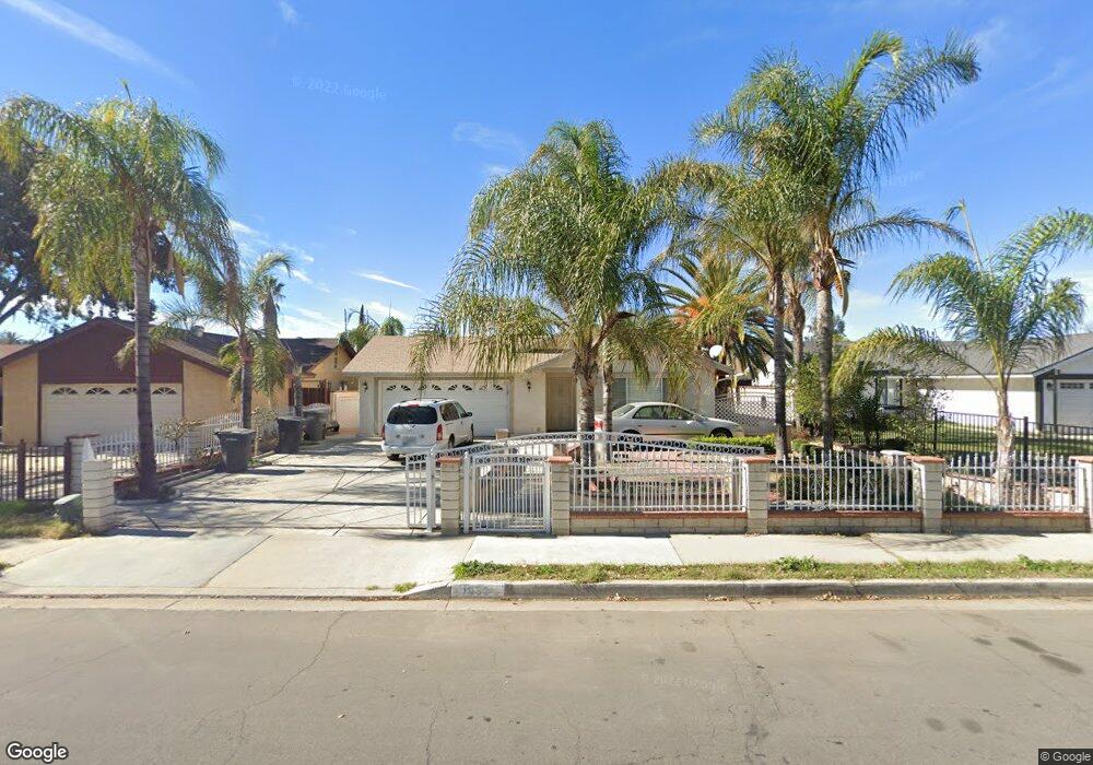
1032 Ruby Dr Perris, CA 92571
Central Perris NeighborhoodEstimated Value: $454,000 - $483,000
4
Beds
2
Baths
1,336
Sq Ft
$348/Sq Ft
Est. Value
About This Home
This home is located at 1032 Ruby Dr, Perris, CA 92571 and is currently estimated at $465,476, approximately $348 per square foot. 1032 Ruby Dr is a home located in Riverside County with nearby schools including Palms Elementary School, Pinacate Middle School, and Perris High School.
Ownership History
Date
Name
Owned For
Owner Type
Purchase Details
Closed on
Nov 11, 2016
Sold by
Ortega David
Bought by
Rangel Roberto Luna and Deluna Angelica Ambriz
Current Estimated Value
Home Financials for this Owner
Home Financials are based on the most recent Mortgage that was taken out on this home.
Original Mortgage
$235,653
Outstanding Balance
$190,078
Interest Rate
3.57%
Mortgage Type
FHA
Estimated Equity
$275,398
Purchase Details
Closed on
Feb 3, 1995
Sold by
Ortega Cristina
Bought by
Ortega David
Home Financials for this Owner
Home Financials are based on the most recent Mortgage that was taken out on this home.
Original Mortgage
$64,928
Interest Rate
9.21%
Mortgage Type
FHA
Purchase Details
Closed on
Jan 3, 1995
Sold by
Novak Michael A and Novak Doreen
Bought by
Ortega David
Home Financials for this Owner
Home Financials are based on the most recent Mortgage that was taken out on this home.
Original Mortgage
$64,928
Interest Rate
9.21%
Mortgage Type
FHA
Create a Home Valuation Report for This Property
The Home Valuation Report is an in-depth analysis detailing your home's value as well as a comparison with similar homes in the area
Home Values in the Area
Average Home Value in this Area
Purchase History
| Date | Buyer | Sale Price | Title Company |
|---|---|---|---|
| Rangel Roberto Luna | $240,000 | Wfg National Title Company | |
| Ortega David | -- | Commonwealth Land Title Co | |
| Ortega David | $65,000 | Commonwealth Land Title Co |
Source: Public Records
Mortgage History
| Date | Status | Borrower | Loan Amount |
|---|---|---|---|
| Open | Rangel Roberto Luna | $235,653 | |
| Previous Owner | Ortega David | $64,928 |
Source: Public Records
Tax History
| Year | Tax Paid | Tax Assessment Tax Assessment Total Assessment is a certain percentage of the fair market value that is determined by local assessors to be the total taxable value of land and additions on the property. | Land | Improvement |
|---|---|---|---|---|
| 2025 | $3,128 | $278,534 | $46,420 | $232,114 |
| 2023 | $3,128 | $267,719 | $44,618 | $223,101 |
| 2022 | $3,094 | $262,471 | $43,744 | $218,727 |
| 2021 | $3,034 | $257,326 | $42,887 | $214,439 |
| 2020 | $2,996 | $254,689 | $42,448 | $212,241 |
| 2019 | $2,927 | $249,696 | $41,616 | $208,080 |
| 2018 | $2,794 | $244,800 | $40,800 | $204,000 |
| 2017 | $2,756 | $240,000 | $40,000 | $200,000 |
| 2016 | $1,001 | $92,197 | $42,552 | $49,645 |
| 2015 | $980 | $90,814 | $41,914 | $48,900 |
| 2014 | $956 | $89,037 | $41,094 | $47,943 |
Source: Public Records
Map
Nearby Homes
- 122 E Bowen Rd
- 338 Mildred St
- 316 Randy Ln
- 344 Mildred St
- 1491 Portrait St
- 1509 Portrait St
- 1455 Remembrance Dr
- 1098 Richards Rd
- 1562 Remembrance Dr
- 1255 Comiskey Ct
- 1486 Olivecrest Way
- 452 Feliz St
- 509 N D St
- 558 Cherry Vista Dr
- 1462 Apple Creek Dr
- 21500 Orange Creek Rd
- 350 E San Jacinto Ave
- 350 E San Jacinto Ave Unit 133
- 350 E San Jacinto Ave Unit 74
- 350 E San Jacinto Ave Unit 125
- 1042 Ruby Dr
- 1052 Ruby Dr
- 1012 Ruby Dr
- 1031 N Ramona Dr
- 1021 N Ramona Dr
- 1041 N Ramona Dr
- 1051 N Ramona Dr
- 1011 N Ramona Dr
- 1062 Ruby Dr
- 1061 N Ramona Dr
- 1072 Ruby Dr
- 1071 N Ramona Dr
- 1082 Ruby Dr
- 1032 N Ramona Dr
- 1022 N Ramona Dr
- 1042 N Ramona Dr
- 1081 N Ramona Dr
- 1012 N Ramona Dr
- 1052 N Ramona Dr
- 1092 Ruby Dr
Your Personal Tour Guide
Ask me questions while you tour the home.