10326 Cook Rd Unit 326 Houston, TX 77099
Alief NeighborhoodHighlights
- Deck
- 1 Fireplace
- Private Yard
- Traditional Architecture
- High Ceiling
- Community Pool
About This Home
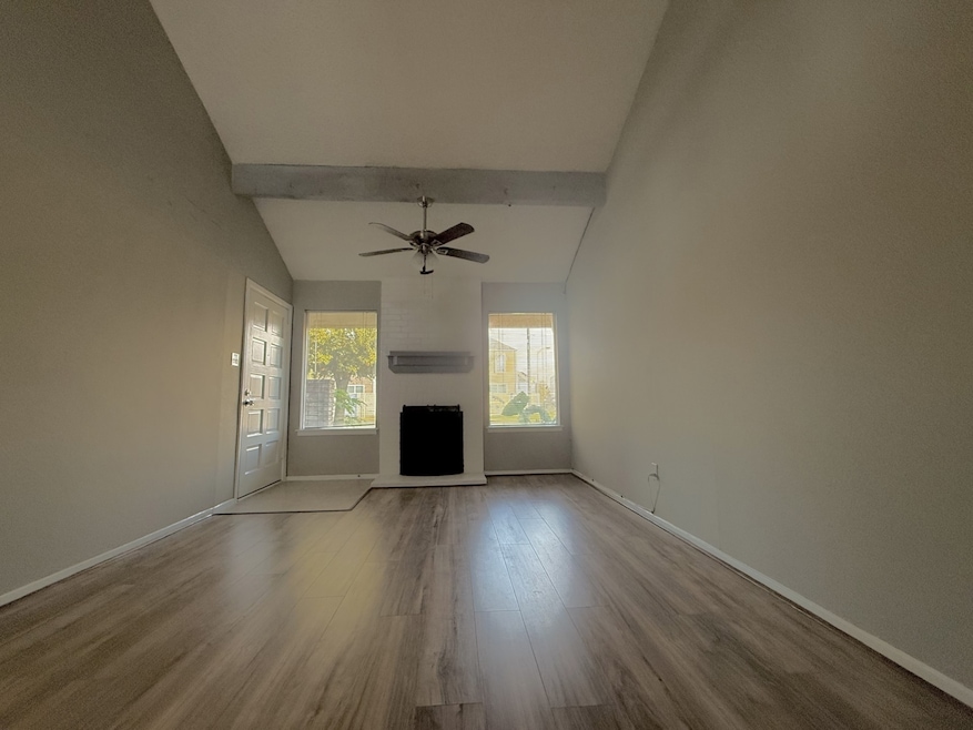
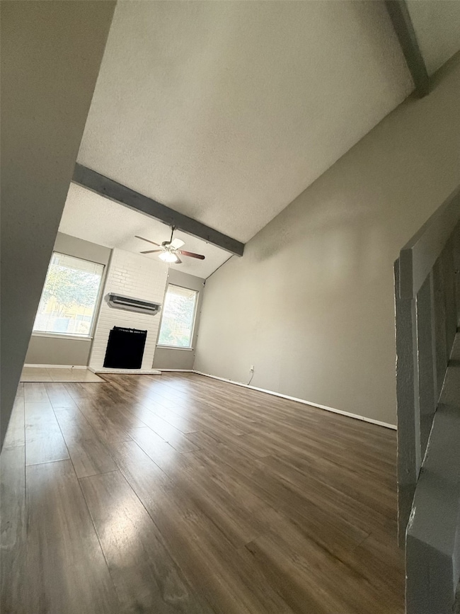
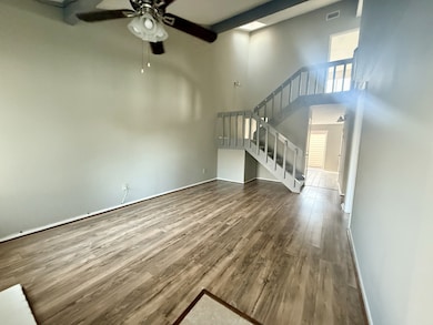
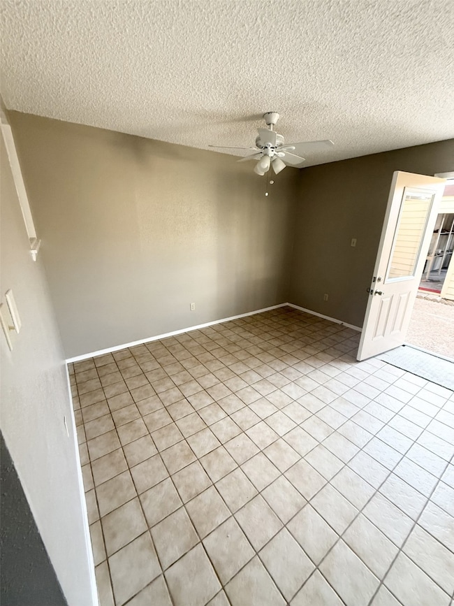
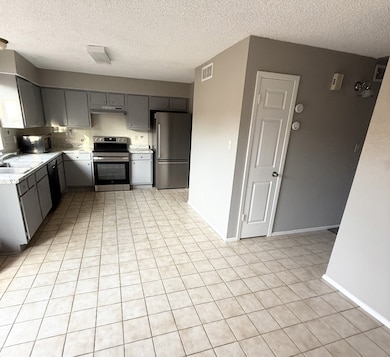
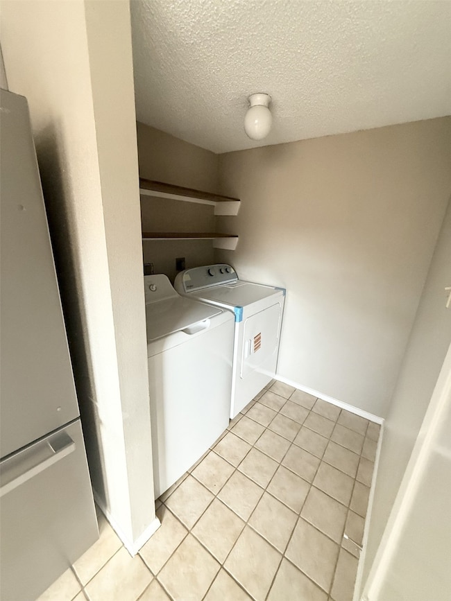
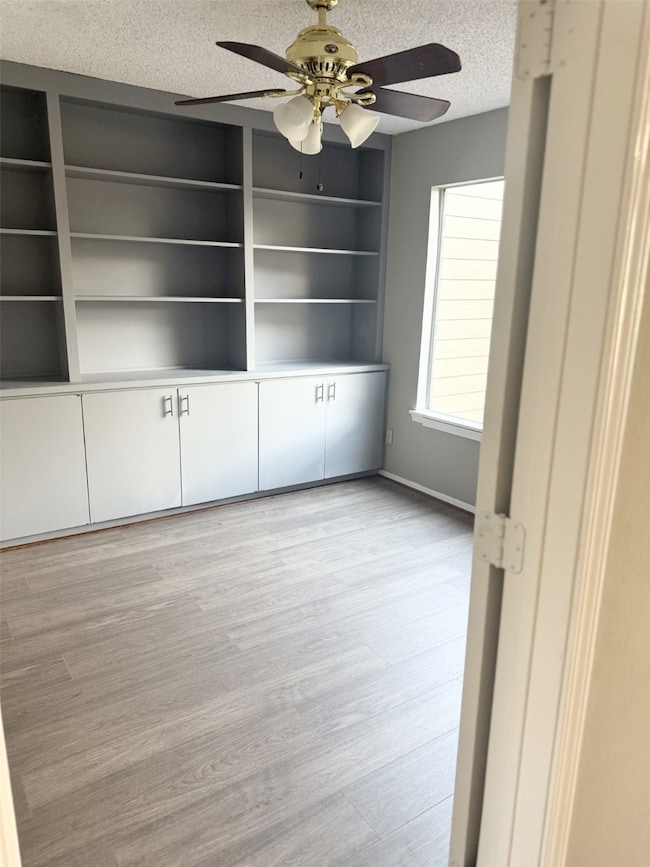
Cozy 3-bedroom, 2.5-bathroom split-level townhouse featuring high ceilings and a warm, inviting fireplace. This charming home offers a bright and open feel. There is a spacious detached 2-car garage right behind a private patio perfect for relaxing. Water and sewer is included, adding extra convenience. A comfortable and well-maintained property ready for you to call home. Section 8 vouchers welcome.
Townhouse Details
Home Type
- Townhome
Year Built
- Built in 1975
Lot Details
- 1,823 Sq Ft Lot
- East Facing Home
- Private Yard
Parking
- 2 Car Detached Garage
- Additional Parking
Home Design
- Traditional Architecture
- Split Level Home
Interior Spaces
- 1,328 Sq Ft Home
- 2-Story Property
- High Ceiling
- Ceiling Fan
- 1 Fireplace
Kitchen
- Oven
- Electric Range
- Microwave
- Dishwasher
- Disposal
Flooring
- Carpet
- Tile
Bedrooms and Bathrooms
- 3 Bedrooms
Laundry
- Dryer
- Washer
Home Security
Outdoor Features
- Deck
- Patio
Schools
- Kennedy Elementary School
- Holub Middle School
- Aisd Draw High School
Utilities
- Central Heating and Cooling System
- Municipal Trash
- Cable TV Available
Listing and Financial Details
- Property Available on 12/7/25
- Long Term Lease
Community Details
Recreation
- Community Pool
Pet Policy
- No Pets Allowed
Additional Features
- Huntington Village Sec 03 Subdivision
- Fire and Smoke Detector
Map
Property History
| Date | Event | Price | List to Sale | Price per Sq Ft |
|---|---|---|---|---|
| 12/07/2025 12/07/25 | For Rent | $1,750 | +29.6% | -- |
| 06/30/2023 06/30/23 | Off Market | $1,350 | -- | -- |
| 07/08/2018 07/08/18 | Rented | $1,350 | -1.8% | -- |
| 06/08/2018 06/08/18 | Under Contract | -- | -- | -- |
| 06/01/2018 06/01/18 | For Rent | $1,375 | -- | -- |
Source: Houston Association of REALTORS®
MLS Number: 46654222
APN: 1055250160003
Disclaimer: Certain information contained herein is derived from information provided by parties other than Homes.com. All information provided is deemed reliable, but is not guaranteed to be accurate and should be independently verified.
![]() Copyright 2025, Houston REALTORS® Information Service, Inc.
Copyright 2025, Houston REALTORS® Information Service, Inc.
The information provided is exclusively for consumers’ personal, non-commercial use, and may not be used for any purpose other than to identify prospective properties consumers may be interested in purchasing.
Information is deemed reliable but not guaranteed.
- 10362 Cook Rd Unit 187
- 10366 Panther Point Dr
- 10347 Panther Point Dr
- 10355 Panther Point Dr
- 10327 Panther Point Dr
- 10410 Cook Rd
- 10325 Huntington Place Dr Unit 325
- 10327 Huntington Place Dr Unit 327
- 12166 Huntington Venture Dr
- 12623 S Dairy Ashford Rd
- 10530 Farmingham Dr
- 12123 Plumpoint Dr
- 10402 Huntington Point Dr
- 12431 Huntington Field Dr
- 10639 Tenneta Dr
- 12714 Palm Desert Ln
- 12071 Plumbrook Dr
- 12119 Spring Grove Dr
- 12211 Pine Knoll Dr
- 9310 Cook Rd
- 10355 Panther Point Dr
- 12339 S Dairy Ashford Rd Unit 2339
- 12623 S Dairy Ashford Rd
- 12115 Creekhurst Dr
- 12322 Huntington Field Dr
- 12051 Creekhurst Dr
- 12335 Huntington Field Dr
- 10534 Huntington View Dr
- 12071 Plumbrook Dr
- 12122 Kemerton Dr
- 12714 Palm Desert Ln
- 12054 Plumpoint Dr
- 9611 Huntington Hill Dr
- 9506 S Dairy Ashford Rd
- 9850 S Kirkwood Rd
- 11503 Meadow Ln Unit D
- 12615 Huntington Venture Dr
- 12023 Bissonnet St
- 11500 Meadow Ln Unit 4
- 9301 Dairy View Ln
