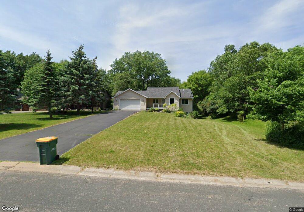
10327 Upper 178th St W Lakeville, MN 55044
Estimated Value: $414,000 - $455,734
4
Beds
2
Baths
2,160
Sq Ft
$204/Sq Ft
Est. Value
About This Home
This home is located at 10327 Upper 178th St W, Lakeville, MN 55044 and is currently estimated at $441,684, approximately $204 per square foot. 10327 Upper 178th St W is a home located in Dakota County with nearby schools including Huddleston Elementary School, Kenwood Trail Middle School, and Lakeville North High School.
Ownership History
Date
Name
Owned For
Owner Type
Purchase Details
Closed on
Mar 25, 2022
Sold by
Rust Kevin and Rust Ashley
Bought by
Olson Jason
Current Estimated Value
Home Financials for this Owner
Home Financials are based on the most recent Mortgage that was taken out on this home.
Original Mortgage
$373,300
Outstanding Balance
$347,866
Interest Rate
3.69%
Mortgage Type
New Conventional
Estimated Equity
$93,818
Purchase Details
Closed on
Mar 24, 2016
Sold by
Pekarna Bradley S and Pekarna Alyssa M
Bought by
Rust Kevin and Bethke Ashley
Home Financials for this Owner
Home Financials are based on the most recent Mortgage that was taken out on this home.
Original Mortgage
$248,400
Interest Rate
3.62%
Mortgage Type
New Conventional
Purchase Details
Closed on
Oct 14, 2008
Sold by
Vander Wonde Seth H
Bought by
Pekarna Bradley S
Home Financials for this Owner
Home Financials are based on the most recent Mortgage that was taken out on this home.
Original Mortgage
$204,155
Interest Rate
5.73%
Mortgage Type
New Conventional
Purchase Details
Closed on
Dec 15, 2005
Sold by
Corley Daniel and Corley Heather
Bought by
Vanderwoude Seth H
Purchase Details
Closed on
Jun 18, 2003
Sold by
Smith Ronald F and Smith Candice R
Bought by
Corley Daniel and Corley Heather
Home Financials for this Owner
Home Financials are based on the most recent Mortgage that was taken out on this home.
Original Mortgage
$320,000
Interest Rate
6.75%
Mortgage Type
Land Contract Argmt. Of Sale
Purchase Details
Closed on
Jun 16, 2003
Sold by
Corley Dan and Corley Heather
Bought by
Smith Ronald F and Smith Candice R
Home Financials for this Owner
Home Financials are based on the most recent Mortgage that was taken out on this home.
Original Mortgage
$320,000
Interest Rate
6.75%
Mortgage Type
Land Contract Argmt. Of Sale
Purchase Details
Closed on
Jul 24, 2002
Sold by
Dakota County Comnty Development Agency
Bought by
Smith Candice R and Smith Ronald F
Create a Home Valuation Report for This Property
The Home Valuation Report is an in-depth analysis detailing your home's value as well as a comparison with similar homes in the area
Home Values in the Area
Average Home Value in this Area
Purchase History
| Date | Buyer | Sale Price | Title Company |
|---|---|---|---|
| Olson Jason | $442,200 | -- | |
| Rust Kevin | $276,000 | Trademark Title Services Inc | |
| Pekarna Bradley S | $214,900 | -- | |
| Vanderwoude Seth H | $348,000 | -- | |
| Corley Daniel | $175,037 | -- | |
| Smith Ronald F | $320,000 | -- | |
| Smith Candice R | $25,328 | -- |
Source: Public Records
Mortgage History
| Date | Status | Borrower | Loan Amount |
|---|---|---|---|
| Open | Olson Jason | $373,300 | |
| Previous Owner | Rust Kevin | $248,400 | |
| Previous Owner | Pekarna Bradley S | $204,155 | |
| Previous Owner | Smith Ronald F | $320,000 |
Source: Public Records
Tax History Compared to Growth
Tax History
| Year | Tax Paid | Tax Assessment Tax Assessment Total Assessment is a certain percentage of the fair market value that is determined by local assessors to be the total taxable value of land and additions on the property. | Land | Improvement |
|---|---|---|---|---|
| 2024 | $4,226 | $385,600 | $86,800 | $298,800 |
| 2023 | $4,226 | $389,800 | $86,500 | $303,300 |
| 2022 | $3,858 | $380,500 | $86,200 | $294,300 |
| 2021 | $3,944 | $334,100 | $77,000 | $257,100 |
| 2020 | $4,038 | $330,000 | $73,400 | $256,600 |
| 2019 | $3,447 | $320,700 | $69,900 | $250,800 |
| 2018 | $3,265 | $286,200 | $66,500 | $219,700 |
| 2017 | $3,061 | $268,000 | $63,300 | $204,700 |
| 2016 | $3,145 | $250,300 | $60,300 | $190,000 |
| 2015 | $2,862 | $229,701 | $54,869 | $174,832 |
| 2014 | -- | $217,929 | $52,970 | $164,959 |
| 2013 | -- | $203,868 | $48,110 | $155,758 |
Source: Public Records
Map
Nearby Homes
- 10185 Upper 178th St W
- 18120 Jarl Ct
- 17655 Empire Trail
- 18031 Jacquard Path
- 17500 Jonquil Ave
- 18120 Jurel Cir
- 10210 183rd St W
- 18111 Ixonia Ave
- 17876 Ixonia Ave
- 17475 Jaguar Path
- 18289 Italy Ave
- 18586 Jonesboro Ct
- 18624 Jasper Way
- 18581 Joplin Ave
- 17408 Ixonia Path
- 17128 Jonquil Ave
- Charleswood II & III Plan at Pheasant Run
- The Arlington Plan at Pheasant Run
- Lincoln II Plan at Pheasant Run
- Newbury Plan at Knob Hill
- 10339 10339 Upper 178th-Street-w
- 10315 Upper 178th St W
- 10339 Upper 178th St W
- 17810 Javelin Ct
- 17801 Jasper Ct
- 17796 Javelin Ct
- 10332 Upper 178th St W
- 10324 Upper 178th St W
- 17782 Javelin Ct
- 10300 Upper 178th St W
- 10308 Upper 178th St W
- 10340 Upper 178th St W
- 17791 Jasper Ct
- 10351 Upper 178th St W
- 17801 Javelin Ct
- 17770 Javelin Ct
- 17781 Jasper Ct
- 10357 10357 Upper 178th-Street-w
- 17791 Javelin Ct
- 17945 Jaguar Path