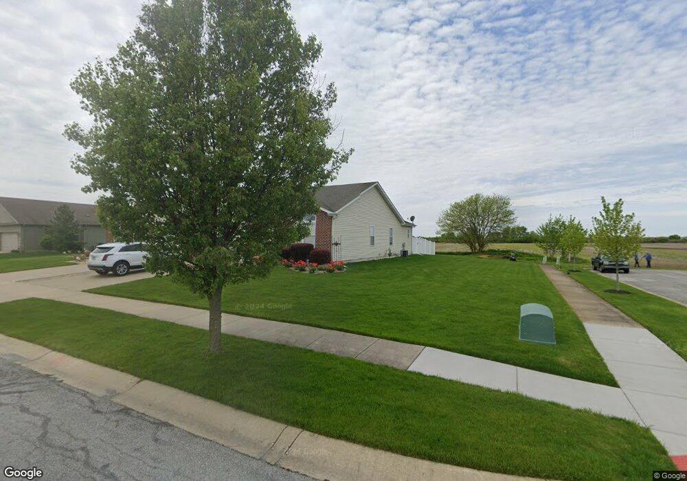
10328 W 151st Ave Cedar Lake, IN 46303
West Creek NeighborhoodEstimated Value: $515,000 - $621,000
4
Beds
3
Baths
3,308
Sq Ft
$167/Sq Ft
Est. Value
About This Home
This home is located at 10328 W 151st Ave, Cedar Lake, IN 46303 and is currently estimated at $553,036, approximately $167 per square foot. 10328 W 151st Ave is a home located in Lake County with nearby schools including Lowell Middle School and Lowell Senior High School.
Ownership History
Date
Name
Owned For
Owner Type
Purchase Details
Closed on
Dec 13, 2016
Sold by
Huseman Kenneth A and Huseman Patricia A
Bought by
Useman Patrcia A and Patricia A Huseman Trust
Current Estimated Value
Purchase Details
Closed on
May 6, 2010
Sold by
Huseman Kenneth A and Huseman Dale R
Bought by
Huseman Kenneth A and Huseman Patricia A
Purchase Details
Closed on
Apr 19, 2010
Sold by
Huseman Kenneth A
Bought by
Huseman Kenneth A and Huseman Dale R
Create a Home Valuation Report for This Property
The Home Valuation Report is an in-depth analysis detailing your home's value as well as a comparison with similar homes in the area
Home Values in the Area
Average Home Value in this Area
Purchase History
| Date | Buyer | Sale Price | Title Company |
|---|---|---|---|
| Useman Patrcia A | -- | None Available | |
| Huseman Farm Inc | -- | None Available | |
| Huseman Kenneth A | -- | Lake Region Title Ins Co | |
| Huseman Kenneth A | -- | None Available |
Source: Public Records
Tax History Compared to Growth
Tax History
| Year | Tax Paid | Tax Assessment Tax Assessment Total Assessment is a certain percentage of the fair market value that is determined by local assessors to be the total taxable value of land and additions on the property. | Land | Improvement |
|---|---|---|---|---|
| 2024 | $8,769 | $487,500 | $54,800 | $432,700 |
| 2023 | $3,887 | $465,400 | $50,300 | $415,100 |
| 2022 | $3,887 | $407,500 | $50,300 | $357,200 |
| 2021 | $3,961 | $427,400 | $47,000 | $380,400 |
| 2020 | $3,600 | $404,100 | $47,000 | $357,100 |
| 2019 | $3,610 | $387,800 | $47,000 | $340,800 |
| 2018 | $3,499 | $376,200 | $47,000 | $329,200 |
| 2017 | $3,748 | $379,100 | $47,000 | $332,100 |
| 2016 | $3,609 | $378,400 | $43,700 | $334,700 |
| 2014 | $3,505 | $370,200 | $43,800 | $326,400 |
| 2013 | $3,570 | $362,200 | $43,400 | $318,800 |
Source: Public Records
Map
Nearby Homes
- 15026 Drummond St
- The Hayes Plan at Lynnsway - The Cottage Homes at Lynnsway
- 14836A Carey St
- 14826 Carey St Unit A
- 14702 Drummond St Unit A
- 9814 W 146th Ave
- 14515 Garden Way
- 14556 Clover Ave
- 14162 Magnolia St
- 9015 W 155th Ave
- 14128 Magnolia St
- 9992 W 141st Ln
- 11525 W 143rd Ave
- 9215 W 142nd Ave
- 15507 Magoun St Unit 10
- 14590 Magoun St
- 14086 Nantucket Dr
- 13952 Flagstaff St
- 13946 Paramount Way
- 8901 W 142nd Place
- 10409 W 151st Ave
- 15028B Carey St
- 15028 Carey St
- 15028 Carey St Unit B
- 15028-b Carey St Unit B
- 15028-b Carey St
- 15028-a Carey St
- 15038-b Carey St Unit B
- 15022 Carey St
- 15038 Carey St Unit B
- 15038 Carey St Unit A
- 15016 Carey St
- 15038-a Carey St Unit A
- 15010 Carey St
- 15004 Carey St
- 14948B Carey St
- 14948A Carey St
- 14948 Carey St Unit A
- 14948 Carey St Unit B
- 14948 Carey St Unit A