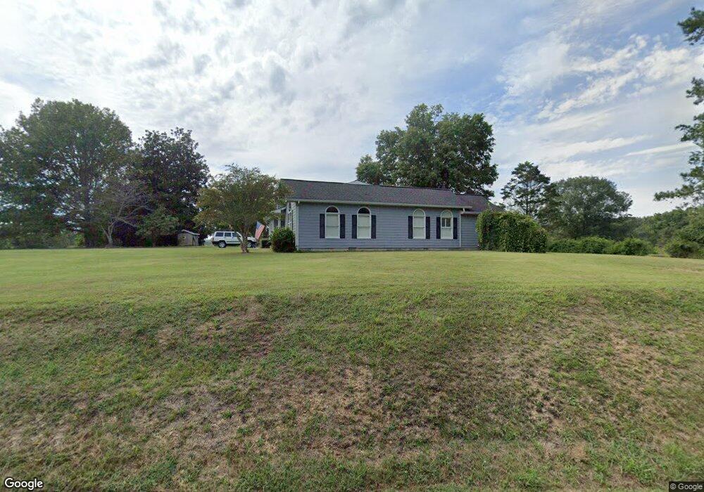
1033 Bryant Rd Chatsworth, GA 30705
Estimated Value: $311,000 - $560,257
--
Bed
2
Baths
2,204
Sq Ft
$198/Sq Ft
Est. Value
About This Home
This home is located at 1033 Bryant Rd, Chatsworth, GA 30705 and is currently estimated at $435,314, approximately $197 per square foot. 1033 Bryant Rd is a home located in Murray County with nearby schools including Woodlawn Elementary School, Bagley Middle School, and North Murray High School.
Ownership History
Date
Name
Owned For
Owner Type
Purchase Details
Closed on
Nov 16, 2017
Sold by
Barbaree William Stephen
Bought by
Barbaree Family Limited Partne
Current Estimated Value
Purchase Details
Closed on
Apr 27, 1998
Sold by
Barbaree William Ste
Bought by
Barbaree Mary Jo
Purchase Details
Closed on
Feb 21, 1997
Sold by
Barbaree W Steve
Bought by
Barbaree William Ste
Purchase Details
Closed on
Mar 24, 1995
Bought by
Barbaree W Steve
Purchase Details
Closed on
Nov 4, 1992
Bought by
Barbaree W Steve
Create a Home Valuation Report for This Property
The Home Valuation Report is an in-depth analysis detailing your home's value as well as a comparison with similar homes in the area
Home Values in the Area
Average Home Value in this Area
Purchase History
| Date | Buyer | Sale Price | Title Company |
|---|---|---|---|
| Barbaree Family Limited Partne | -- | -- | |
| Barbaree Mary Jo | -- | -- | |
| Barbaree William Ste | -- | -- | |
| Barbaree W Steve | -- | -- | |
| Barbaree W Steve | -- | -- |
Source: Public Records
Tax History Compared to Growth
Tax History
| Year | Tax Paid | Tax Assessment Tax Assessment Total Assessment is a certain percentage of the fair market value that is determined by local assessors to be the total taxable value of land and additions on the property. | Land | Improvement |
|---|---|---|---|---|
| 2024 | $2,395 | $167,484 | $89,760 | $77,724 |
| 2023 | $1,603 | $173,448 | $89,760 | $83,688 |
| 2022 | $1,588 | $162,168 | $89,760 | $72,408 |
| 2021 | $1,660 | $121,408 | $63,240 | $58,168 |
| 2020 | $1,651 | $108,728 | $60,240 | $48,488 |
| 2019 | $1,646 | $107,088 | $58,600 | $48,488 |
| 2018 | $1,640 | $102,768 | $54,280 | $48,488 |
| 2017 | $0 | $43,492 | $2,040 | $41,452 |
| 2016 | $971 | $42,808 | $5,960 | $36,848 |
| 2015 | -- | $42,808 | $5,960 | $36,848 |
| 2014 | -- | $42,808 | $5,960 | $36,848 |
| 2013 | -- | $42,808 | $5,960 | $36,848 |
Source: Public Records
Map
Nearby Homes
- 237 Windmill Dr
- 1860 Boyles Mill Rd NE
- 757 Ellis Cir
- 254 Fashion Cir
- 1594 Goswick Rd
- 257 Ellis Cir
- 273 Ellis Cir
- 567 Fullers Chapel Rd
- 351 Valley Rd
- 214 Nassau Cir
- 359 Norton Bridge Rd
- 255 Norton Bridge Rd
- 308 Twin Lakes Rd
- 5710 Hwy 255n
- 557 McCamy Rd
- 232 Brandon Cir
- 232 Brandon Cir Unit Lot 21
- 685 Goswick Rd
- 1379 Presley Rd NE
- 1914 Bowers Rd
- 968 Bryant Rd
- 841 Bryant Rd
- 772 Bryant Rd
- 707 Bryant Rd
- 1330 Bryant Rd
- 1967 Norton Bridge Rd
- 1710 Norton Bridge Rd
- 1881 Norton Bridge Rd
- 611 Bryant Rd
- 1805 Norton Bridge Rd
- 1795 Norton Bridge Rd
- 1473 Fullers Chapel Rd
- 1475 Fullers Chapel Rd
- 1717 Norton Bridge Rd
- 177 River Rd
- 55 Springfield Rd
- 00 Springfield Rd
- 1620 Norton Bridge Rd
- 457 River Rd
- 1471 Fullers Chapel Rd