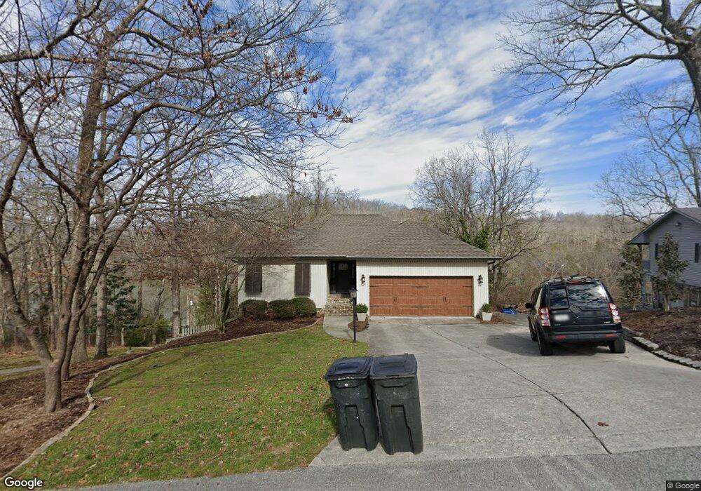
1033 Clift Cave Rd Soddy Daisy, TN 37379
Estimated Value: $645,000 - $872,000
3
Beds
3
Baths
2,861
Sq Ft
$262/Sq Ft
Est. Value
About This Home
This home is located at 1033 Clift Cave Rd, Soddy Daisy, TN 37379 and is currently estimated at $748,191, approximately $261 per square foot. 1033 Clift Cave Rd is a home located in Hamilton County.
Ownership History
Date
Name
Owned For
Owner Type
Purchase Details
Closed on
Dec 13, 2011
Sold by
Houston Sandra S and Polk Wayne Jefferson
Bought by
Watson Corey B and Watson Leah M
Current Estimated Value
Home Financials for this Owner
Home Financials are based on the most recent Mortgage that was taken out on this home.
Original Mortgage
$313,500
Outstanding Balance
$214,969
Interest Rate
4.06%
Mortgage Type
New Conventional
Estimated Equity
$533,222
Purchase Details
Closed on
Sep 22, 1997
Sold by
Blake Steve E and Blake Gail L
Bought by
Houston Sandra S
Purchase Details
Closed on
Feb 16, 1995
Sold by
Blake Steve E and Blake Gail L
Bought by
Blake Steve E and Blake Gail L
Create a Home Valuation Report for This Property
The Home Valuation Report is an in-depth analysis detailing your home's value as well as a comparison with similar homes in the area
Home Values in the Area
Average Home Value in this Area
Purchase History
| Date | Buyer | Sale Price | Title Company |
|---|---|---|---|
| Watson Corey B | $330,000 | Century Title & Escrow Inc | |
| Houston Sandra S | $202,000 | -- | |
| Blake Steve E | -- | -- |
Source: Public Records
Mortgage History
| Date | Status | Borrower | Loan Amount |
|---|---|---|---|
| Open | Watson Corey B | $313,500 |
Source: Public Records
Tax History Compared to Growth
Tax History
| Year | Tax Paid | Tax Assessment Tax Assessment Total Assessment is a certain percentage of the fair market value that is determined by local assessors to be the total taxable value of land and additions on the property. | Land | Improvement |
|---|---|---|---|---|
| 2024 | $2,429 | $108,550 | $0 | $0 |
| 2023 | $3,649 | $108,550 | $0 | $0 |
| 2022 | $3,649 | $108,550 | $0 | $0 |
| 2021 | $3,649 | $108,550 | $0 | $0 |
| 2020 | $3,645 | $88,300 | $0 | $0 |
| 2019 | $3,645 | $88,300 | $0 | $0 |
| 2018 | $3,645 | $88,300 | $0 | $0 |
| 2017 | $3,645 | $88,300 | $0 | $0 |
| 2016 | $3,427 | $0 | $0 | $0 |
| 2015 | $3,427 | $83,000 | $0 | $0 |
| 2014 | $3,427 | $0 | $0 | $0 |
Source: Public Records
Map
Nearby Homes
- 11312 Hixson Pike
- 11636 Holly Cir
- 11652 Hixson Pike
- 1235 Bentley Ln
- 11734 Armstrong Rd
- 1055 Apollo Dr
- 11219 Dayton Pike
- 11213 Dayton Pike
- 11570 Armstrong Rd
- 11317 Cape View
- 11008 Lovell Rd
- 1708 Restful Dr
- 191 Depot St
- 176 Depot St
- 155 Depot St
- 168 Depot St
- 167 Depot St
- 11942 Old Dayton Pike
- 345 Ducktown St
- Tbd Old Dayton Pike
- 1031 Clift Cave Rd
- 1035 Clift Cave Dr
- 1029 Clift Cave Rd
- 1029 Clift Cave Dr
- 1037 Clift Cave Dr
- 1036 Clift Cave Rd
- 1034 Clift Cave Rd
- 1034 Clift Cave Dr
- 1023 Clift Cave Rd
- 1040 Clift Cave Rd
- 1021 Clift Cave Rd
- 1064 Harbor Crest Dr
- 1043 Clift Cave Rd
- 1043 Clift Cave Dr
- 1095 Harbor Point Dr
- 1097 Harbor Point Dr
- 1019 Clift Cave Rd
- 1105 Clift Cave Rd
- 1093 Harbor Point Dr
- 1104 Clift Cave Rd