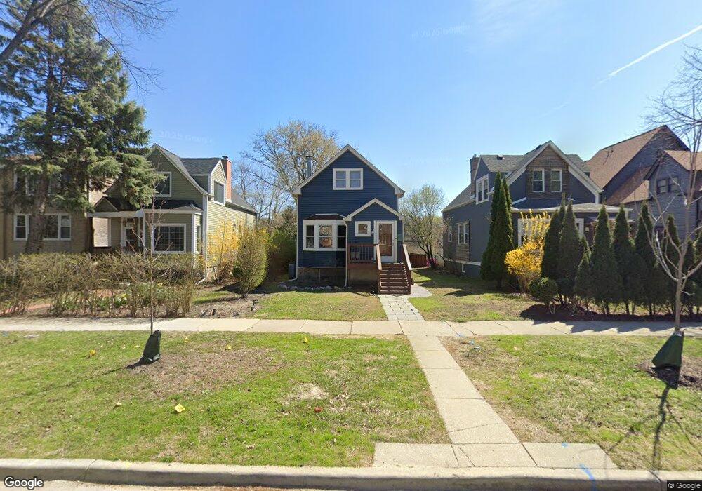
1033 Darrow Ave Evanston, IL 60202
Crown Park NeighborhoodEstimated Value: $632,000 - $729,000
4
Beds
3
Baths
1,998
Sq Ft
$329/Sq Ft
Est. Value
About This Home
This home is located at 1033 Darrow Ave, Evanston, IL 60202 and is currently estimated at $657,186, approximately $328 per square foot. 1033 Darrow Ave is a home located in Cook County with nearby schools including Nichols Middle School, Evanston Township High School, and Pope John XXIII School.
Ownership History
Date
Name
Owned For
Owner Type
Purchase Details
Closed on
Jul 2, 2009
Sold by
Thomas Tracie Ann
Bought by
Perry Patrick M and Perry Christen E
Current Estimated Value
Home Financials for this Owner
Home Financials are based on the most recent Mortgage that was taken out on this home.
Original Mortgage
$380,785
Interest Rate
5.21%
Mortgage Type
FHA
Purchase Details
Closed on
Oct 25, 2004
Sold by
North Star Trust Co
Bought by
1021 Thc Llc
Home Financials for this Owner
Home Financials are based on the most recent Mortgage that was taken out on this home.
Original Mortgage
$435,000
Interest Rate
5.85%
Mortgage Type
Purchase Money Mortgage
Purchase Details
Closed on
Sep 27, 2001
Sold by
Lee Emma
Bought by
Thomas Tracie Ann
Home Financials for this Owner
Home Financials are based on the most recent Mortgage that was taken out on this home.
Original Mortgage
$166,250
Interest Rate
6.99%
Purchase Details
Closed on
Aug 12, 1996
Sold by
Lee Joe Edward
Bought by
Lee Emma
Home Financials for this Owner
Home Financials are based on the most recent Mortgage that was taken out on this home.
Original Mortgage
$78,000
Interest Rate
11.75%
Create a Home Valuation Report for This Property
The Home Valuation Report is an in-depth analysis detailing your home's value as well as a comparison with similar homes in the area
Home Values in the Area
Average Home Value in this Area
Purchase History
| Date | Buyer | Sale Price | Title Company |
|---|---|---|---|
| Perry Patrick M | $290,000 | Cti | |
| 1021 Thc Llc | -- | Multiple | |
| Thomas Tracie Ann | $175,000 | -- | |
| Lee Emma | -- | -- |
Source: Public Records
Mortgage History
| Date | Status | Borrower | Loan Amount |
|---|---|---|---|
| Previous Owner | Perry Patrick M | $380,785 | |
| Previous Owner | 1021 Thc Llc | $435,000 | |
| Previous Owner | Thomas Tracie Ann | $166,250 | |
| Previous Owner | Lee Emma | $78,000 | |
| Closed | 1021 Thc Llc | $1,065,000 |
Source: Public Records
Tax History Compared to Growth
Tax History
| Year | Tax Paid | Tax Assessment Tax Assessment Total Assessment is a certain percentage of the fair market value that is determined by local assessors to be the total taxable value of land and additions on the property. | Land | Improvement |
|---|---|---|---|---|
| 2024 | $11,188 | $46,229 | $11,084 | $35,145 |
| 2023 | $11,488 | $52,243 | $11,084 | $41,159 |
| 2022 | $11,488 | $52,243 | $11,084 | $41,159 |
| 2021 | $8,570 | $35,193 | $7,389 | $27,804 |
| 2020 | $8,513 | $35,193 | $7,389 | $27,804 |
| 2019 | $8,488 | $39,191 | $7,389 | $31,802 |
| 2018 | $9,738 | $38,513 | $6,158 | $32,355 |
| 2017 | $10,638 | $42,730 | $6,158 | $36,572 |
| 2016 | $10,313 | $42,730 | $6,158 | $36,572 |
| 2015 | $5,921 | $24,396 | $5,080 | $19,316 |
| 2014 | $7,396 | $27,458 | $5,080 | $22,378 |
| 2013 | $7,725 | $29,358 | $5,080 | $24,278 |
Source: Public Records
Map
Nearby Homes
- 1133 Dodge Ave
- 1216 Darrow Ave
- 1025 Wesley Ave
- 1810 Washington St
- 1610 Washington St
- 1310 Wesley Ave
- 1723 Greenwood St
- 1810 Monroe St
- 722 Brown Ave
- 930 Pitner Ave Unit 3
- 2321 Lee St
- 1232 Ridge Ave
- 1335 Asbury Ave
- 1112 Main St Unit 3E
- 1114 Main St Unit 1W
- 604 Dodge Ave
- 647 Asbury Ave
- 1312 Oak Ave Unit 1
- 1112 Greenwood St
- 835 Ridge Ave Unit 507
- 1029 Darrow Ave
- 1037 Darrow Ave
- 1027 Darrow Ave
- 1034 Dewey Ave
- 1023 Darrow Ave
- 1043 Darrow Ave
- 1021 Darrow Ave
- 1047 Darrow Ave
- 1030 Dewey Ave
- 1019 Darrow Ave
- 1038 Dewey Ave
- 1026 Dewey Ave
- 1017 Darrow Ave
- 1800 Greenleaf St
- 1022 Dewey Ave
- 1032 Darrow Ave
- 1802 Greenleaf St
- 1036 Darrow Ave
- 1013 Darrow Ave
- 1026 Darrow Ave