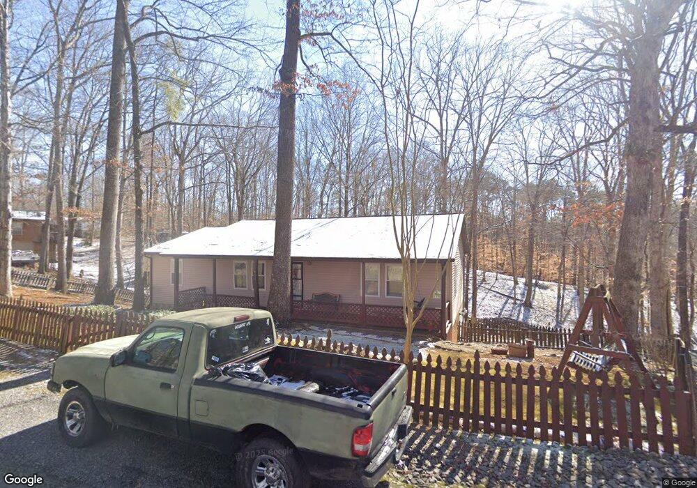
1033 Dean Cir Dandridge, TN 37725
Estimated Value: $294,080 - $434,000
--
Bed
2
Baths
1,456
Sq Ft
$240/Sq Ft
Est. Value
About This Home
This home is located at 1033 Dean Cir, Dandridge, TN 37725 and is currently estimated at $349,270, approximately $239 per square foot. 1033 Dean Cir is a home located in Jefferson County.
Ownership History
Date
Name
Owned For
Owner Type
Purchase Details
Closed on
Jan 9, 2003
Sold by
Baker Betty J
Bought by
Ricky Bilingham
Current Estimated Value
Home Financials for this Owner
Home Financials are based on the most recent Mortgage that was taken out on this home.
Original Mortgage
$102,837
Outstanding Balance
$48,059
Interest Rate
6.25%
Estimated Equity
$301,211
Purchase Details
Closed on
Dec 17, 2002
Bought by
Billingham Ricky
Home Financials for this Owner
Home Financials are based on the most recent Mortgage that was taken out on this home.
Original Mortgage
$102,837
Outstanding Balance
$48,059
Interest Rate
6.25%
Estimated Equity
$301,211
Purchase Details
Closed on
Sep 3, 1993
Bought by
Baker Betty J
Purchase Details
Closed on
Jun 11, 1993
Bought by
Easement-99
Purchase Details
Closed on
Oct 10, 1980
Bought by
Barton Tom E and Barton Rose
Create a Home Valuation Report for This Property
The Home Valuation Report is an in-depth analysis detailing your home's value as well as a comparison with similar homes in the area
Home Values in the Area
Average Home Value in this Area
Purchase History
| Date | Buyer | Sale Price | Title Company |
|---|---|---|---|
| Ricky Bilingham | $108,250 | -- | |
| Billingham Ricky | $108,300 | -- | |
| Baker Betty J | $2,000 | -- | |
| Easement-99 | -- | -- | |
| Barton Tom E | -- | -- |
Source: Public Records
Mortgage History
| Date | Status | Borrower | Loan Amount |
|---|---|---|---|
| Open | Barton Tom E | $102,837 | |
| Closed | Barton Tom E | $102,837 |
Source: Public Records
Tax History Compared to Growth
Tax History
| Year | Tax Paid | Tax Assessment Tax Assessment Total Assessment is a certain percentage of the fair market value that is determined by local assessors to be the total taxable value of land and additions on the property. | Land | Improvement |
|---|---|---|---|---|
| 2025 | $974 | $68,125 | $8,000 | $60,125 |
| 2023 | $775 | $33,675 | $0 | $0 |
| 2022 | $737 | $33,675 | $5,250 | $28,425 |
| 2021 | $737 | $33,675 | $5,250 | $28,425 |
| 2020 | $737 | $33,675 | $5,250 | $28,425 |
| 2019 | $737 | $33,675 | $5,250 | $28,425 |
| 2018 | $762 | $32,425 | $5,250 | $27,175 |
| 2017 | $762 | $32,425 | $5,250 | $27,175 |
| 2016 | $762 | $32,425 | $5,250 | $27,175 |
| 2015 | $762 | $32,425 | $5,250 | $27,175 |
| 2014 | $762 | $32,425 | $5,250 | $27,175 |
Source: Public Records
Map
Nearby Homes
- 1027 Dean Cir
- 929 Black Alder Ln
- 0 Beechwood Dr Unit 1262622
- 177 Cove Springs Dr
- 18 Cove Springs Dr
- 911 Burchfield Rd
- 123 Cove Springs Dr
- 1116 Lake Ridge Dr
- 1114 Lake Ridge Dr
- TBD Burchfield Rd
- 1523 Cherry Brook Dr
- 0 Flat Woods Rd
- 219 Sullivan Point
- Lot 30 Sullivan Pointe
- 727 Burchfield Rd
- Lot 15 Waterstone Dr
- 943 Waterstone Dr
- 1053 Dean Cir
- 1036 Dean Cir
- 1039 Dean Cir
- 0 Dean Cir
- 102 Dean Cir
- 1028 Dean Cir
- 1063 Dean Cir
- 1021 Dean Cir
- 1020 Dean Cir
- 1032 Dean Cir
- 1049 Dean Cir
- 1049 Dean Cir Unit 19
- 1065 Beechwood Dr
- 1037 Beechwood Dr
- 1004 Beechwood Dr
- 1058 Dean Cir
- 1057 Dean Cir
- 1073 Beechwood Dr
- 1034 Beechwood Dr
- 1059 Dean Cir