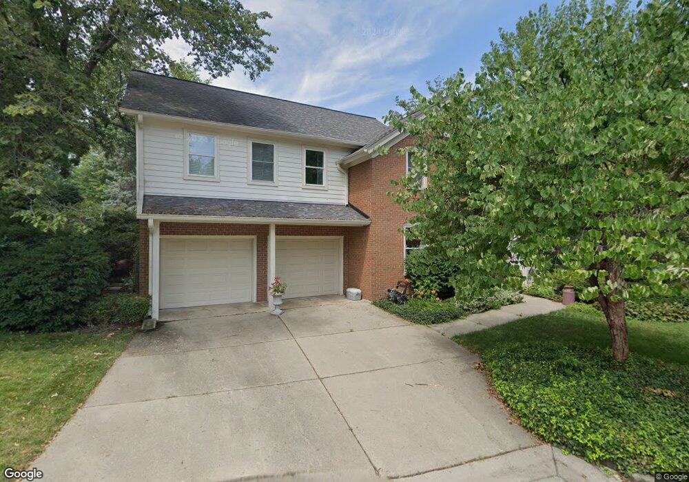
1033 Dockside Ct Naperville, IL 60540
Will-O-Way NeighborhoodEstimated Value: $639,000 - $760,000
2
Beds
3
Baths
2,584
Sq Ft
$276/Sq Ft
Est. Value
About This Home
This home is located at 1033 Dockside Ct, Naperville, IL 60540 and is currently estimated at $713,943, approximately $276 per square foot. 1033 Dockside Ct is a home located in DuPage County with nearby schools including Elmwood Elementary School, Lincoln Jr. High School, and Naperville Central High School.
Ownership History
Date
Name
Owned For
Owner Type
Purchase Details
Closed on
Nov 10, 2003
Sold by
Mitchell Alton J and Federico Julie
Bought by
Mitchell Alton J and Federico Julie
Current Estimated Value
Purchase Details
Closed on
Mar 7, 2003
Sold by
Campbell Karen Z
Bought by
Mitchell Alton J and Federico Julie
Home Financials for this Owner
Home Financials are based on the most recent Mortgage that was taken out on this home.
Original Mortgage
$322,700
Outstanding Balance
$139,336
Interest Rate
5.94%
Estimated Equity
$574,607
Purchase Details
Closed on
Nov 19, 1999
Sold by
Honaker Donald E and Honaker Diane
Bought by
Campbell Karen Z
Home Financials for this Owner
Home Financials are based on the most recent Mortgage that was taken out on this home.
Original Mortgage
$240,000
Interest Rate
7.9%
Create a Home Valuation Report for This Property
The Home Valuation Report is an in-depth analysis detailing your home's value as well as a comparison with similar homes in the area
Home Values in the Area
Average Home Value in this Area
Purchase History
| Date | Buyer | Sale Price | Title Company |
|---|---|---|---|
| Mitchell Alton J | -- | -- | |
| Mitchell Alton J | $430,000 | -- | |
| Campbell Karen Z | $315,000 | Law Title |
Source: Public Records
Mortgage History
| Date | Status | Borrower | Loan Amount |
|---|---|---|---|
| Open | Mitchell Alton J | $322,700 | |
| Previous Owner | Campbell Karen Z | $240,000 | |
| Closed | Mitchell Alton J | $60,000 |
Source: Public Records
Tax History
| Year | Tax Paid | Tax Assessment Tax Assessment Total Assessment is a certain percentage of the fair market value that is determined by local assessors to be the total taxable value of land and additions on the property. | Land | Improvement |
|---|---|---|---|---|
| 2024 | $12,854 | $217,594 | $72,672 | $144,922 |
| 2023 | $12,167 | $195,520 | $65,300 | $130,220 |
| 2022 | $12,200 | $194,820 | $64,600 | $130,220 |
| 2021 | $11,773 | $187,860 | $62,290 | $125,570 |
| 2020 | $11,735 | $187,860 | $62,290 | $125,570 |
| 2019 | $11,319 | $178,670 | $59,240 | $119,430 |
| 2018 | $10,588 | $167,750 | $54,610 | $113,140 |
| 2017 | $10,372 | $162,060 | $52,760 | $109,300 |
| 2016 | $10,122 | $155,520 | $50,630 | $104,890 |
| 2015 | $10,138 | $147,660 | $48,070 | $99,590 |
| 2014 | $10,346 | $146,160 | $49,890 | $96,270 |
| 2013 | $10,275 | $147,180 | $50,240 | $96,940 |
Source: Public Records
Map
Nearby Homes
- 417 River Bluff Cir
- 511 Aurora Ave Unit 620
- 511 Aurora Ave Unit 606
- 1095 Devonshire Ave
- 7S146 Wild Cherry Rd
- 1099 W Jefferson Ave
- 28W075 Aurora Ave
- 610 W Jefferson Ave
- 411 W Jefferson Ave
- 7S410 Arbor Dr
- 332 S River Rd
- 212 S River Rd
- 1112 Candlenut Dr
- 305 N Fremont St
- 927 Elderberry Cir Unit 103
- 107 S Webster St
- 103 S Webster St
- 731 S River Rd
- 1336 Chestnut Ridge Dr
- 1225 Whispering Hills Ct Unit 3B
- 1029 Dockside Ct
- 470 River Bend Rd
- 414 River Bluff Cir
- 414 River Bluff Cir Unit 414
- 1025 Dockside Ct
- 418 River Bluff Cir
- 394 River Bluff Cir
- 1020 Dockside Ct
- 390 River Bluff Cir
- 450 River Bluff Cir
- 1015 Landing Rd
- 384 River Bluff Cir
- 473 River Bend Rd Unit 107
- 481 River Bend Rd Unit 107
- 473 River Bend Rd Unit 111
- 479 River Bend Rd Unit 103
- 471 River Bend Rd Unit 103
- 481 River Bend Rd Unit 111
- 479 River Bend Rd Unit 107
- 471 River Bend Rd Unit 115
Your Personal Tour Guide
Ask me questions while you tour the home.