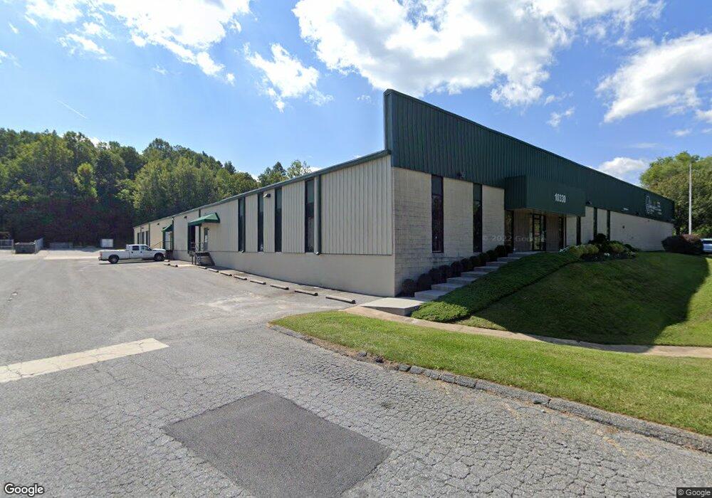
10330 S Dolfield Rd Owings Mills, MD 21117
Estimated Value: $4,843,534
--
Bed
--
Bath
43,200
Sq Ft
$112/Sq Ft
Est. Value
About This Home
This home is located at 10330 S Dolfield Rd, Owings Mills, MD 21117 and is currently estimated at $4,843,534, approximately $112 per square foot. 10330 S Dolfield Rd is a home located in Baltimore County with nearby schools including Woodholme Elementary School, Northwest Academy of Health Sciences, and Owings Mills High School.
Ownership History
Date
Name
Owned For
Owner Type
Purchase Details
Closed on
Aug 30, 2012
Sold by
Ambec Realty Limited Partnership
Bought by
Asi Holdings Llc
Current Estimated Value
Home Financials for this Owner
Home Financials are based on the most recent Mortgage that was taken out on this home.
Original Mortgage
$1,000,000
Outstanding Balance
$691,959
Interest Rate
3.57%
Mortgage Type
Commercial
Estimated Equity
$4,151,575
Create a Home Valuation Report for This Property
The Home Valuation Report is an in-depth analysis detailing your home's value as well as a comparison with similar homes in the area
Home Values in the Area
Average Home Value in this Area
Purchase History
| Date | Buyer | Sale Price | Title Company |
|---|---|---|---|
| Asi Holdings Llc | $2,600,000 | None Available |
Source: Public Records
Mortgage History
| Date | Status | Borrower | Loan Amount |
|---|---|---|---|
| Open | Asi Holdings Llc | $1,000,000 |
Source: Public Records
Tax History Compared to Growth
Tax History
| Year | Tax Paid | Tax Assessment Tax Assessment Total Assessment is a certain percentage of the fair market value that is determined by local assessors to be the total taxable value of land and additions on the property. | Land | Improvement |
|---|---|---|---|---|
| 2025 | $42,887 | $3,518,000 | $846,400 | $2,671,600 |
| 2024 | $42,887 | $3,451,600 | $0 | $0 |
| 2023 | $21,089 | $3,385,200 | $0 | $0 |
| 2022 | $41,304 | $3,318,800 | $846,400 | $2,472,400 |
| 2021 | $35,866 | $3,087,067 | $0 | $0 |
| 2020 | $35,866 | $2,855,333 | $0 | $0 |
| 2019 | $33,134 | $2,623,600 | $846,400 | $1,777,200 |
| 2018 | $33,226 | $2,619,933 | $0 | $0 |
| 2017 | $16,126 | $2,616,267 | $0 | $0 |
| 2016 | $35,787 | $2,612,600 | $0 | $0 |
| 2015 | $35,787 | $2,612,600 | $0 | $0 |
| 2014 | $35,787 | $2,612,600 | $0 | $0 |
Source: Public Records
Map
Nearby Homes
- 16 Garrison Ridge Ct
- 60 S Ritters Ln
- 153 Wilgate Rd
- 10 Harmon Rd
- 305 Wyndham Cir Unit 305K
- 8 Saint Thomas Ln
- 156 S Ritters Ln
- 57 Chins Ct
- 22 Saint Thomas Ln
- 372 Paladium Ct
- 9339 Paragon Way
- 5109 Gold Hill Rd
- 9450 Davy Ln Unit 466
- 4524 Reaney Ln Unit 485
- 9363 Seney Ln Unit 519
- 118 Oliver Heights Rd
- 8931 Groffs Mill Dr Unit 8931
- 19 Pleasant Hill Rd
- 1067 Campbell Meadow Rd
- 9242 Christo Ct
- 10328 S Dolfield Rd
- 10335 S Dolfield Rd
- 10324 S Dolfield Rd
- 10 New Plant Ct
- 10331 S Dolfield Rd
- 25 New Plant Ct
- 20 New Plant Ct
- 100 Dolfield Rd
- 102 Dolfield Rd
- 104 Dolfield Rd
- 3 S Ritters Ln
- 30 New Plant Ct
- 48 Wyegate Ct
- 50 Wyegate Ct
- 42 Wyegate Ct
- 40 Wyegate Ct
- 44 Wyegate Ct
- 54 Wyegate Ct
- 52 Wyegate Ct
- 38 Wyegate Ct