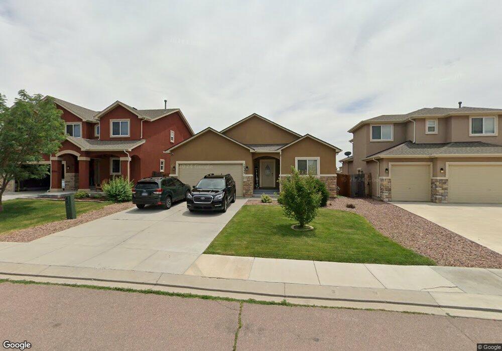
10333 Abrams Dr Colorado Springs, CO 80925
Widefield NeighborhoodEstimated Value: $435,290 - $529,000
4
Beds
3
Baths
1,580
Sq Ft
$311/Sq Ft
Est. Value
About This Home
This home is located at 10333 Abrams Dr, Colorado Springs, CO 80925 and is currently estimated at $491,823, approximately $311 per square foot. 10333 Abrams Dr is a home with nearby schools including Grand Mountain School, Mesa Ridge High School, and Valley Christian Academy.
Ownership History
Date
Name
Owned For
Owner Type
Purchase Details
Closed on
Apr 10, 2014
Sold by
Windsor Ridge Homes Llc
Bought by
Seau Tiagogo and Seau Sifua
Current Estimated Value
Home Financials for this Owner
Home Financials are based on the most recent Mortgage that was taken out on this home.
Original Mortgage
$279,400
Outstanding Balance
$212,955
Interest Rate
4.41%
Mortgage Type
VA
Estimated Equity
$278,868
Create a Home Valuation Report for This Property
The Home Valuation Report is an in-depth analysis detailing your home's value as well as a comparison with similar homes in the area
Home Values in the Area
Average Home Value in this Area
Purchase History
| Date | Buyer | Sale Price | Title Company |
|---|---|---|---|
| Seau Tiagogo | $279,400 | Empire Title Co Springs Llc |
Source: Public Records
Mortgage History
| Date | Status | Borrower | Loan Amount |
|---|---|---|---|
| Open | Seau Tiagogo | $279,400 |
Source: Public Records
Tax History Compared to Growth
Tax History
| Year | Tax Paid | Tax Assessment Tax Assessment Total Assessment is a certain percentage of the fair market value that is determined by local assessors to be the total taxable value of land and additions on the property. | Land | Improvement |
|---|---|---|---|---|
| 2025 | $4,558 | $32,840 | -- | -- |
| 2024 | $4,558 | $33,990 | $6,040 | $27,950 |
| 2022 | $3,362 | $24,290 | $4,810 | $19,480 |
| 2021 | $3,501 | $24,990 | $4,950 | $20,040 |
| 2020 | $3,384 | $23,900 | $4,330 | $19,570 |
| 2019 | $3,373 | $23,900 | $4,330 | $19,570 |
| 2018 | $2,927 | $20,420 | $4,360 | $16,060 |
| 2017 | $2,988 | $20,420 | $4,360 | $16,060 |
| 2016 | $3,009 | $23,250 | $4,380 | $18,870 |
| 2015 | $3,170 | $23,250 | $4,380 | $18,870 |
| 2014 | $1,607 | $11,840 | $4,290 | $7,550 |
Source: Public Records
Map
Nearby Homes
- 10394 Abrams Dr
- 10405 Abrams Dr
- 10732 Deer Meadow Cir
- 6572 Justice Way
- 10604 Deer Meadow Cir
- 10442 Abrams Dr
- 10202 Abrams Dr
- 10208 Abrams Dr
- 6225 Laurel Grass Range Trail
- 10868 Deer Meadow Cir
- 10420 Deer Meadow Cir
- 10525 Abrams Dr
- 10634 Abrams Dr
- 10179 Seawolf Dr
- 10463 Desert Bloom Way
- 10670 Abrams Dr
- 6035 White Wolf Point
- 10648 Desert Bloom Way
- 10188 Winter Gem Grove
- 6071 Old Glory Dr
- 10327 Abrams Dr
- 10339 Abrams Dr
- 10345 Abrams Dr
- 10321 Abrams Dr
- 10354 Declaration Dr
- 10360 Declaration Dr
- 10315 Abrams Dr
- 10366 Declaration Dr
- 10348 Declaration Dr
- 10334 Abrams Dr
- 10351 Abrams Dr
- 10346 Abrams Dr
- 10328 Abrams Dr
- 10372 Declaration Dr
- 10322 Abrams Dr
- 10357 Abrams Dr
- 6419 Nassau Trail
- 10303 Abrams Dr
- 10316 Abrams Dr
- 10352 Abrams Dr