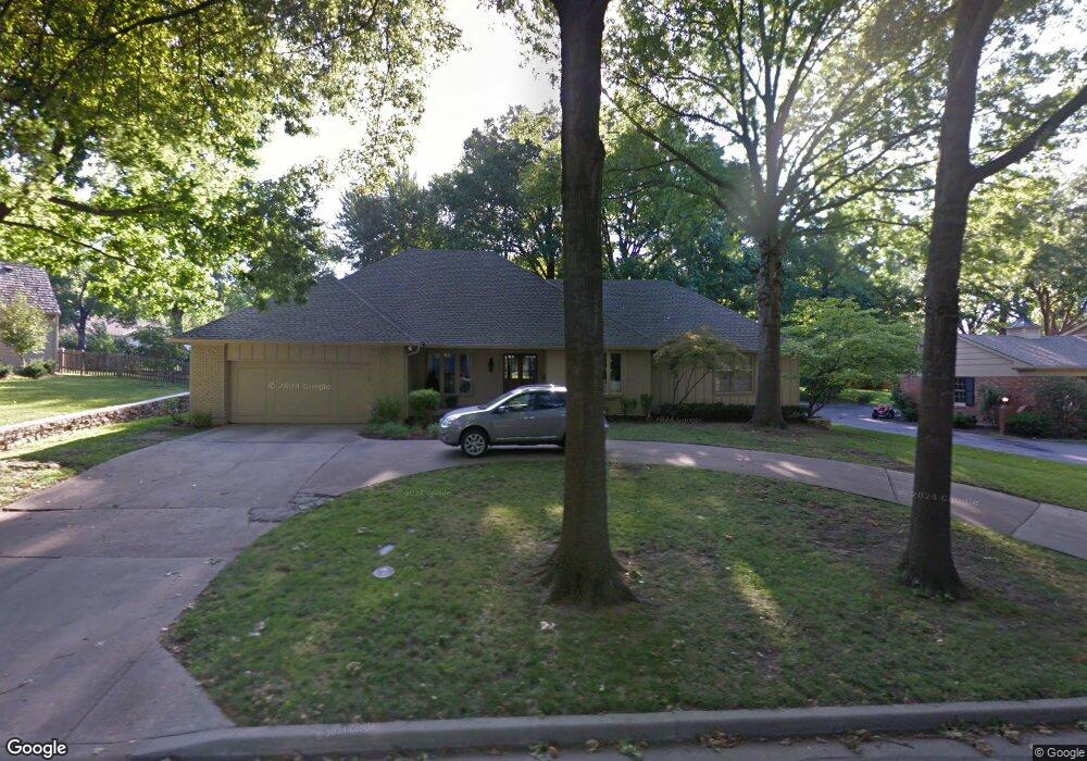
10333 Mohawk Ln Leawood, KS 66206
Estimated Value: $735,000 - $829,000
4
Beds
4
Baths
2,453
Sq Ft
$319/Sq Ft
Est. Value
About This Home
This home is located at 10333 Mohawk Ln, Leawood, KS 66206 and is currently estimated at $782,264, approximately $318 per square foot. 10333 Mohawk Ln is a home located in Johnson County with nearby schools including Brookwood Elementary School, Shawnee Mission South High School, and Indian Woods Middle School.
Ownership History
Date
Name
Owned For
Owner Type
Purchase Details
Closed on
Feb 20, 2020
Sold by
Willey Dave and Willey Gwen
Bought by
Gray Christopher D and Gray Allyson R
Current Estimated Value
Home Financials for this Owner
Home Financials are based on the most recent Mortgage that was taken out on this home.
Original Mortgage
$414,000
Outstanding Balance
$365,785
Interest Rate
3.6%
Mortgage Type
New Conventional
Estimated Equity
$416,479
Purchase Details
Closed on
Apr 4, 2006
Sold by
Dupriest Todd M and Dupriest Kerri M
Bought by
Willey Dave and Willey Gwen
Home Financials for this Owner
Home Financials are based on the most recent Mortgage that was taken out on this home.
Original Mortgage
$33,495
Interest Rate
6.21%
Mortgage Type
Stand Alone Second
Create a Home Valuation Report for This Property
The Home Valuation Report is an in-depth analysis detailing your home's value as well as a comparison with similar homes in the area
Home Values in the Area
Average Home Value in this Area
Purchase History
| Date | Buyer | Sale Price | Title Company |
|---|---|---|---|
| Gray Christopher D | -- | Continental Title Company | |
| Willey Dave | -- | Chicago Title Ins Co |
Source: Public Records
Mortgage History
| Date | Status | Borrower | Loan Amount |
|---|---|---|---|
| Open | Gray Christopher D | $414,000 | |
| Previous Owner | Willey Dave | $33,495 | |
| Previous Owner | Willey Dave | $267,960 |
Source: Public Records
Tax History Compared to Growth
Tax History
| Year | Tax Paid | Tax Assessment Tax Assessment Total Assessment is a certain percentage of the fair market value that is determined by local assessors to be the total taxable value of land and additions on the property. | Land | Improvement |
|---|---|---|---|---|
| 2024 | $8,839 | $82,984 | $20,695 | $62,289 |
| 2023 | $8,036 | $75,083 | $20,695 | $54,388 |
| 2022 | $6,251 | $58,627 | $18,000 | $40,627 |
| 2021 | $5,875 | $52,900 | $16,367 | $36,533 |
| 2020 | $5,526 | $49,048 | $14,886 | $34,162 |
| 2019 | $5,357 | $47,679 | $13,540 | $34,139 |
| 2018 | $5,303 | $47,035 | $12,305 | $34,730 |
| 2017 | $5,199 | $45,402 | $11,185 | $34,217 |
| 2016 | $5,229 | $45,069 | $8,945 | $36,124 |
| 2015 | $5,068 | $44,034 | $8,945 | $35,089 |
| 2013 | -- | $42,228 | $8,128 | $34,100 |
Source: Public Records
Map
Nearby Homes
- 10332 Cherokee Ln
- 10316 Howe Dr
- 10425 Mohawk Ln
- 10408 Howe Ln
- 10531 Mission Rd Unit 312
- 10531 Mission Rd Unit 310
- 10314 Manor Rd
- 10511 Mission Rd Unit 211A
- 3905 W 101st Terrace
- 2301 W 103rd St
- 10315 High Dr
- 10314 Sagamore Ln
- 3523 W 100th Terrace
- 10310 Sagamore Ln
- 2209 W 103rd St
- 10221 El Monte St
- 10501 Sagamore Rd
- 10318 Sagamore Rd
- 4009 W 110th St
- 9815 Overbrook Rd
- 10337 Mohawk Ln
- 10332 Pawnee Ln
- 10336 Pawnee Ln
- 10328 Pawnee Ln
- 10336 Mohawk Ln
- 10341 Mohawk Ln
- 10328 Mohawk Ln
- 10340 Pawnee Ln
- 10340 Mohawk Ln
- 3000 W 103rd Terrace
- 10401 Mohawk Ln
- 10337 Pawnee Ln
- 2904 W 103rd Terrace
- 3004 W 103rd Terrace
- 10333 Pawnee Ln
- 10400 Pawnee Ln
- 10341 Pawnee Ln
- 10400 Mohawk Ln
- 3100 W 103rd Terrace
- 10331 Pawnee Ln