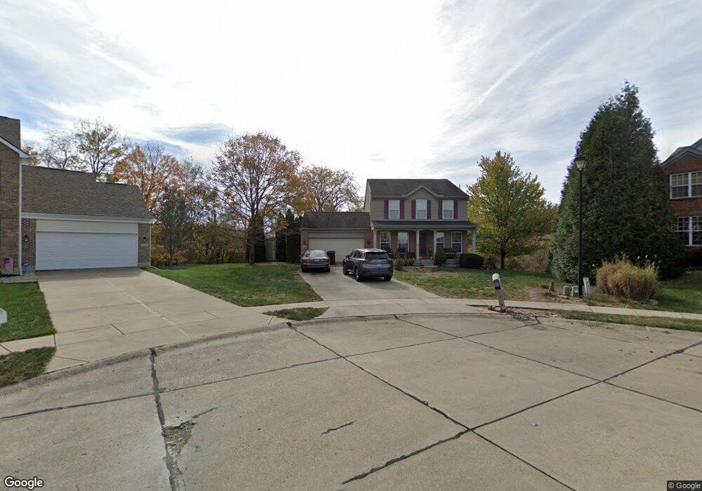
10339 Mackay Ct Independence, KY 41051
Estimated Value: $359,000 - $404,000
4
Beds
3
Baths
2,272
Sq Ft
$166/Sq Ft
Est. Value
About This Home
This home is located at 10339 Mackay Ct, Independence, KY 41051 and is currently estimated at $378,127, approximately $166 per square foot. 10339 Mackay Ct is a home located in Kenton County with nearby schools including Simon Kenton High School and St. Cecilia Catholic School.
Ownership History
Date
Name
Owned For
Owner Type
Purchase Details
Closed on
Sep 17, 2004
Sold by
The Drees Co
Bought by
Rosen Meyer C and Rosen Barbara
Current Estimated Value
Home Financials for this Owner
Home Financials are based on the most recent Mortgage that was taken out on this home.
Original Mortgage
$155,952
Outstanding Balance
$76,384
Interest Rate
5.71%
Mortgage Type
Purchase Money Mortgage
Estimated Equity
$301,743
Purchase Details
Closed on
Aug 10, 2004
Sold by
Independence Station Road Llc
Bought by
The Drees Co
Home Financials for this Owner
Home Financials are based on the most recent Mortgage that was taken out on this home.
Original Mortgage
$155,952
Outstanding Balance
$76,384
Interest Rate
5.71%
Mortgage Type
Purchase Money Mortgage
Estimated Equity
$301,743
Create a Home Valuation Report for This Property
The Home Valuation Report is an in-depth analysis detailing your home's value as well as a comparison with similar homes in the area
Home Values in the Area
Average Home Value in this Area
Purchase History
| Date | Buyer | Sale Price | Title Company |
|---|---|---|---|
| Rosen Meyer C | $194,940 | Bluegrass Title Co | |
| The Drees Co | $37,500 | -- |
Source: Public Records
Mortgage History
| Date | Status | Borrower | Loan Amount |
|---|---|---|---|
| Open | Rosen Meyer C | $155,952 | |
| Closed | Rosen Meyer C | $19,480 |
Source: Public Records
Tax History Compared to Growth
Tax History
| Year | Tax Paid | Tax Assessment Tax Assessment Total Assessment is a certain percentage of the fair market value that is determined by local assessors to be the total taxable value of land and additions on the property. | Land | Improvement |
|---|---|---|---|---|
| 2024 | $2,403 | $242,500 | $35,000 | $207,500 |
| 2023 | $2,475 | $242,500 | $35,000 | $207,500 |
| 2022 | $2,609 | $242,500 | $35,000 | $207,500 |
| 2021 | $2,647 | $242,500 | $35,000 | $207,500 |
| 2020 | $2,132 | $197,400 | $26,000 | $171,400 |
| 2019 | $2,138 | $197,400 | $26,000 | $171,400 |
| 2018 | $2,171 | $197,400 | $26,000 | $171,400 |
| 2017 | $2,112 | $197,400 | $26,000 | $171,400 |
| 2015 | $2,059 | $197,400 | $37,500 | $159,900 |
| 2014 | $2,483 | $197,400 | $37,500 | $159,900 |
Source: Public Records
Map
Nearby Homes
- 1365 Cairns Ct
- 10363 Canberra Dr
- 114 Sylvan Dr
- 9947 Meadow Glen Dr
- 9972 Meadow Glen Dr
- 10438 Canberra Dr
- 10444 Canberra Dr
- 10448 Canberra Dr
- 64 Sylvan Dr
- 5186 Christopher Dr
- 1355 Meadowcrest Cir
- Cumberland Plan at Meadow Glen - Maple Street Collection
- Wesley Plan at Meadow Glen - Maple Street Collection
- 1375 Grandarbor Cir
- 1373 Meadowrun Ln
- 1381 Poplartree Place
- 10150 Meadow Glen Dr
- 10383 Lynchburg Dr
- 5151 Noble Ct
- 1884 Bridle Path
- 10338 Mackay Ct
- 10334 Mackay Ct
- 10346 Canberra Dr
- 1339 Cairns Ct
- 1335 Cairns Ct
- 1345 Cairns Ct
- 10350 Canberra Dr
- 10342 Canberra Dr
- 1349 Cairns Ct
- 10354 Canberra Dr
- 10338 Canberra Dr
- 1351 Cairns Ct Unit 15
- 1353 Cairns Ct
- 1342 Cairns Ct
- 10334 Canberra Dr
- 1334 Cairns Ct
- 1346 Cairns Ct
- 10343 Canberra Dr
- 10360 Canberra Dr
- 10364 Canberra Dr