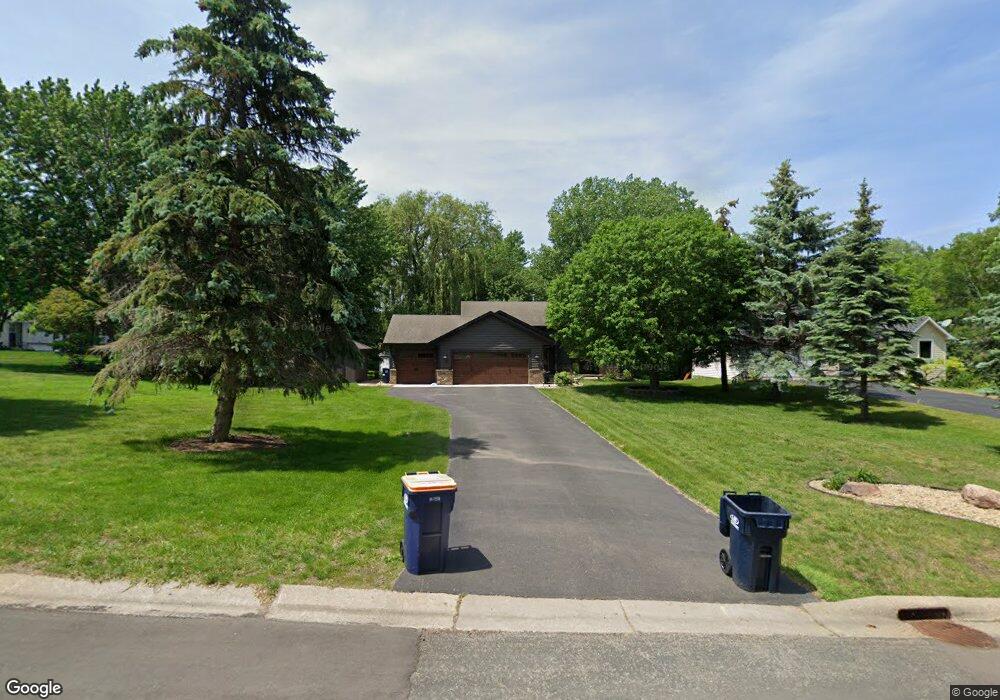
10339 Upper 178th St W Lakeville, MN 55044
Estimated Value: $421,693 - $443,000
4
Beds
2
Baths
1,084
Sq Ft
$399/Sq Ft
Est. Value
About This Home
This home is located at 10339 Upper 178th St W, Lakeville, MN 55044 and is currently estimated at $432,923, approximately $399 per square foot. 10339 Upper 178th St W is a home located in Dakota County with nearby schools including Huddleston Elementary School, Kenwood Trail Middle School, and Lakeville North High School.
Ownership History
Date
Name
Owned For
Owner Type
Purchase Details
Closed on
Aug 12, 2008
Sold by
Mccoy Philip C and Mccoy Nancy J
Bought by
Anderson Elizabeth A
Current Estimated Value
Home Financials for this Owner
Home Financials are based on the most recent Mortgage that was taken out on this home.
Original Mortgage
$140,500
Outstanding Balance
$92,485
Interest Rate
6.39%
Mortgage Type
New Conventional
Estimated Equity
$340,438
Create a Home Valuation Report for This Property
The Home Valuation Report is an in-depth analysis detailing your home's value as well as a comparison with similar homes in the area
Home Values in the Area
Average Home Value in this Area
Purchase History
| Date | Buyer | Sale Price | Title Company |
|---|---|---|---|
| Anderson Elizabeth A | $265,000 | -- |
Source: Public Records
Mortgage History
| Date | Status | Borrower | Loan Amount |
|---|---|---|---|
| Open | Anderson Elizabeth A | $140,500 |
Source: Public Records
Tax History Compared to Growth
Tax History
| Year | Tax Paid | Tax Assessment Tax Assessment Total Assessment is a certain percentage of the fair market value that is determined by local assessors to be the total taxable value of land and additions on the property. | Land | Improvement |
|---|---|---|---|---|
| 2024 | $4,178 | $377,200 | $86,800 | $290,400 |
| 2023 | $4,178 | $385,700 | $86,500 | $299,200 |
| 2022 | $3,818 | $374,600 | $86,200 | $288,400 |
| 2021 | $3,760 | $331,000 | $73,400 | $257,600 |
| 2020 | $3,816 | $315,900 | $69,900 | $246,000 |
| 2019 | $3,410 | $304,500 | $66,600 | $237,900 |
| 2018 | $3,130 | $283,400 | $63,400 | $220,000 |
| 2017 | $2,967 | $258,100 | $60,300 | $197,800 |
| 2016 | $3,009 | $243,500 | $57,400 | $186,100 |
| 2015 | $2,738 | $219,455 | $51,998 | $167,457 |
| 2014 | -- | $208,228 | $50,115 | $158,113 |
| 2013 | -- | $196,783 | $45,552 | $151,231 |
Source: Public Records
Map
Nearby Homes
- 18120 Jarl Ct
- 10185 Upper 178th St W
- 17655 Empire Trail
- 18031 Jacquard Path
- 18120 Jurel Cir
- 10210 183rd St W
- 17500 Jonquil Ave
- 18111 Ixonia Ave
- 17876 Ixonia Ave
- 17475 Jaguar Path
- 18289 Italy Ave
- 18586 Jonesboro Ct
- 18581 Joplin Ave
- 18624 Jasper Way
- 18020 Kenrick Ave
- 18727 Jarosite Ct
- 18710 Jarosite Ct
- Charleswood II & III Plan at Pheasant Run
- The Arlington Plan at Pheasant Run
- Lincoln II Plan at Pheasant Run
- 10339 10339 Upper 178th-Street-w
- 17810 Javelin Ct
- 10327 Upper 178th St W
- 17796 Javelin Ct
- 10340 Upper 178th St W
- 10332 Upper 178th St W
- 10315 Upper 178th St W
- 10351 Upper 178th St W
- 10324 Upper 178th St W
- 10357 10357 Upper 178th-Street-w
- 17782 Javelin Ct
- 17801 Javelin Ct
- 17947 Jaguar Path
- 10357 Upper 178th St W
- 10308 Upper 178th St W
- 17945 Jaguar Path
- 17791 Javelin Ct
- 10363 Upper 178th St W
- 10300 Upper 178th St W
- 17801 Jasper Ct