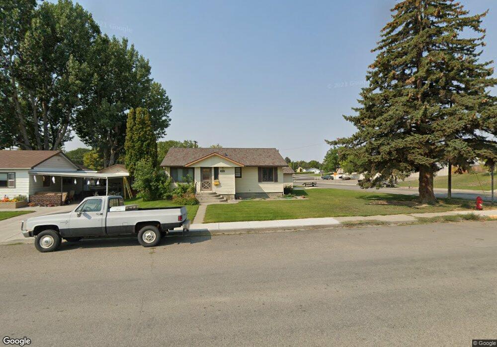
1034 1st Ave Laurel, MT 59044
Estimated Value: $274,000 - $299,824
2
Beds
2
Baths
1,592
Sq Ft
$183/Sq Ft
Est. Value
About This Home
This home is located at 1034 1st Ave, Laurel, MT 59044 and is currently estimated at $290,706, approximately $182 per square foot. 1034 1st Ave is a home located in Yellowstone County with nearby schools including Fred W. Graff School, West School, and Laurel Middle School.
Ownership History
Date
Name
Owned For
Owner Type
Purchase Details
Closed on
Mar 6, 2020
Sold by
Neihart Douglas Jay and Neihart Maureen Frances
Bought by
Pais Jeremy
Current Estimated Value
Home Financials for this Owner
Home Financials are based on the most recent Mortgage that was taken out on this home.
Original Mortgage
$195,886
Outstanding Balance
$173,485
Interest Rate
3.5%
Mortgage Type
FHA
Estimated Equity
$117,221
Purchase Details
Closed on
Feb 21, 2014
Sold by
Ready Bonnie
Bought by
Neihart Douglas Jay and Neihart Maureen Frances
Create a Home Valuation Report for This Property
The Home Valuation Report is an in-depth analysis detailing your home's value as well as a comparison with similar homes in the area
Home Values in the Area
Average Home Value in this Area
Purchase History
| Date | Buyer | Sale Price | Title Company |
|---|---|---|---|
| Pais Jeremy | -- | First American Title Company | |
| Neihart Douglas Jay | -- | None Available |
Source: Public Records
Mortgage History
| Date | Status | Borrower | Loan Amount |
|---|---|---|---|
| Open | Pais Jeremy | $195,886 |
Source: Public Records
Tax History Compared to Growth
Tax History
| Year | Tax Paid | Tax Assessment Tax Assessment Total Assessment is a certain percentage of the fair market value that is determined by local assessors to be the total taxable value of land and additions on the property. | Land | Improvement |
|---|---|---|---|---|
| 2025 | $2,505 | $286,700 | $65,848 | $220,852 |
| 2024 | $2,505 | $240,300 | $42,978 | $197,322 |
| 2023 | $2,321 | $240,300 | $42,978 | $197,322 |
| 2022 | $2,018 | $194,900 | $33,962 | $160,938 |
| 2021 | $2,033 | $194,900 | $0 | $0 |
| 2020 | $1,928 | $183,900 | $0 | $0 |
| 2019 | $1,974 | $183,900 | $0 | $0 |
| 2018 | $1,890 | $172,500 | $0 | $0 |
| 2017 | $1,756 | $172,500 | $0 | $0 |
| 2016 | $1,662 | $164,000 | $0 | $0 |
| 2015 | $1,644 | $164,000 | $0 | $0 |
| 2014 | $1,452 | $74,412 | $0 | $0 |
Source: Public Records
Map
Nearby Homes
- 109 E 12th St
- 1003 Montana Ave
- 403 Grandview Blvd
- 1336 Pennsylvania Ave
- 512 W 14th St
- 516 Pennsylvania Ave
- 1036 9th Ave
- 110 E 5th St
- 1109 10th Ave
- 1013 W 12th St
- 1106 W 12th St
- 717 E 5th, 506 Alder Ave
- 1004 E 8th St
- 802-816 Date Ave
- 1006 Sunhaven Dr
- 1008 Sunhaven Dr
- 801 E 4th St
- 810 Piper Loop
- 116 4th Ave
- 1104 E 8th St