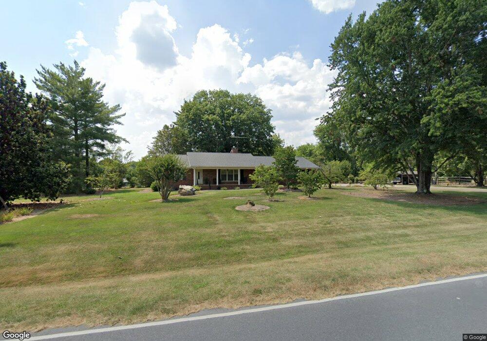
1034 Jason Hoover Rd Asheboro, NC 27205
Estimated Value: $260,000 - $305,000
--
Bed
--
Bath
1,680
Sq Ft
$169/Sq Ft
Est. Value
About This Home
This home is located at 1034 Jason Hoover Rd, Asheboro, NC 27205 and is currently estimated at $283,496, approximately $168 per square foot. 1034 Jason Hoover Rd is a home located in Randolph County with nearby schools including Sycamore Elementary School, Southmont Elementary School, and Southwestern Randolph Middle School.
Ownership History
Date
Name
Owned For
Owner Type
Purchase Details
Closed on
Aug 29, 2016
Sold by
Bean John Wesley and Bean Nancy S
Bought by
Department Of Transportation
Current Estimated Value
Purchase Details
Closed on
Oct 16, 2013
Sold by
Beane Evelyn Hancock and Hayes Janet B
Bought by
Bean John Wesley and Bean Nancy S
Purchase Details
Closed on
Apr 5, 2013
Sold by
Bean Hilda Lee
Bought by
Bean John Wesley and Bean Nancy S
Purchase Details
Closed on
Feb 27, 2009
Sold by
Bean John Wesley and Bean Nancy S
Bought by
Bean John Wesley and Bean Nancy S
Create a Home Valuation Report for This Property
The Home Valuation Report is an in-depth analysis detailing your home's value as well as a comparison with similar homes in the area
Home Values in the Area
Average Home Value in this Area
Purchase History
| Date | Buyer | Sale Price | Title Company |
|---|---|---|---|
| Department Of Transportation | $3,000 | None Available | |
| Bean John Wesley | -- | None Available | |
| Bean John Wesley | -- | None Available | |
| Bean Nancy S | -- | None Available | |
| Bean John Wesley | -- | Chicago Title Insurance Co |
Source: Public Records
Tax History Compared to Growth
Tax History
| Year | Tax Paid | Tax Assessment Tax Assessment Total Assessment is a certain percentage of the fair market value that is determined by local assessors to be the total taxable value of land and additions on the property. | Land | Improvement |
|---|---|---|---|---|
| 2025 | $1,290 | $194,950 | $37,620 | $157,330 |
| 2024 | $1,270 | $194,950 | $37,620 | $157,330 |
| 2023 | $1,267 | $194,950 | $37,620 | $157,330 |
| 2022 | $1,089 | $139,170 | $29,200 | $109,970 |
| 2021 | $1,089 | $139,170 | $29,200 | $109,970 |
| 2020 | $1,061 | $139,170 | $29,200 | $109,970 |
| 2019 | $1,061 | $139,170 | $29,200 | $109,970 |
| 2018 | $1,069 | $136,630 | $29,200 | $107,430 |
| 2016 | $1,059 | $137,098 | $29,650 | $107,448 |
| 2015 | $1,049 | $137,098 | $29,650 | $107,448 |
| 2014 | -- | $137,098 | $29,650 | $107,448 |
Source: Public Records
Map
Nearby Homes
- 1301 Nc Highway 49 S
- 00 U S Highway 64
- 0 Muriel Ln
- 1564 Walker Rd
- 1575 Leslie St
- 964 Old Nc Highway 49
- 0 Nc Highway 49 S Unit 1162269
- 2209 Cedarwood Ct
- 0 Danny Bell Rd
- 481 Nc Highway 49 S
- 1676 Mack Rd
- 841 Hollings Rd
- 1559 Allen Ct
- 2442 Farmwood Ln
- 386 Sherwood Oaks Dr
- 01 Mack Rd
- 406 Ashmont Ct
- 272 Cheyenne Cir
- 2006 Lambert Dr
- 536 Oakgrove Rd
- 953 Maurine Dr
- 943 Maurine Dr
- 1082 Jason Hoover Rd
- 1004 Jason Hoover Rd
- 933 Maurine Dr
- 926 Maurine Dr
- 1543 Nc Highway 49 S
- 0 Billy Walker Rd
- 1130 Billy Walker Rd
- 1143 Billy Walker Rd
- 947 Jason Hoover Rd
- 944 Jason Hoover Rd
- 1150 Billy Walker Rd
- 1211 Billy Walker Rd
- 1210 Billy Walker Rd
- 1126 Walker Cir
- 1403 Ervin Ln
- 1226 Billy Walker Rd
- 1131 Sheridan Dr
- 1151 Sheridan Dr