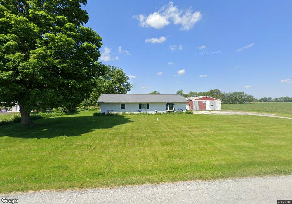
10342 S 400 W Union Mills, IN 46382
Estimated Value: $247,000 - $312,000
3
Beds
1
Bath
1,711
Sq Ft
$162/Sq Ft
Est. Value
About This Home
This home is located at 10342 S 400 W, Union Mills, IN 46382 and is currently estimated at $276,968, approximately $161 per square foot. 10342 S 400 W is a home located in LaPorte County with nearby schools including South Central Elementary School and South Central Junior/Senior High School.
Ownership History
Date
Name
Owned For
Owner Type
Purchase Details
Closed on
Jun 19, 2019
Sold by
Goss Johnnie D and Goss Deborah J
Bought by
Goss Johnnie D and Goss Deborah Jean
Current Estimated Value
Purchase Details
Closed on
Mar 29, 2005
Sold by
Zepik John W
Bought by
Goss Johnnie D and Goss Deborah J
Home Financials for this Owner
Home Financials are based on the most recent Mortgage that was taken out on this home.
Original Mortgage
$100,000
Outstanding Balance
$51,134
Interest Rate
5.64%
Mortgage Type
Fannie Mae Freddie Mac
Estimated Equity
$225,834
Create a Home Valuation Report for This Property
The Home Valuation Report is an in-depth analysis detailing your home's value as well as a comparison with similar homes in the area
Home Values in the Area
Average Home Value in this Area
Purchase History
| Date | Buyer | Sale Price | Title Company |
|---|---|---|---|
| Goss Johnnie D | -- | None Available | |
| Goss Johnnie D | -- | Meridian Title Corp |
Source: Public Records
Mortgage History
| Date | Status | Borrower | Loan Amount |
|---|---|---|---|
| Open | Goss Johnnie D | $100,000 |
Source: Public Records
Tax History Compared to Growth
Tax History
| Year | Tax Paid | Tax Assessment Tax Assessment Total Assessment is a certain percentage of the fair market value that is determined by local assessors to be the total taxable value of land and additions on the property. | Land | Improvement |
|---|---|---|---|---|
| 2024 | $1,675 | $164,000 | $36,400 | $127,600 |
| 2023 | $1,586 | $163,600 | $36,400 | $127,200 |
| 2022 | $1,515 | $161,100 | $36,400 | $124,700 |
| 2021 | $1,515 | $151,400 | $36,400 | $115,000 |
| 2020 | $1,479 | $151,400 | $36,400 | $115,000 |
| 2019 | $1,503 | $147,200 | $36,400 | $110,800 |
| 2018 | $1,312 | $139,200 | $32,500 | $106,700 |
| 2017 | $1,378 | $141,100 | $32,500 | $108,600 |
| 2016 | $1,205 | $137,600 | $32,500 | $105,100 |
| 2014 | $859 | $111,500 | $27,500 | $84,000 |
Source: Public Records
Map
Nearby Homes
- 11333 S State Road 39
- 104 N Cummings St
- 6465 W 1100 S
- 210 Union St
- 307 N Pennsylvania St
- 7052 Long Ln
- 114 E Jersey St
- DUPONT Plan at Park Place South
- AUBURN Plan at Park Place South
- ESSEX Plan at Park Place South
- 819 Larchmere Rd
- 817 Larchmere Rd
- 813 Larchmere Rd
- 818 Kenilworth Rd
- 820 Kenilworth Rd
- 818 Kenilworth Rd
- 816 Kenilworth Rd
- 814 Kenilworth Rd
- 812 Kenilworth Rd
- 14501 S 400 W