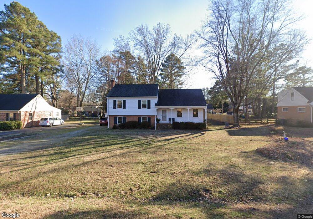
10347 Ashburn Rd North Chesterfield, VA 23235
Bon Air NeighborhoodEstimated Value: $430,000 - $505,000
3
Beds
3
Baths
2,264
Sq Ft
$202/Sq Ft
Est. Value
About This Home
This home is located at 10347 Ashburn Rd, North Chesterfield, VA 23235 and is currently estimated at $457,930, approximately $202 per square foot. 10347 Ashburn Rd is a home located in Chesterfield County with nearby schools including Bon Air Elementary School, Robious Middle School, and James River High School.
Ownership History
Date
Name
Owned For
Owner Type
Purchase Details
Closed on
May 21, 2002
Bought by
Jeffries David G and Jeffries Patricia C
Current Estimated Value
Home Financials for this Owner
Home Financials are based on the most recent Mortgage that was taken out on this home.
Original Mortgage
$114,400
Outstanding Balance
$49,054
Interest Rate
7.15%
Mortgage Type
New Conventional
Estimated Equity
$408,876
Purchase Details
Closed on
Jul 26, 1996
Sold by
White Hugh M
Bought by
Jeffries David G and Jeffries Patricia C
Home Financials for this Owner
Home Financials are based on the most recent Mortgage that was taken out on this home.
Original Mortgage
$103,600
Interest Rate
8.37%
Mortgage Type
New Conventional
Create a Home Valuation Report for This Property
The Home Valuation Report is an in-depth analysis detailing your home's value as well as a comparison with similar homes in the area
Home Values in the Area
Average Home Value in this Area
Purchase History
| Date | Buyer | Sale Price | Title Company |
|---|---|---|---|
| Jeffries David G | -- | -- | |
| Jeffries David G | $129,500 | -- |
Source: Public Records
Mortgage History
| Date | Status | Borrower | Loan Amount |
|---|---|---|---|
| Open | Jeffries David G | $114,400 | |
| Previous Owner | Jeffries David G | $103,600 |
Source: Public Records
Tax History Compared to Growth
Tax History
| Year | Tax Paid | Tax Assessment Tax Assessment Total Assessment is a certain percentage of the fair market value that is determined by local assessors to be the total taxable value of land and additions on the property. | Land | Improvement |
|---|---|---|---|---|
| 2025 | $3,375 | $376,400 | $105,000 | $271,400 |
| 2024 | $3,375 | $349,600 | $100,000 | $249,600 |
| 2023 | $3,018 | $331,600 | $89,000 | $242,600 |
| 2022 | $2,890 | $314,100 | $79,000 | $235,100 |
| 2021 | $2,759 | $283,500 | $72,000 | $211,500 |
| 2020 | $2,601 | $273,800 | $68,000 | $205,800 |
| 2019 | $2,457 | $258,600 | $64,000 | $194,600 |
| 2018 | $2,389 | $251,500 | $60,000 | $191,500 |
| 2017 | $2,376 | $247,500 | $60,000 | $187,500 |
| 2016 | $2,282 | $237,700 | $58,000 | $179,700 |
| 2015 | $2,143 | $220,600 | $52,000 | $168,600 |
| 2014 | $2,060 | $212,000 | $52,000 | $160,000 |
Source: Public Records
Map
Nearby Homes
- 10400 Gotham Rd
- 2341 Francine Rd
- 2930 Poyntelle Rd
- 10551 Archer Springs Place
- 10250 Maplested Ln
- 10967 Live Oak Ct
- 2621 Cromwell Rd
- 3460 Archer Springs Terrace
- 2910 Wighton Dr
- 3320 Traylor Dr
- 10841 Ramshorn Rd
- 3013 Weymouth Dr
- 2819 Live Oak Ln
- 2764 Williamswood Rd
- 3500 Margate Dr
- 2406 Trefoil Way
- 3024 Williamswood Rd
- 9911 Groundhog Dr
- 9737 Groundhog Dr
- 10394 Iron Mill Rd
- 10339 Ashburn Rd
- 10355 Ashburn Rd
- 10348 Jason Rd
- 10356 Jason Rd
- 10331 Ashburn Rd
- 10363 Ashburn Rd
- 10340 Jason Rd
- 10348 Ashburn Rd
- 10340 Ashburn Rd
- 10364 Jason Rd
- 10356 Ashburn Rd
- 10332 Ashburn Rd
- 10332 Jason Rd
- 10323 Ashburn Rd
- 10371 Ashburn Rd
- 10372 Jason Rd
- 10364 Ashburn Rd
- 10324 Ashburn Rd
- 10324 Jason Rd
- 10315 Ashburn Rd