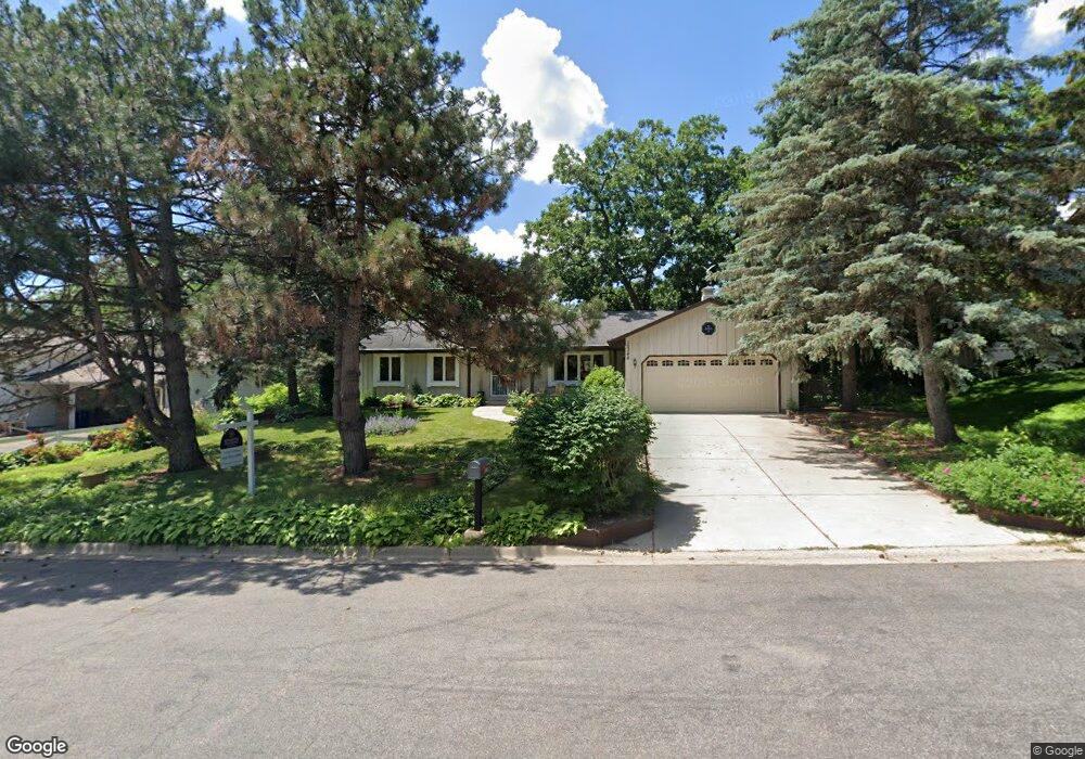
10348 Yukon Ave S Bloomington, MN 55438
West Bloomington NeighborhoodEstimated Value: $460,638 - $512,000
3
Beds
3
Baths
1,580
Sq Ft
$309/Sq Ft
Est. Value
About This Home
This home is located at 10348 Yukon Ave S, Bloomington, MN 55438 and is currently estimated at $488,410, approximately $309 per square foot. 10348 Yukon Ave S is a home located in Hennepin County with nearby schools including Normandale Hills Elementary School, Olson Middle School, and Jefferson Senior High School.
Ownership History
Date
Name
Owned For
Owner Type
Purchase Details
Closed on
Jun 17, 2019
Sold by
Frederick Alice M
Bought by
Pregler Christopher and Pregler Rosella
Current Estimated Value
Home Financials for this Owner
Home Financials are based on the most recent Mortgage that was taken out on this home.
Original Mortgage
$300,000
Outstanding Balance
$263,773
Interest Rate
4.1%
Mortgage Type
New Conventional
Estimated Equity
$224,637
Create a Home Valuation Report for This Property
The Home Valuation Report is an in-depth analysis detailing your home's value as well as a comparison with similar homes in the area
Home Values in the Area
Average Home Value in this Area
Purchase History
| Date | Buyer | Sale Price | Title Company |
|---|---|---|---|
| Pregler Christopher | $350,000 | Burnet Title |
Source: Public Records
Mortgage History
| Date | Status | Borrower | Loan Amount |
|---|---|---|---|
| Open | Pregler Christopher | $300,000 |
Source: Public Records
Tax History Compared to Growth
Tax History
| Year | Tax Paid | Tax Assessment Tax Assessment Total Assessment is a certain percentage of the fair market value that is determined by local assessors to be the total taxable value of land and additions on the property. | Land | Improvement |
|---|---|---|---|---|
| 2024 | $5,575 | $433,000 | $163,200 | $269,800 |
| 2023 | $5,541 | $456,600 | $173,500 | $283,100 |
| 2022 | $4,613 | $430,500 | $152,900 | $277,600 |
| 2021 | $4,159 | $360,400 | $134,600 | $225,800 |
| 2020 | $4,426 | $330,700 | $130,800 | $199,900 |
| 2019 | $4,101 | $340,900 | $130,800 | $210,100 |
| 2018 | $3,937 | $312,400 | $129,100 | $183,300 |
| 2017 | $3,732 | $282,400 | $115,900 | $166,500 |
| 2016 | $3,788 | $273,100 | $110,700 | $162,400 |
| 2015 | $3,769 | $262,300 | $107,400 | $154,900 |
| 2014 | -- | $241,300 | $104,100 | $137,200 |
Source: Public Records
Map
Nearby Homes
- 8149 W 103rd St
- 10170 Utah Ave S
- 10433 Utah Rd
- 10405 Decatur Ave S
- 7920 W 107th Street Cir
- 10434 Decatur Ave S
- 10462 Decatur Ave S
- 7501 W 101st St Unit 310
- 7501 W 101st St Unit 107
- 7534 Landau Dr
- 10707 Yukon Ave S
- 9579 Falcons Way
- 10417 Fawns Way
- 7401 Landau Dr Unit 12
- 7651 Bush Lake Dr
- 7256 Woodstock Dr
- 7321 Woodstock Curve
- 9775 Dorset Ln
- 10561 Maryland Rd
- 9767 Dorset Ln
- 10356 Yukon Ave S
- 10340 Yukon Ave S
- 10353 Zinran Cir S
- 10351 Zinran Cir S
- 10364 Yukon Ave S
- 10332 Yukon Ave S
- 10355 Zinran Cir S
- 10341 Yukon Ave S
- 10349 Yukon Ave S
- 10349 Zinran Cir S
- 10333 Yukon Ave S
- 10372 Yukon Ave S
- 10357 Yukon Ave S
- 10324 Yukon Ave S
- 10357 Zinran Cir S
- 10347 Zinran Cir S
- 10365 Yukon Ave S
- 10380 Yukon Ave S
- 10316 Yukon Ave S
- 10317 Yukon Ave S