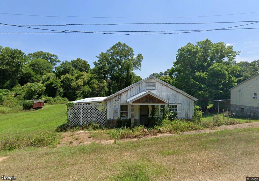
1035 Collier St Wesson, MS 39191
Estimated Value: $60,000
3
Beds
1
Bath
1,150
Sq Ft
$52/Sq Ft
Est. Value
About This Home
This home is located at 1035 Collier St, Wesson, MS 39191 and is currently priced at $60,000, approximately $52 per square foot. 1035 Collier St is a home located in Copiah County.
Ownership History
Date
Name
Owned For
Owner Type
Purchase Details
Closed on
Oct 23, 2025
Sold by
Turnbo Teresa W and Turnbo Wilma Sabitero
Bought by
Southern Grid Properties Llc
Current Estimated Value
Home Financials for this Owner
Home Financials are based on the most recent Mortgage that was taken out on this home.
Original Mortgage
$226,950
Outstanding Balance
$226,950
Interest Rate
6.35%
Mortgage Type
New Conventional
Purchase Details
Closed on
Jan 31, 2024
Sold by
Durkee Victoria Todd and Reynolds John C
Bought by
Howell Investments Llc
Create a Home Valuation Report for This Property
The Home Valuation Report is an in-depth analysis detailing your home's value as well as a comparison with similar homes in the area
Purchase History
| Date | Buyer | Sale Price | Title Company |
|---|---|---|---|
| Southern Grid Properties Llc | -- | None Listed On Document | |
| Howell Investments Llc | -- | None Listed On Document |
Source: Public Records
Mortgage History
| Date | Status | Borrower | Loan Amount |
|---|---|---|---|
| Open | Southern Grid Properties Llc | $226,950 |
Source: Public Records
Map
Nearby Homes
- 1079 Beech St
- 1119 Milltowne Dr
- 0 00 Milltowne Dr
- 0 Milltownte Dr
- 1001 Lumley Ln
- 0 Sawders Ln
- 0 David Britt St
- 0 Loom St
- 596 Mount Zion Rd
- 589 Mount Zion Rd
- 594 Mount Zion Rd
- 0 Furrs Mill Dr NE
- 2038 Rocky Hill Rd
- 2548 Furrs Mill Dr NE
- 3066 New Sight Dr NE
- 3085 Beauregard Rd
- 0 Anderson Rd
- 4001 Stegall Rd
- 0 Linwood Ln NE
- 0 Old Hwy 51 NE
- 1014 E Railroad St
- 1014 E Railroad Ave
- 1022 E Railroad Ave
- 1022 E Railroad St
- 1080 Beech St
- 1020 Collier St
- 1096 Beech St
- 1024 E Railroad St
- 1024 E Railroad Ave
- 1021 Collier St
- 1008 Hotel St
- 1074 Beech St
- 1022 Collier St
- 1010 Hotel St
- 1010 Hotel St
- 1095 Beech St
- 2008 Hwy 51s
- 1036 Spring St
- 1034 Highway 51
- 1022 Hotel St
Your Personal Tour Guide
Ask me questions while you tour the home.