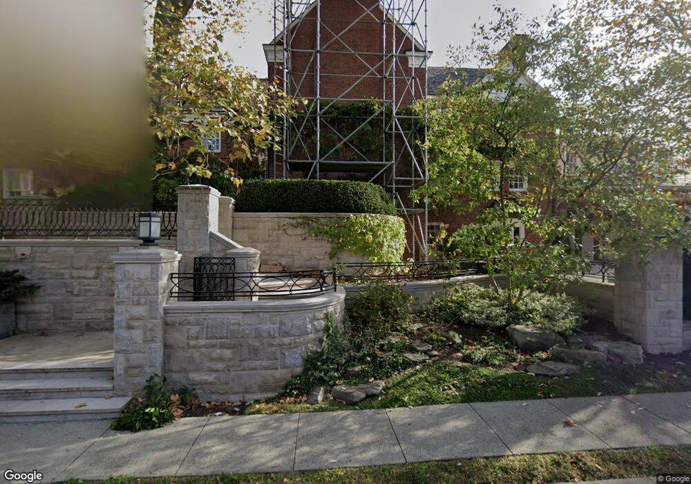
1035 Devon Rd Pittsburgh, PA 15213
Squirrel Hill North NeighborhoodEstimated Value: $2,400,663 - $3,847,000
6
Beds
7
Baths
8,763
Sq Ft
$341/Sq Ft
Est. Value
About This Home
This home is located at 1035 Devon Rd, Pittsburgh, PA 15213 and is currently estimated at $2,988,888, approximately $341 per square foot. 1035 Devon Rd is a home located in Allegheny County with nearby schools including Colfax K-8, Pittsburgh Allderdice High School, and Winchester Thurston School.
Ownership History
Date
Name
Owned For
Owner Type
Purchase Details
Closed on
Jul 3, 2001
Sold by
Weiss Md Paul Irving
Bought by
Guttman William L and Rigopulos Kristine M
Current Estimated Value
Create a Home Valuation Report for This Property
The Home Valuation Report is an in-depth analysis detailing your home's value as well as a comparison with similar homes in the area
Home Values in the Area
Average Home Value in this Area
Purchase History
| Date | Buyer | Sale Price | Title Company |
|---|---|---|---|
| Guttman William L | $1,100,000 | -- |
Source: Public Records
Tax History
| Year | Tax Paid | Tax Assessment Tax Assessment Total Assessment is a certain percentage of the fair market value that is determined by local assessors to be the total taxable value of land and additions on the property. | Land | Improvement |
|---|---|---|---|---|
| 2025 | $40,507 | $1,758,100 | $149,500 | $1,608,600 |
| 2024 | $40,507 | $1,758,100 | $149,500 | $1,608,600 |
| 2023 | $40,507 | $1,758,100 | $149,500 | $1,608,600 |
| 2022 | $39,979 | $1,758,100 | $149,500 | $1,608,600 |
| 2021 | $39,979 | $1,758,100 | $149,500 | $1,608,600 |
| 2020 | $39,786 | $1,758,100 | $149,500 | $1,608,600 |
| 2019 | $39,786 | $1,758,100 | $149,500 | $1,608,600 |
| 2018 | $31,817 | $1,758,100 | $149,500 | $1,608,600 |
| 2017 | $39,786 | $1,758,100 | $149,500 | $1,608,600 |
| 2016 | $8,316 | $1,758,100 | $149,500 | $1,608,600 |
| 2015 | $8,316 | $1,758,100 | $149,500 | $1,608,600 |
| 2014 | $38,907 | $1,758,100 | $149,500 | $1,608,600 |
Source: Public Records
Map
Nearby Homes
- 5048 5th Ave Unit 101
- 5030 5th Ave Unit 213
- 5100 Fifth Ave Unit 506
- 5100 5th Ave Unit 301
- 872 Canterbury Ln
- 5000 Fifth Ave Unit 101
- 5025 5th Ave Unit 3F
- 800 Amberson Ave
- 825 Morewood Ave Unit G11
- 5130 Pembroke Place
- 5219 Pembroke Place
- 1 Schoolhouse Ln
- 918 S Aiken Ave
- 5238 Ellsworth Ave
- 5 Bayard Rd Unit 102
- 5 Bayard Rd Unit 317
- 5 Bayard Rd Unit 514
- 5 Bayard Rd Unit 717
- 5 Bayard Rd Unit 416
- 5 Bayard Rd Unit 100
- 5078 Warwick Terrace
- 5060 Warwick Terrace
- 1045 Devon Rd
- 1040 Devon Rd
- 5051 Warwick Terrace
- 5050 Warwick Terrace
- 5048 5th Ave Unit 204
- 5048 5th Ave Unit 106
- 5048 5th Ave Unit 301
- 5048 5th Ave Unit 206
- 5048 5th Ave Unit 303
- 5048 5th Ave Unit 201
- 5048 5th Ave Unit 210
- 1050 Devon Rd
- 5048 Fifth Ave Unit 101
- 5048 Fifth Ave Unit 204
- 5048 Fifth Ave Unit 306
- 5048 Fifth Ave Unit 105
- 5048 Fifth Ave Unit 102
- 5048 Fifth Ave Unit 202
Your Personal Tour Guide
Ask me questions while you tour the home.