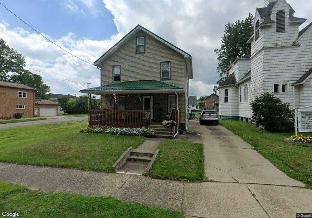
1035 E Grant St Alliance, OH 44601
Estimated Value: $82,000 - $121,000
3
Beds
2
Baths
1,598
Sq Ft
$67/Sq Ft
Est. Value
About This Home
This home is located at 1035 E Grant St, Alliance, OH 44601 and is currently estimated at $107,396, approximately $67 per square foot. 1035 E Grant St is a home located in Stark County with nearby schools including Alliance Elementary School at Rockhill, Alliance Intermediate School at Northside, and Alliance Middle School.
Ownership History
Date
Name
Owned For
Owner Type
Purchase Details
Closed on
Apr 29, 2004
Sold by
Black Deborah A and Young Robert D
Bought by
Young Robert D and Young Deborah A
Current Estimated Value
Home Financials for this Owner
Home Financials are based on the most recent Mortgage that was taken out on this home.
Original Mortgage
$63,200
Interest Rate
5.63%
Mortgage Type
Stand Alone Refi Refinance Of Original Loan
Purchase Details
Closed on
Aug 18, 2000
Sold by
Black Deborah A
Bought by
Black Deborah A and Young Robert D
Home Financials for this Owner
Home Financials are based on the most recent Mortgage that was taken out on this home.
Original Mortgage
$50,000
Interest Rate
8.12%
Mortgage Type
Purchase Money Mortgage
Purchase Details
Closed on
Mar 27, 1995
Sold by
Alliance Area Farm Worke
Bought by
Alliance Area Farm Workers Housing Orp
Home Financials for this Owner
Home Financials are based on the most recent Mortgage that was taken out on this home.
Original Mortgage
$23,750
Interest Rate
8.82%
Mortgage Type
New Conventional
Purchase Details
Closed on
Jul 15, 1994
Sold by
Parochia Romana
Bought by
Alliance Area Farm Workers Housing Orp
Create a Home Valuation Report for This Property
The Home Valuation Report is an in-depth analysis detailing your home's value as well as a comparison with similar homes in the area
Home Values in the Area
Average Home Value in this Area
Purchase History
| Date | Buyer | Sale Price | Title Company |
|---|---|---|---|
| Young Robert D | -- | Majestic Title Agency Llc | |
| Black Deborah A | -- | Majestic Title Agency Llc | |
| Alliance Area Farm Workers Housing Orp | $25,000 | -- | |
| Alliance Area Farm Workers Housing Orp | $20,000 | -- |
Source: Public Records
Mortgage History
| Date | Status | Borrower | Loan Amount |
|---|---|---|---|
| Closed | Young Robert D | $63,200 | |
| Closed | Black Deborah A | $50,000 | |
| Closed | Alliance Area Farm Workers Housing Orp | $23,750 |
Source: Public Records
Tax History
| Year | Tax Paid | Tax Assessment Tax Assessment Total Assessment is a certain percentage of the fair market value that is determined by local assessors to be the total taxable value of land and additions on the property. | Land | Improvement |
|---|---|---|---|---|
| 2025 | -- | $32,130 | $3,360 | $28,770 |
| 2024 | -- | $32,130 | $3,360 | $28,770 |
| 2023 | $895 | $22,260 | $3,430 | $18,830 |
| 2022 | $900 | $22,260 | $3,430 | $18,830 |
| 2021 | $901 | $22,260 | $3,430 | $18,830 |
| 2020 | $806 | $18,590 | $2,980 | $15,610 |
| 2019 | $794 | $18,600 | $2,980 | $15,620 |
| 2018 | $799 | $18,600 | $2,980 | $15,620 |
| 2017 | $743 | $17,020 | $2,490 | $14,530 |
| 2016 | $749 | $17,020 | $2,490 | $14,530 |
| 2015 | $755 | $17,020 | $2,490 | $14,530 |
| 2014 | $340 | $7,290 | $2,280 | $5,010 |
| 2013 | $170 | $7,290 | $2,280 | $5,010 |
Source: Public Records
Map
Nearby Homes
- 955 E Summit St
- 935 S Morgan Ave
- 442 S Liberty Ave
- 22862 Norman Ave
- 452 E Summit St
- V/L S Freedom Ave
- 726 S Arch Ave
- 234 Rosenberry St
- 226 Milner St
- 834 Devine St
- 1608 S Liberty Ave
- 167 11th St
- 134 11th St
- 361 E Main St
- 46 Rosenberry St
- 224 Shadyside Ct
- 62 E High St
- 233 Shadyside Ct
- 1226 Noble St
- 314 Oak Ave
- 1019 E Grant St
- 1103 E Grant St
- 1011 E Grant St
- 1036 Garwood St
- 1046 Garwood St
- 1030 Garwood St
- 1046 E Grant St
- 1036 E Grant St
- 1113 E Grant St
- 826 Wade Ave
- 1022 Garwood St
- 1104 Garwood St
- 1104 Garwood St
- 755 Woodland Ave
- 1133 E Grant St
- 1006 E Grant St
- 1006 Garwood St
- 1104 E Grant St
- 1120 Garwood St
- 756 Wade Ave