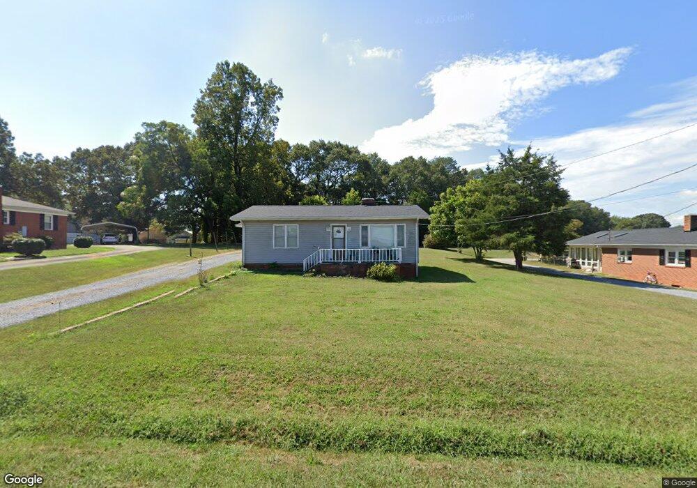
1035 W Highway 27 Lincolnton, NC 28092
Estimated Value: $147,821 - $204,000
2
Beds
1
Bath
936
Sq Ft
$185/Sq Ft
Est. Value
About This Home
This home is located at 1035 W Highway 27, Lincolnton, NC 28092 and is currently estimated at $173,455, approximately $185 per square foot. 1035 W Highway 27 is a home located in Lincoln County with nearby schools including Norris S. Childers Elementary School, West Lincoln Middle, and West Lincoln High School.
Ownership History
Date
Name
Owned For
Owner Type
Purchase Details
Closed on
May 11, 2021
Sold by
Shelley Deborah Beam and Shelley Adrian
Bought by
Helms Karen B and Helms Kenneth
Current Estimated Value
Purchase Details
Closed on
Jun 18, 1992
Bought by
Beam Bobby C and Beam Sadie N
Create a Home Valuation Report for This Property
The Home Valuation Report is an in-depth analysis detailing your home's value as well as a comparison with similar homes in the area
Home Values in the Area
Average Home Value in this Area
Purchase History
| Date | Buyer | Sale Price | Title Company |
|---|---|---|---|
| Helms Karen B | $50,000 | None Available | |
| Helms Karen B | $50,000 | None Listed On Document | |
| Beam Bobby C | $41,500 | -- |
Source: Public Records
Tax History Compared to Growth
Tax History
| Year | Tax Paid | Tax Assessment Tax Assessment Total Assessment is a certain percentage of the fair market value that is determined by local assessors to be the total taxable value of land and additions on the property. | Land | Improvement |
|---|---|---|---|---|
| 2025 | $813 | $109,581 | $28,000 | $81,581 |
| 2024 | $793 | $109,581 | $28,000 | $81,581 |
| 2023 | $756 | $109,581 | $28,000 | $81,581 |
| 2022 | $534 | $59,421 | $22,000 | $37,421 |
| 2021 | $534 | $59,421 | $22,000 | $37,421 |
| 2020 | $407 | $59,421 | $22,000 | $37,421 |
| 2019 | $407 | $59,421 | $22,000 | $37,421 |
| 2018 | $492 | $56,106 | $20,000 | $36,106 |
| 2017 | $379 | $56,106 | $20,000 | $36,106 |
| 2016 | $379 | $56,106 | $20,000 | $36,106 |
| 2015 | $457 | $56,106 | $20,000 | $36,106 |
| 2014 | $450 | $55,766 | $21,000 | $34,766 |
Source: Public Records
Map
Nearby Homes
- 1070 N Carolina 182
- 0 N Carolina 182 Unit CAR4246688
- 1338 Pell Dr
- 668 Riverside Dr
- 515 Willow St
- 743 Lore Rd
- 536 Lincolnview Rd
- 776 S Grove St Unit EXT
- 1231 Better Brook Ln
- 524 Bonview Ave
- 00 Glenn St
- 000 Better Brook Ln
- 697 S Grove St
- 689 S Grove St
- 681 S Grove St
- 217 Blossom Hill Rd
- 502 Forney Ave
- 000 Blossom Hill Rd Unit 138
- 411 W Sycamore St
- 627 W Main St
- 1046 W Highway 27
- 1045 W Highway 27
- 1025 W Highway 27
- 1055 N Carolina 27
- 1055 W Highway 27
- 1105 Davis Rd
- 1062 Nc-182
- 1062 Highway 182
- 1070 Highway 182
- 1050 Highway 182
- 1024 W Highway 27
- 1014 W Hwy 27
- 1014 W Highway 27
- 1085 W Highway 27
- 0 Davis Rd Unit 2 3433529
- 0 Davis Rd Unit 789471
- 0 Davis Rd Unit 2012756
- 0 Davis Rd Unit 3142320
- 00 Davis Rd
- 0 Davis Rd Unit 2