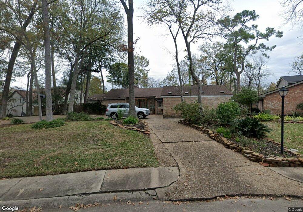
10350 Briar Dr Houston, TX 77042
Briar Forest NeighborhoodEstimated Value: $922,000 - $1,121,000
4
Beds
5
Baths
3,600
Sq Ft
$279/Sq Ft
Est. Value
About This Home
This home is located at 10350 Briar Dr, Houston, TX 77042 and is currently estimated at $1,003,869, approximately $278 per square foot. 10350 Briar Dr is a home located in Harris County with nearby schools including Walnut Bend Elementary School, Paul Revere Middle School, and Westside High School.
Ownership History
Date
Name
Owned For
Owner Type
Purchase Details
Closed on
Oct 16, 2021
Sold by
Potnis Shirish Raghunath and Taparia Shveta S
Bought by
Potnis Shirish Raghunath and Taparia Shveta S
Current Estimated Value
Home Financials for this Owner
Home Financials are based on the most recent Mortgage that was taken out on this home.
Original Mortgage
$506,000
Outstanding Balance
$383,629
Interest Rate
2.1%
Mortgage Type
New Conventional
Estimated Equity
$620,240
Purchase Details
Closed on
Dec 30, 2011
Sold by
Susman Kenneth and Susman Patricia G
Bought by
Potnis Shirish R and Taparia Shveta S
Home Financials for this Owner
Home Financials are based on the most recent Mortgage that was taken out on this home.
Original Mortgage
$73,000
Interest Rate
6.62%
Mortgage Type
Adjustable Rate Mortgage/ARM
Create a Home Valuation Report for This Property
The Home Valuation Report is an in-depth analysis detailing your home's value as well as a comparison with similar homes in the area
Home Values in the Area
Average Home Value in this Area
Purchase History
| Date | Buyer | Sale Price | Title Company |
|---|---|---|---|
| Potnis Shirish Raghunath | -- | Mortgage Connect Lp | |
| Potnis Shirish R | -- | Old Republic National Title |
Source: Public Records
Mortgage History
| Date | Status | Borrower | Loan Amount |
|---|---|---|---|
| Open | Potnis Shirish Raghunath | $506,000 | |
| Closed | Potnis Shirish R | $73,000 | |
| Closed | Potnis Shirish R | $584,000 |
Source: Public Records
Tax History Compared to Growth
Tax History
| Year | Tax Paid | Tax Assessment Tax Assessment Total Assessment is a certain percentage of the fair market value that is determined by local assessors to be the total taxable value of land and additions on the property. | Land | Improvement |
|---|---|---|---|---|
| 2025 | $11,880 | $757,046 | $553,500 | $203,546 |
| 2024 | $11,880 | $760,294 | $553,500 | $206,794 |
| 2023 | $11,880 | $713,856 | $553,500 | $160,356 |
| 2022 | $15,515 | $704,606 | $553,500 | $151,106 |
| 2021 | $17,349 | $746,839 | $553,500 | $193,339 |
| 2020 | $16,387 | $676,726 | $553,500 | $123,226 |
| 2019 | $18,569 | $733,812 | $553,500 | $180,312 |
| 2018 | $14,627 | $733,812 | $295,200 | $438,612 |
| 2017 | $18,505 | $733,812 | $295,200 | $438,612 |
| 2016 | $16,823 | $733,812 | $295,200 | $438,612 |
| 2015 | $11,187 | $680,986 | $295,200 | $385,786 |
| 2014 | $11,187 | $580,000 | $295,200 | $284,800 |
Source: Public Records
Map
Nearby Homes
- 12625 Memorial Dr Unit 180
- 12625 Memorial Dr Unit 17
- 12625 Memorial Dr Unit 4
- 12625 Memorial Dr Unit 146
- 12625 Memorial Dr Unit 87
- 12625 Memorial Dr
- 12625 Memorial Dr Unit 11
- 168 Litchfield Ln
- 152 Litchfield Ln
- 238 Litchfield Ln
- 171 Litchfield Ln
- 12633 Memorial Dr Unit 74
- 12633 Memorial Dr Unit 177
- 12633 Memorial Dr Unit 14
- 12633 Memorial Dr Unit 51
- 12633 Memorial Dr Unit 83
- 12633 Memorial Dr Unit 72
- 12633 Memorial Dr Unit 170
- 12633 Memorial Dr Unit 236
- 12633 Memorial Dr Unit 250
- 10346 Briar Dr
- 10354 Briar Dr
- 19 Briar Hill Dr
- 10339 Briar Dr
- 103 Briar Hill Dr
- 10338 Briar Dr
- 15 Briar Hill Dr
- 10335 Briar Dr
- 107 Briar Hill Dr
- 10334 Briar Dr
- 11 Briar Hill Dr
- 22 Briar Hill Dr
- 26 Briar Hill Dr
- 18 Briar Hill Dr
- 10331 Briar Dr
- 102 Briar Hill Dr
- 14 Briar Hill Dr
- 111 Briar Hill Dr
- 106 Briar Hill Dr
- 7 Briar Hill Dr