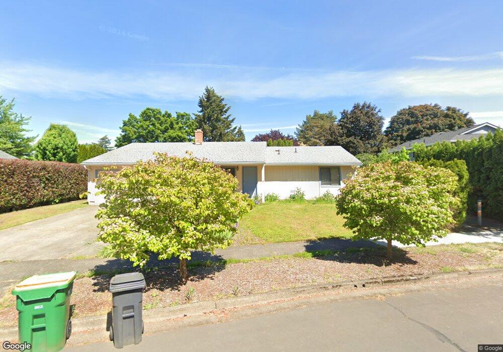
10350 SW Cornhusker Ave Beaverton, OR 97008
South Beaverton NeighborhoodEstimated Value: $518,000 - $554,000
3
Beds
2
Baths
1,260
Sq Ft
$426/Sq Ft
Est. Value
About This Home
This home is located at 10350 SW Cornhusker Ave, Beaverton, OR 97008 and is currently estimated at $536,221, approximately $425 per square foot. 10350 SW Cornhusker Ave is a home located in Washington County with nearby schools including Hiteon Elementary School, Conestoga Middle School, and Southridge High School.
Ownership History
Date
Name
Owned For
Owner Type
Purchase Details
Closed on
Jun 10, 2013
Sold by
Seidel Maryann D and Seidel Maryann
Bought by
Seidel Maryann D
Current Estimated Value
Home Financials for this Owner
Home Financials are based on the most recent Mortgage that was taken out on this home.
Original Mortgage
$108,000
Interest Rate
3.32%
Mortgage Type
New Conventional
Purchase Details
Closed on
Oct 21, 2002
Sold by
Seidel Maryann D
Bought by
Seidel Siegfried and Seidel Maryann
Home Financials for this Owner
Home Financials are based on the most recent Mortgage that was taken out on this home.
Original Mortgage
$87,500
Interest Rate
6.09%
Create a Home Valuation Report for This Property
The Home Valuation Report is an in-depth analysis detailing your home's value as well as a comparison with similar homes in the area
Home Values in the Area
Average Home Value in this Area
Purchase History
| Date | Buyer | Sale Price | Title Company |
|---|---|---|---|
| Seidel Maryann D | -- | Ticor Title | |
| Seidel Siegfried | -- | Multiple |
Source: Public Records
Mortgage History
| Date | Status | Borrower | Loan Amount |
|---|---|---|---|
| Closed | Seidel Maryann D | $108,000 | |
| Closed | Seidel Siegfried | $87,500 |
Source: Public Records
Tax History Compared to Growth
Tax History
| Year | Tax Paid | Tax Assessment Tax Assessment Total Assessment is a certain percentage of the fair market value that is determined by local assessors to be the total taxable value of land and additions on the property. | Land | Improvement |
|---|---|---|---|---|
| 2026 | $5,463 | $266,670 | -- | -- |
| 2025 | $5,463 | $258,910 | -- | -- |
| 2024 | $5,157 | $251,370 | -- | -- |
| 2023 | $5,157 | $244,050 | $0 | $0 |
| 2022 | $4,936 | $244,050 | $0 | $0 |
| 2021 | $4,763 | $230,050 | $0 | $0 |
| 2020 | $4,619 | $223,350 | $0 | $0 |
| 2019 | $4,472 | $216,850 | $0 | $0 |
| 2018 | $4,330 | $210,540 | $0 | $0 |
| 2017 | $4,168 | $204,410 | $0 | $0 |
| 2016 | $4,023 | $198,460 | $0 | $0 |
| 2015 | $3,873 | $192,680 | $0 | $0 |
| 2014 | $3,791 | $187,070 | $0 | $0 |
Source: Public Records
Map
Nearby Homes
- 13180 SW Haystack Dr
- 13250 SW Weir Rd
- 10820 SW Huntington Ave
- 10830 SW Briarwood Place
- 10845 SW Summer Lake Dr
- 10835 SW Huntington Ave
- 10910 SW Huntington Ave
- 9965 SW Pimlico Terrace
- 9970 SW Silver Place
- 9625 SW 130th Ave
- 13775 SW Scholls Ferry Rd Unit 205
- 13775 SW Scholls Ferry Rd Unit 3
- 13775 SW Scholls Ferry Rd Unit 212
- 0 SW Scholls Ferry Rd
- 11325 SW Eucalyptus Place
- 13850 SW Scholls Ferry Rd Unit 102
- 9750 SW Lookout Terrace
- 12062 SW Conestoga Dr Unit 6
- 12145 SW Gingham Ln
- 13140 SW Madison Ct
- 13030 SW Combine St
- 13020 SW Combine St
- 10325 SW 130th Ave
- 10405 SW 130th Ave
- 13010 SW Combine St
- 10420 SW Cornhusker Ave
- 13125 SW Snowshoe Ln
- 10355 SW Cornhusker Ave
- 10425 SW 130th Ave
- 10335 SW Cornhusker Ave
- 13145 SW Snowshoe Ln
- 10440 SW Cornhusker Ave
- 10420 SW 130th Ave
- 13035 SW Combine St
- 13025 SW Combine St
- 10445 SW 130th Ave
- 13120 SW Snowshoe Ln
- 13045 SW Combine St
- 13140 SW Combine Ct
- 13115 SW Combine Ct