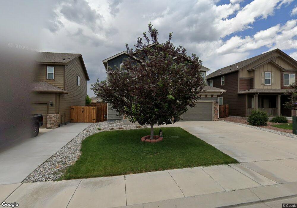
10352 Abrams Dr Colorado Springs, CO 80925
Widefield NeighborhoodEstimated Value: $453,835 - $504,000
4
Beds
3
Baths
2,188
Sq Ft
$223/Sq Ft
Est. Value
About This Home
This home is located at 10352 Abrams Dr, Colorado Springs, CO 80925 and is currently estimated at $486,959, approximately $222 per square foot. 10352 Abrams Dr is a home with nearby schools including Grand Mountain School, Mesa Ridge High School, and Valley Christian Academy.
Ownership History
Date
Name
Owned For
Owner Type
Purchase Details
Closed on
Aug 7, 2013
Sold by
Saint Aubyn Homes Llc
Bought by
Tuliloa Tuliloa and Tulilao Fuatai T
Current Estimated Value
Home Financials for this Owner
Home Financials are based on the most recent Mortgage that was taken out on this home.
Original Mortgage
$263,405
Outstanding Balance
$194,785
Interest Rate
4.25%
Mortgage Type
FHA
Estimated Equity
$292,174
Create a Home Valuation Report for This Property
The Home Valuation Report is an in-depth analysis detailing your home's value as well as a comparison with similar homes in the area
Home Values in the Area
Average Home Value in this Area
Purchase History
| Date | Buyer | Sale Price | Title Company |
|---|---|---|---|
| Tuliloa Tuliloa | $268,300 | Heritage Title |
Source: Public Records
Mortgage History
| Date | Status | Borrower | Loan Amount |
|---|---|---|---|
| Open | Tuliloa Tuliloa | $263,405 |
Source: Public Records
Tax History Compared to Growth
Tax History
| Year | Tax Paid | Tax Assessment Tax Assessment Total Assessment is a certain percentage of the fair market value that is determined by local assessors to be the total taxable value of land and additions on the property. | Land | Improvement |
|---|---|---|---|---|
| 2025 | $4,493 | $32,430 | -- | -- |
| 2024 | $4,449 | $33,560 | $6,040 | $27,520 |
| 2022 | $3,308 | $23,900 | $4,810 | $19,090 |
| 2021 | $3,445 | $24,590 | $4,950 | $19,640 |
| 2020 | $3,380 | $23,870 | $4,330 | $19,540 |
| 2019 | $3,369 | $23,870 | $4,330 | $19,540 |
| 2018 | $2,877 | $20,070 | $4,360 | $15,710 |
| 2017 | $2,937 | $20,070 | $4,360 | $15,710 |
| 2016 | $2,679 | $20,700 | $4,380 | $16,320 |
| 2015 | $2,822 | $20,700 | $4,380 | $16,320 |
| 2014 | $2,810 | $20,700 | $4,290 | $16,410 |
Source: Public Records
Map
Nearby Homes
- 10394 Abrams Dr
- 10405 Abrams Dr
- 10604 Deer Meadow Cir
- 10732 Deer Meadow Cir
- 10442 Abrams Dr
- 6572 Justice Way
- 10420 Deer Meadow Cir
- 6225 Laurel Grass Range Trail
- 10202 Abrams Dr
- 10208 Abrams Dr
- 10525 Abrams Dr
- 10463 Desert Bloom Way
- 10648 Desert Bloom Way
- 10868 Deer Meadow Cir
- 10634 Abrams Dr
- 6035 White Wolf Point
- 6152 Water Trough Trail
- 10670 Abrams Dr
- 10179 Seawolf Dr
- 6071 Old Glory Dr
- 10358 Abrams Dr
- 10346 Abrams Dr
- 10364 Abrams Dr
- 10370 Abrams Dr
- 10334 Abrams Dr
- 10357 Abrams Dr
- 10345 Abrams Dr
- 10351 Abrams Dr
- 10339 Abrams Dr
- 10363 Abrams Dr
- 10376 Abrams Dr
- 10328 Abrams Dr
- 10333 Abrams Dr
- 10375 Abrams Dr
- 10322 Abrams Dr
- 10327 Abrams Dr
- 10382 Abrams Dr
- 10372 Declaration Dr
- 10321 Abrams Dr
- 10388 Abrams Dr