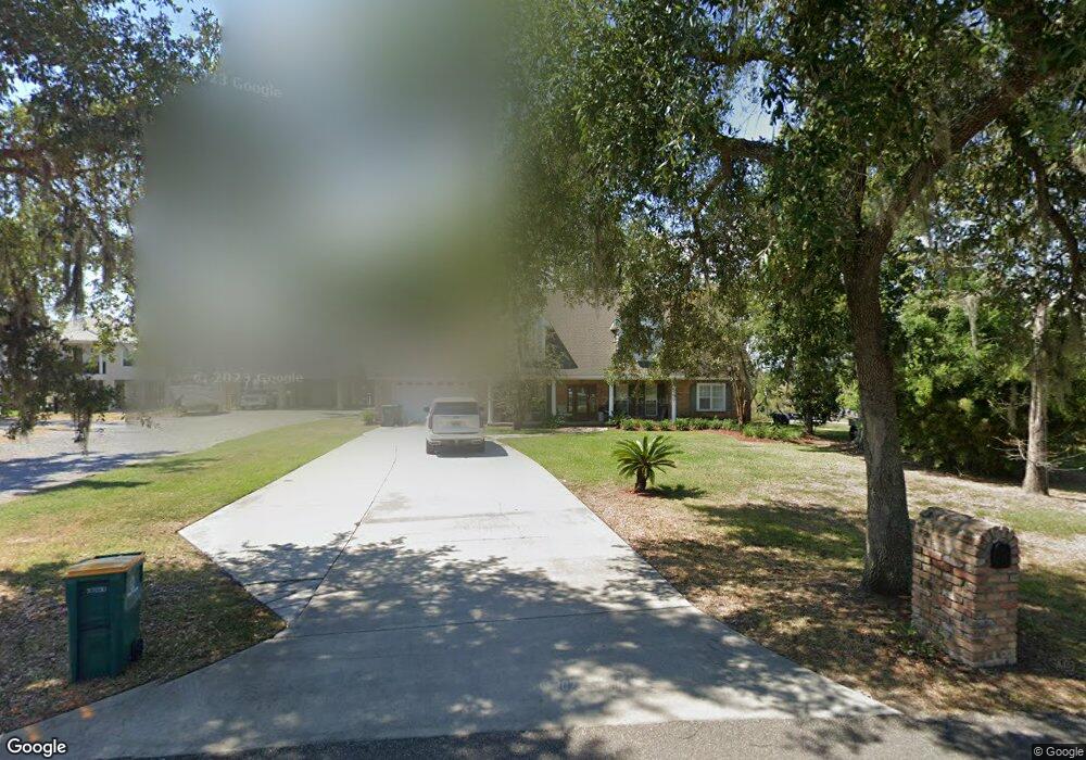
10356 Shorecrest Rd Biloxi, MS 39532
Estimated Value: $446,000 - $621,000
--
Bed
--
Bath
3,403
Sq Ft
$154/Sq Ft
Est. Value
About This Home
This home is located at 10356 Shorecrest Rd, Biloxi, MS 39532 and is currently estimated at $524,465, approximately $154 per square foot. 10356 Shorecrest Rd is a home located in Harrison County with nearby schools including Woolmarket Elementary School, North Woolmarket Elementary/Middle School, and D'Iberville Senior High School.
Ownership History
Date
Name
Owned For
Owner Type
Purchase Details
Closed on
Nov 8, 2023
Sold by
Herrington Ira Stephen
Bought by
Williams Trey H and Williams William Courtney
Current Estimated Value
Purchase Details
Closed on
Aug 4, 2020
Sold by
Djt Properties Llc
Bought by
Herrington Ira S
Purchase Details
Closed on
Feb 5, 2019
Sold by
Herrington Ira S and Herrington Rhonda D
Bought by
Herringtn Ira S and Herringtn Rhonda D
Create a Home Valuation Report for This Property
The Home Valuation Report is an in-depth analysis detailing your home's value as well as a comparison with similar homes in the area
Home Values in the Area
Average Home Value in this Area
Purchase History
| Date | Buyer | Sale Price | Title Company |
|---|---|---|---|
| Williams Trey H | -- | None Listed On Document | |
| Herrington Ira S | -- | None Available | |
| Herringtn Ira S | -- | -- |
Source: Public Records
Tax History Compared to Growth
Tax History
| Year | Tax Paid | Tax Assessment Tax Assessment Total Assessment is a certain percentage of the fair market value that is determined by local assessors to be the total taxable value of land and additions on the property. | Land | Improvement |
|---|---|---|---|---|
| 2025 | $3,376 | $31,891 | $0 | $0 |
| 2024 | $3,223 | $30,616 | $0 | $0 |
| 2023 | $3,164 | $29,959 | $0 | $0 |
| 2022 | $3,186 | $29,959 | $0 | $0 |
| 2021 | $3,198 | $29,959 | $0 | $0 |
| 2020 | $3,209 | $29,070 | $0 | $0 |
| 2019 | $3,230 | $29,070 | $0 | $0 |
| 2018 | $3,259 | $29,070 | $0 | $0 |
| 2017 | $3,258 | $29,070 | $0 | $0 |
| 2015 | $2,162 | $24,861 | $0 | $0 |
| 2014 | -- | $7,500 | $0 | $0 |
| 2013 | -- | $24,862 | $6,131 | $18,731 |
Source: Public Records
Map
Nearby Homes
- 10355 Pin Oak Dr
- 0 Eagle Point Cir Unit 4112102
- 10555 Pak Cove
- 10415 Pin Oak Dr
- 10242 Webb Ln
- 10556 Shore Cove
- 10124 Skyhawk Ct
- 10452 Riviere Vue Dr
- 10574 Shore Cove
- 0 W River Vue
- 0 S River Rd Unit 4118873
- 0 S River Rd Unit 4096766
- 11025 Pin Oak Dr
- 11044 Pin Oak Dr
- 0 N River Vue Cir
- 11209 Shorecrest Rd
- Kai Plan at River Oaks
- Opal Plan at River Oaks
- 9700 W Oaklawn Rd
- 9658 W Oaklawn Rd
- 10350 Shorecrest Rd
- 10360 Shorecrest Rd
- 10354 Shorecrest Rd
- 10364 Shorecrest Rd
- 10366 Shorecrest Rd
- 10370 Shorecrest Rd
- 10340 Shorecrest Rd
- 10333 Shorecrest Rd
- 10330 E Shorecrest Rd
- 10376 Shorecrest Rd
- 10380 Shorecrest Rd
- 10390 S River Dr
- 10447 Shorecrest Rd
- 13048 S River Dr
- 10390 Shorecrest Rd
- 10463 Shorecrest Rd
- 10166 E Shorecrest Rd
- 10465 Shorecrest Rd
- 10446 Shorecrest Rd
- 10158 E Shorecrest Dr