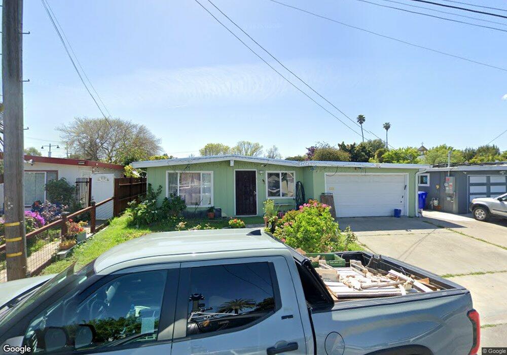
1036 Barbara Ln San Pablo, CA 94806
Estimated Value: $477,000 - $584,044
3
Beds
2
Baths
1,436
Sq Ft
$380/Sq Ft
Est. Value
About This Home
This home is located at 1036 Barbara Ln, San Pablo, CA 94806 and is currently estimated at $546,261, approximately $380 per square foot. 1036 Barbara Ln is a home located in Contra Costa County with nearby schools including Lake Elementary School, Walter T. Helms Middle School, and Richmond High School.
Ownership History
Date
Name
Owned For
Owner Type
Purchase Details
Closed on
Feb 24, 2021
Sold by
Esparza Matias and Esparza Maria N
Bought by
Esparza Matias
Current Estimated Value
Home Financials for this Owner
Home Financials are based on the most recent Mortgage that was taken out on this home.
Original Mortgage
$236,000
Interest Rate
2.7%
Mortgage Type
New Conventional
Create a Home Valuation Report for This Property
The Home Valuation Report is an in-depth analysis detailing your home's value as well as a comparison with similar homes in the area
Home Values in the Area
Average Home Value in this Area
Purchase History
| Date | Buyer | Sale Price | Title Company |
|---|---|---|---|
| Esparza Matias | -- | Fidelity National Title Co |
Source: Public Records
Mortgage History
| Date | Status | Borrower | Loan Amount |
|---|---|---|---|
| Closed | Esparza Matias | $236,000 |
Source: Public Records
Tax History
| Year | Tax Paid | Tax Assessment Tax Assessment Total Assessment is a certain percentage of the fair market value that is determined by local assessors to be the total taxable value of land and additions on the property. | Land | Improvement |
|---|---|---|---|---|
| 2025 | $3,660 | $182,644 | $67,527 | $115,117 |
| 2024 | $3,493 | $179,063 | $66,203 | $112,860 |
| 2023 | $3,493 | $175,553 | $64,905 | $110,648 |
| 2022 | $3,432 | $172,112 | $63,633 | $108,479 |
| 2021 | $3,304 | $168,738 | $62,386 | $106,352 |
| 2019 | $3,138 | $163,736 | $60,537 | $103,199 |
| 2018 | $3,005 | $160,526 | $59,350 | $101,176 |
| 2017 | $2,912 | $157,380 | $58,187 | $99,193 |
| 2016 | $2,843 | $154,296 | $57,047 | $97,249 |
| 2015 | $2,805 | $151,980 | $56,191 | $95,789 |
| 2014 | $2,784 | $149,004 | $55,091 | $93,913 |
Source: Public Records
Map
Nearby Homes
- 2190 Giant Rd
- 113 Westgate Cir
- 1780 Road 20
- 2600 Giant Rd Unit 37
- 1034 Trenton Blvd
- 2036 Brookside Dr
- 2796 13th St
- 2717 10th St
- 2729 18th St
- 1945 21st St
- 812 Market Ave
- 1413 Post Ave
- 2754 19th St
- 2857 16th St
- 2872 10th St Unit 70
- 1971 23rd St
- 2011 Market Ave Unit 317
- 1800 Post Ave
- 110 Del Alba St
- 112 Serra Way Unit 19
- 1030 Barbara Ln
- 1044 Barbara Ln
- 1024 Barbara Ln
- 1052 Barbara Ln
- 1033 Barbara Ln
- 1029 Barbara Ln
- 1043 Barbara Ln
- 1020 Barbara Ln
- 1058 Barbara Ln
- 1023 Barbara Ln
- 1051 Barbara Ln
- 1017 Barbara Ln
- 1111 Barbara Ln
- 1012 Barbara Ln
- 1036 Road 20
- 1030 Road 20
- 1044 Road 20
- 1052 Road 20
- 1024 Road 20
- 1013 Barbara Ln
Your Personal Tour Guide
Ask me questions while you tour the home.