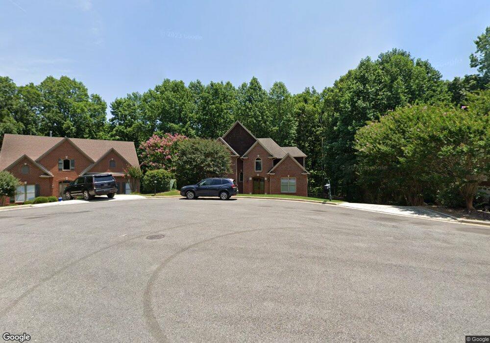
1036 Cole Cir Birmingham, AL 35242
Estimated Value: $526,908 - $623,000
Studio
3
Baths
2,538
Sq Ft
$226/Sq Ft
Est. Value
About This Home
This home is located at 1036 Cole Cir, Birmingham, AL 35242 and is currently estimated at $574,477, approximately $226 per square foot. 1036 Cole Cir is a home located in Shelby County with nearby schools including Oak Mountain Elementary School, Oak Mountain Intermediate School, and Oak Mt. Middle School.
Ownership History
Date
Name
Owned For
Owner Type
Purchase Details
Closed on
Nov 20, 2001
Sold by
Robert S Grant Const Inc
Bought by
Porter Scott A and Porter Rebecca S
Current Estimated Value
Home Financials for this Owner
Home Financials are based on the most recent Mortgage that was taken out on this home.
Original Mortgage
$265,000
Outstanding Balance
$102,582
Interest Rate
6.59%
Estimated Equity
$471,895
Purchase Details
Closed on
May 21, 1999
Sold by
Reamer Development Corp
Bought by
Robert S Grant Construction Inc
Home Financials for this Owner
Home Financials are based on the most recent Mortgage that was taken out on this home.
Original Mortgage
$207,000
Interest Rate
7.91%
Mortgage Type
Construction
Create a Home Valuation Report for This Property
The Home Valuation Report is an in-depth analysis detailing your home's value as well as a comparison with similar homes in the area
Home Values in the Area
Average Home Value in this Area
Purchase History
| Date | Buyer | Sale Price | Title Company |
|---|---|---|---|
| Porter Scott A | $295,900 | -- | |
| Robert S Grant Construction Inc | $32,900 | -- |
Source: Public Records
Mortgage History
| Date | Status | Borrower | Loan Amount |
|---|---|---|---|
| Open | Porter Scott A | $265,000 | |
| Previous Owner | Robert S Grant Construction Inc | $207,000 |
Source: Public Records
Tax History
| Year | Tax Paid | Tax Assessment Tax Assessment Total Assessment is a certain percentage of the fair market value that is determined by local assessors to be the total taxable value of land and additions on the property. | Land | Improvement |
|---|---|---|---|---|
| 2024 | $2,105 | $47,840 | $0 | $0 |
| 2023 | $2,001 | $46,400 | $0 | $0 |
| 2022 | $1,653 | $38,500 | $0 | $0 |
| 2021 | $1,543 | $36,000 | $0 | $0 |
| 2020 | $1,503 | $35,080 | $0 | $0 |
| 2019 | $1,500 | $35,020 | $0 | $0 |
| 2017 | $1,415 | $33,080 | $0 | $0 |
| 2015 | $1,349 | $31,600 | $0 | $0 |
| 2014 | $1,319 | $30,900 | $0 | $0 |
Source: Public Records
Map
Nearby Homes
- 8028 Eagle Crest Ln Unit 7
- 8024 Eagle Crest Ln
- 553 Griffin Lake Trace
- 4982 Eagle Crest Rd
- 321 Cedar Hill Dr
- 842 Griffin Park Cir
- 1098 Eagle Nest Cir
- 1077 Eagle Nest Cir
- 851 Griffin Park Cir
- 420 Griffin Park Ln
- 415 Griffin Park Ln
- 765 Griffin Park Cir
- 4540 Eagle Point Dr
- 4528 Eagle Point Dr
- 105 Bridge Dr
- 4700 Eagle Wood Ct
- 164 Bridge Dr
- 4049 Cross Grove Cir
- 4573 Eagle Point Dr
- 5373 Harvest Ridge Ln
- 1032 Cole Cir
- 1040 Cole Cir
- 1028 Cole Cir
- 1044 Cole Cir
- 1033 Cole Cir
- 1048 Cole Cir
- 1020 Cole Cir
- 5033 Eagle Crest Rd
- 5037 Eagle Crest Rd
- 1029 Cole Cir
- 5029 Eagle Crest Rd
- 5041 Eagle Crest Rd
- 1025 Cole Cir
- 5045 Eagle Crest Rd
- 5025 Eagle Crest Rd
- 5049 Eagle Crest Rd
- 1021 Cole Cir
- 1016 Cole Cir
- 5053 Eagle Crest Rd
- 5021 Eagle Crest Rd
Your Personal Tour Guide
Ask me questions while you tour the home.