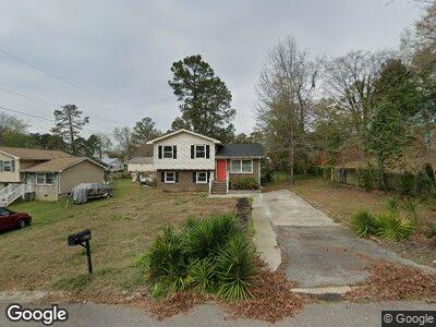
1036 Dawson Dr West Columbia, SC 29169
Estimated Value: $183,000 - $202,670
3
Beds
2
Baths
1,542
Sq Ft
$126/Sq Ft
Est. Value
About This Home
This home is located at 1036 Dawson Dr, West Columbia, SC 29169 and is currently estimated at $194,918, approximately $126 per square foot. 1036 Dawson Dr is a home located in Lexington County with nearby schools including Riverbank Elementary, Northside Middle, and Brookland-Cayce High School.
Ownership History
Date
Name
Owned For
Owner Type
Purchase Details
Closed on
May 3, 2019
Sold by
Checca Joseph
Bought by
Evans Robert N
Current Estimated Value
Home Financials for this Owner
Home Financials are based on the most recent Mortgage that was taken out on this home.
Original Mortgage
$122,735
Interest Rate
4.75%
Mortgage Type
FHA
Purchase Details
Closed on
Aug 15, 2018
Sold by
South Carolina State Housing Finance And
Bought by
Skipper Properties Llc
Purchase Details
Closed on
Aug 30, 2004
Sold by
Forth Betty L
Bought by
Pereira Christina S
Create a Home Valuation Report for This Property
The Home Valuation Report is an in-depth analysis detailing your home's value as well as a comparison with similar homes in the area
Home Values in the Area
Average Home Value in this Area
Purchase History
| Date | Buyer | Sale Price | Title Company |
|---|---|---|---|
| Evans Robert N | $125,000 | None Available | |
| Skipper Properties Llc | $49,500 | None Available | |
| Pereira Christina S | $72,400 | -- |
Source: Public Records
Mortgage History
| Date | Status | Borrower | Loan Amount |
|---|---|---|---|
| Open | Evans Robert N | $185,000 | |
| Closed | Evans Robert N | $121,028 | |
| Closed | Evans Robert N | $122,735 | |
| Previous Owner | Pereira Derrick Christina S | $36,000 | |
| Previous Owner | Pereira Christina S | $11,711 |
Source: Public Records
Tax History Compared to Growth
Tax History
| Year | Tax Paid | Tax Assessment Tax Assessment Total Assessment is a certain percentage of the fair market value that is determined by local assessors to be the total taxable value of land and additions on the property. | Land | Improvement |
|---|---|---|---|---|
| 2024 | -- | $5,000 | $1,000 | $4,000 |
| 2023 | -- | $5,000 | $1,000 | $4,000 |
| 2022 | $0 | $5,000 | $1,000 | $4,000 |
| 2020 | $507 | $5,000 | $1,000 | $4,000 |
| 2019 | $507 | $3,520 | $800 | $2,720 |
| 2018 | $1,638 | $5,280 | $1,200 | $4,080 |
| 2017 | $1,614 | $5,280 | $1,200 | $4,080 |
| 2016 | $1,629 | $5,280 | $1,200 | $4,080 |
| 2014 | $1,365 | $5,216 | $759 | $4,457 |
| 2013 | -- | $5,220 | $760 | $4,460 |
Source: Public Records
Map
Nearby Homes
- 825 Coburg Ln
- 821 Coburg Ln
- 819 Coburg Ln
- 817 Coburg Ln
- 807 Coburg Ln
- 805 Coburg Ln
- 173 Snow Ln
- 1155 Ederbach Dr
- 106 Compass Ln
- 127 Agape Village Ct
- 105 Agape Village Ct
- 139 Agape Village Ct
- 3161 Leaphart Rd
- 105 Golden Pond Dr
- 405 Shag Bark Trail
- 314 Duchess Trail
- 157 Golden Pond Dr
- 111 Crepe Myrtle Cir
- 184 Lott Ct
- TBD Jessamine Rd
- 1036 Dawson Dr
- 1038 Dawson Dr
- 1034 Dawson Dr
- 1042 Dawson Dr
- 1031 Orangeburg Dr
- 1030 Dawson Dr
- 1035 Orangeburg Dr
- 1037 Dawson Dr
- 1029 Orangeburg Dr
- 1039 Dawson Dr
- 1033 Dawson Dr
- 1044 Dawson Dr
- 1037 Orangeburg Dr
- 1041 Dawson Dr
- 1027 Orangeburg Dr
- 1029 Dawson Dr
- 1043 Dawson Dr
- 1039 Orangeburg Dr
- 104 Allendale Dr
- 1025 Orangeburg Dr