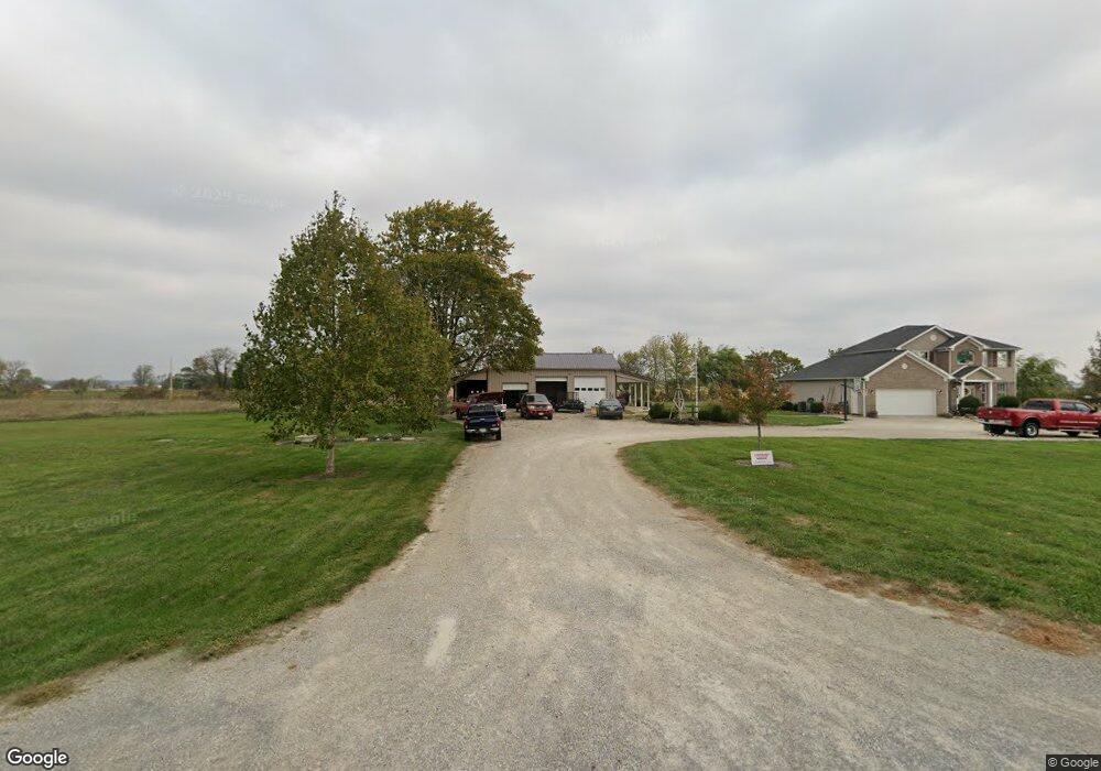
1036 Ellis Rd Union City, OH 45390
Estimated Value: $238,000 - $480,022
4
Beds
3
Baths
2,917
Sq Ft
$122/Sq Ft
Est. Value
About This Home
This home is located at 1036 Ellis Rd, Union City, OH 45390 and is currently estimated at $357,006, approximately $122 per square foot. 1036 Ellis Rd is a home with nearby schools including Mississinawa Valley Elementary School and Mississinawa Valley Junior/Senior High School.
Ownership History
Date
Name
Owned For
Owner Type
Purchase Details
Closed on
Apr 15, 2019
Sold by
Amspaugh Jason
Bought by
Wehrkamp Ronnie L
Current Estimated Value
Home Financials for this Owner
Home Financials are based on the most recent Mortgage that was taken out on this home.
Original Mortgage
$147,741
Outstanding Balance
$130,718
Interest Rate
4.62%
Mortgage Type
FHA
Estimated Equity
$226,288
Purchase Details
Closed on
Nov 15, 2012
Sold by
Wehrkamp Ronnie L
Bought by
Wehrkamp Ronnie L and Amspaugh Jason
Purchase Details
Closed on
Nov 13, 2007
Sold by
Estate Of Matthew K Wehrkamp
Bought by
Wehrkamp Ronnie L
Purchase Details
Closed on
May 11, 2007
Sold by
Wimbley Dorothy A
Bought by
Wehrkamp Matthew K and Wehrkamp Ronnie L
Home Financials for this Owner
Home Financials are based on the most recent Mortgage that was taken out on this home.
Original Mortgage
$42,500
Interest Rate
6.2%
Mortgage Type
Purchase Money Mortgage
Create a Home Valuation Report for This Property
The Home Valuation Report is an in-depth analysis detailing your home's value as well as a comparison with similar homes in the area
Home Values in the Area
Average Home Value in this Area
Purchase History
| Date | Buyer | Sale Price | Title Company |
|---|---|---|---|
| Wehrkamp Ronnie L | -- | None Available | |
| Wehrkamp Ronnie L | -- | Attorney | |
| Wehrkamp Ronnie L | -- | None Available | |
| Wehrkamp Matthew K | $42,500 | Attorney |
Source: Public Records
Mortgage History
| Date | Status | Borrower | Loan Amount |
|---|---|---|---|
| Open | Wehrkamp Ronnie L | $147,741 | |
| Previous Owner | Wehrkamp Matthew K | $42,500 |
Source: Public Records
Tax History Compared to Growth
Tax History
| Year | Tax Paid | Tax Assessment Tax Assessment Total Assessment is a certain percentage of the fair market value that is determined by local assessors to be the total taxable value of land and additions on the property. | Land | Improvement |
|---|---|---|---|---|
| 2024 | $3,451 | $117,710 | $17,770 | $99,940 |
| 2023 | $3,497 | $119,110 | $19,170 | $99,940 |
| 2022 | $3,584 | $103,810 | $16,910 | $86,900 |
| 2021 | $3,642 | $103,810 | $16,910 | $86,900 |
| 2020 | $3,663 | $103,810 | $16,910 | $86,900 |
| 2019 | $2,854 | $86,430 | $16,910 | $69,520 |
| 2018 | $2,802 | $86,430 | $16,910 | $69,520 |
| 2017 | $1,607 | $86,430 | $16,910 | $69,520 |
| 2016 | $1,028 | $46,590 | $13,690 | $32,900 |
| 2015 | $979 | $32,550 | $13,690 | $18,860 |
| 2014 | $982 | $32,550 | $13,690 | $18,860 |
| 2013 | $1,030 | $32,270 | $13,410 | $18,860 |
Source: Public Records
Map
Nearby Homes
- 0 County Road 400 N
- 3709 Rossburg-Lightsville Rd
- 1200 N Jackson Pike
- 509 Indiana 28
- 0 W Deerfield Rd Unit 23016117
- 0 W Deerfield Rd Unit 837795
- 0 W Deerfield Rd
- 718 Lynwood Ct
- 706 Lynwood Ct
- 207 Allen Dr
- 543 N Walnut St
- 807 E Cherry St
- 230 NW Deerfield Rd
- 722 N Union St
- 3052 State Route 47
- 305 E North St
- 612 N Howard St
- 504 N Union St
- 504 N Union St Unit Street
- 113 E North St
- 12508 Oswalt Good Rd
- 924 Ellis Rd
- 12630 Oswalt Good Rd
- 1130 Ellis Rd
- 12685 Oswalt Good Rd
- 12354 Oswalt Good Rd
- 1191 Ellis Rd
- 12317 Oswalt Good Rd
- 12317 Oswalt-Good Rd
- 1273 Ellis Rd
- 1265 Ellis Rd
- 772 Ellis Rd
- 12650 Hillgrove Fort Recover Rd
- 12650 Hillgrove Fort Recover Rd
- 12399 Hillgrove Fort Recover Rd
- 1415 Ellis Rd
- 613 Ellis Rd
- 1419 Ellis Rd
- 758 Brock Cosmos Rd
- 12920 Hillgrove Fort Recover Rd